


Pictorial tourist map of the Aosta Valley - Italy, ca. 1930
Pictorial tourist map of the Aosta Valley - Italy, ca. 1930
Couldn't load pickup availability
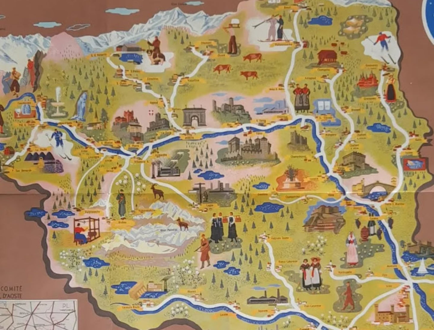
An old, illustrated tourist map of the Aosta Valley and its province. This map was produced under the auspices of the Aosta Provincial Tourism Committee. It presents a picturesque and detailed view of the region, highlighting both natural features (mountains, rivers such as the Dora Baltea, forests) and cultural and historical elements (castles, churches, monuments, and scenes of local life, such as skiing, cattle breeding, and traditional costumes). The distinctive pictorial style transforms the map into a true illustration of the region. Medieval fortifications, the Arch of Augustus in Aosta, factories, skiers, chamois, and people in traditional dress are all depicted. The title is at the bottom, framed by coats of arms on the sides, and the map has a dark brown background. A small overview map of the connections is located in the lower left corner, showing the region's position relative to cities like Milan and Turin. The borders with Switzerland (SVİZZERA) and France (FRANCIA) are indicated. The map measures 48 cm by 68 cm.
Condition :
Very good condition. Please note, my maps are old and not always in perfect condition!
List of the main locations represented:
Aosta, Dora Baltea, Switzerland, France, Valpelline, Variney, La Sarre, Aymavilles, Cogne, Valsavaranche, Fenis, Châtillon, Issogne, Champoluc, Courmayeur, Breuil Cervinia, Gran Paradiso.


-

Secure payment
-

Careful shipping
-

No reproduction
-

Satisfied or refunded


-

“Hello, thank you for sending this, the cards are superb!”
Jean-Philippe
-
"They are very beautiful, just need to frame them! Thank you"
Baptiste
-
"Fast shipping and very good tracking."
Alice
-
"My husband loved the maps I gave him for Christmas!"
Solène
