


Pictorial map of Vienna - ca. 1930
Pictorial map of Vienna - ca. 1930
Couldn't load pickup availability
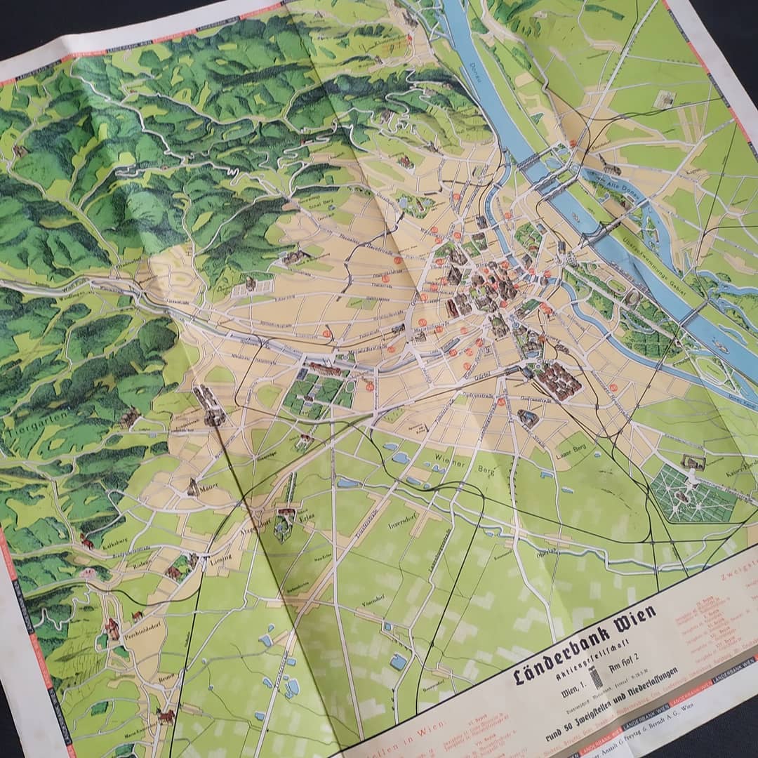
This geographical and pictorial map of the city of Vienna (Wien) is a promotional document for the Länderbank Wien. The plan is highly detailed and presents the city's topography with a relief effect for the hills and woods (in dark green in the west, including the Tiergarten area). The map uses a distinct color scheme: green for natural areas, yellow-beige for urbanized areas, and blue for the Danube and other waterways. The city center is clearly highlighted, as is the course of the Danube. The map also shows the detailed road network with street names, neighborhoods (such as Hütteldorf, Penzing), and key monuments depicted in perspective (e.g., Schloss Wilhelminenberg). At the bottom, the Länderbank's advertising insert highlights its branches (Zweigstellen in Wien and rund 50 Zweigstellen und Niederlassungen). The illustrations in the lower corners show representative bank buildings. The card measures 51 cm by 57 cm.
Condition :
Good condition Please note, my maps are old and are not always in perfect condition!
List of main places represented:
Vienna (Wien), Donau (Danube), Satz Berg, Schaf Berg, Tiergarten, Hütteldorf, Penzing, Neuwaldegg, Dornbach, Hornalser, Linzer Straße, Hadikgasse, Schloss Wilhelminenberg.


-

Secure payment
-

Careful shipping
-

No reproduction
-

Satisfied or refunded


-

“Hello, thank you for sending this, the cards are superb!”
Jean-Philippe
-
"They are very beautiful, just need to frame them! Thank you"
Baptiste
-
"Fast shipping and very good tracking."
Alice
-
"My husband loved the maps I gave him for Christmas!"
Solène
