


Vintage pictorial map of Swiss costumes - 1933
Vintage pictorial map of Swiss costumes - 1933
Couldn't load pickup availability
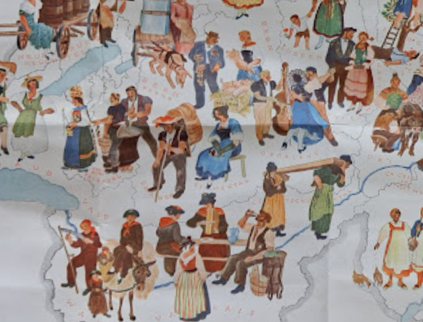
This vintage map, published in 1933 by the Swiss Federal Railways (SBB), is a magnificent pictorial work celebrating Swiss traditions. Entitled "Trachtenkarte der Schweiz" (Map of Swiss Costumes), it illustrates the country's cultural diversity through numerous figures in traditional regional costumes, engaged in rural and artisanal activities. Scenes of mountain life such as milking, transporting milk, haymaking, and weaving are depicted, each illustration geographically positioned on the outline of Switzerland. The bilingual legends (German and French) underscore the railway's mission to promote tourism at the time. The graphic style is typical of the interwar period, combining folkloric charm with descriptive precision. The map is an excellent example of promotional and ethnographic cartography. The map measures 45 cm by 31 cm.
Condition :
Good condition (slight signs of wear). Please note, my maps are old and not always in perfect condition!
List of the main locations represented:
Geneva, Valais, Vaud, Fribourg, Bern, Lucerne, Glarus, Grisons (Graubünden), Saint-Gall (Toggenburg), Zurich, Neuchâtel.


-

Secure payment
-

Careful shipping
-

No reproduction
-

Satisfied or refunded


-

“Hello, thank you for sending this, the cards are superb!”
Jean-Philippe
-
"They are very beautiful, just need to frame them! Thank you"
Baptiste
-
"Fast shipping and very good tracking."
Alice
-
"My husband loved the maps I gave him for Christmas!"
Solène
