


Vintage pictorial map "The British Isles" by Alfred Taylor - ca. 1950
Vintage pictorial map "The British Isles" by Alfred Taylor - ca. 1950
Couldn't load pickup availability
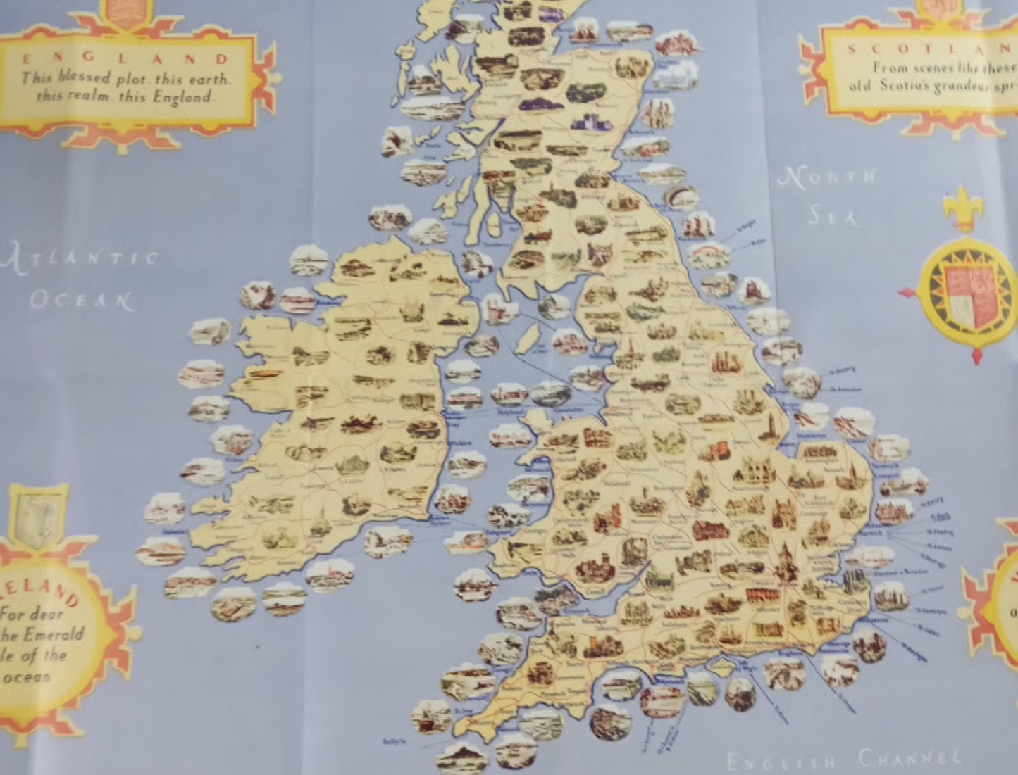
This magnificent illustrated geographical map of the British Isles is the work of artist Alfred E. Taylor. Designed as a retro travel poster, it showcases England, Scotland, Ireland, and Wales through a multitude of hand-drawn vignettes depicting castles, historic landmarks, and typical landscapes. Four decorative cartouches in the corners of the map feature poetic quotations dedicated to each nation, while colorful heraldic crests adorn the maritime areas. Ferry routes, including those between Dublin, Holyhead, Fishguard, and Rosslare, are indicated by dotted lines, highlighting the map's promotional purpose. The elegant graphic style and pastel tones are characteristic of mid-20th-century advertising maps. The map measures 60 cm by 46 cm.
Condition :
Good condition. Please note, my maps are old and not always in perfect condition!
List of the main locations represented:
London, Edinburgh, Dublin, Cardiff, Belfast, Glasgow, Liverpool, Manchester, Birmingham, Oxford, Cambridge, York, Inverness, Aberdeen, Cork, Limerick, Galway, Isle of Man, Hebrides Islands, Shetland Islands.


-

Secure payment
-

Careful shipping
-

No reproduction
-

Satisfied or refunded


-

“Hello, thank you for sending this, the cards are superb!”
Jean-Philippe
-
"They are very beautiful, just need to frame them! Thank you"
Baptiste
-
"Fast shipping and very good tracking."
Alice
-
"My husband loved the maps I gave him for Christmas!"
Solène
