


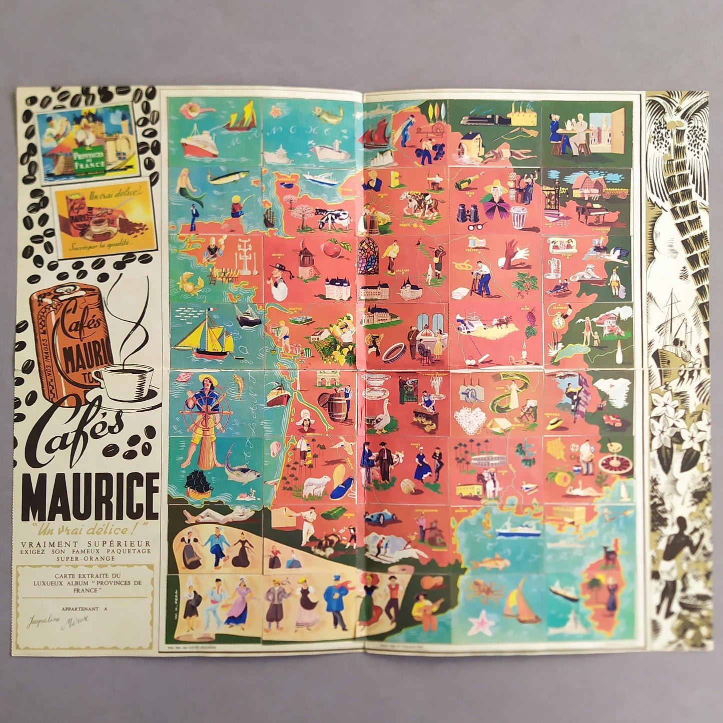
Advertising Map of the Provinces of France by Cafés Maurice - 1950s
Advertising Map of the Provinces of France by Cafés Maurice - 1950s
Couldn't load pickup availability
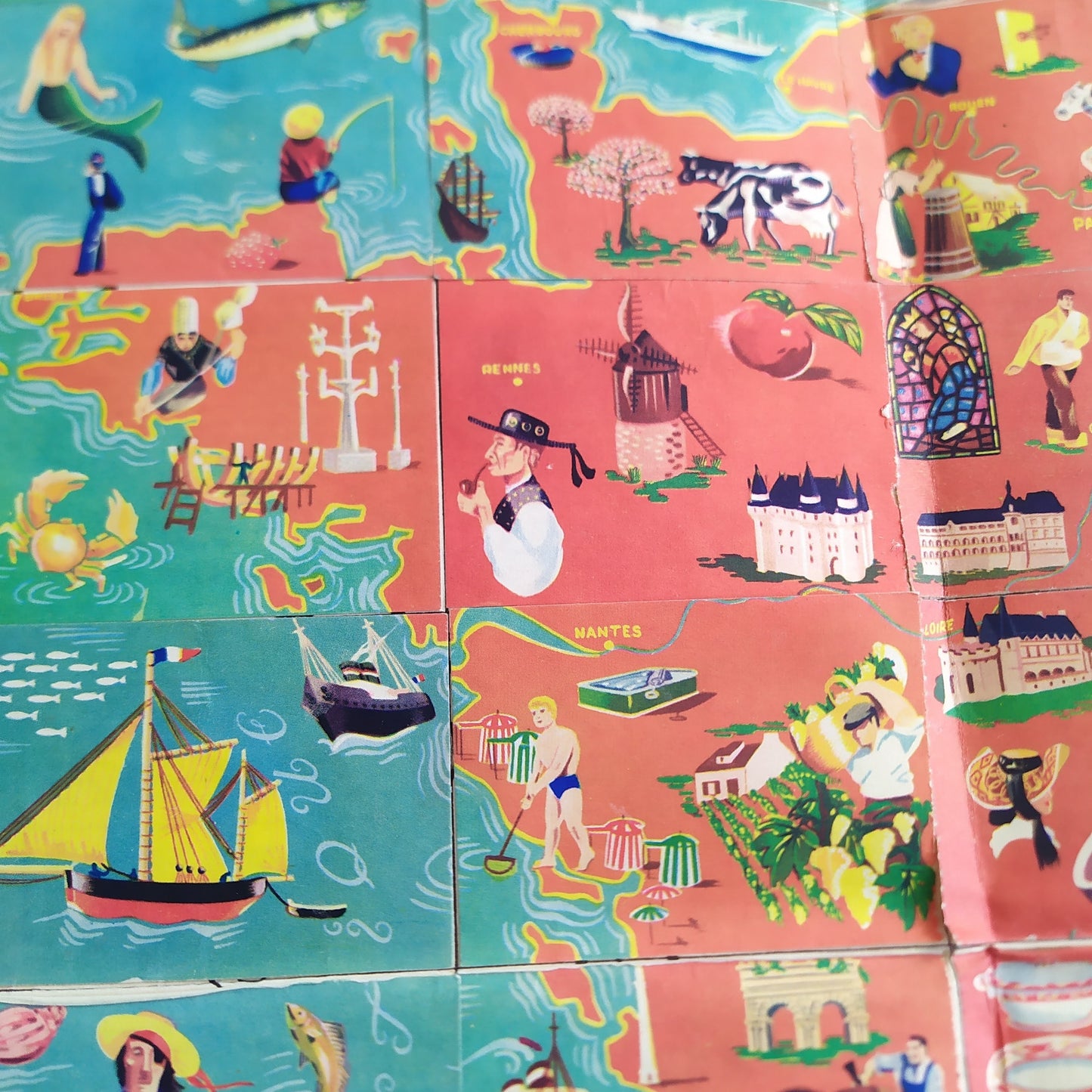
This 1950s advertising card, created for Cafés Maurice, is a unique artistic and promotional work. Measuring 41.5 x 52 cm, it features an illustrated map of the provinces of France, where each region is represented by colorful and lively scenes highlighting local culture, traditions, and activities. The illustrations are rich in detail, with characters dressed in traditional costumes, picturesque landscapes, and activities typical of each region. The bright colors and dynamic designs make this card not only educational but also visually captivating. It likely served as an advertising medium to promote coffee while celebrating French cultural heritage.
Condition :
Very good condition. Advertising map made of stickers. Please note, my maps are old and are not always in perfect condition!
List of main places represented:
Paris, Marseille, Lyon, Toulouse, Nice, Nantes, Strasbourg, Bordeaux, Lille, Rennes, Reims, Le Havre, Saint-Étienne, Toulon, Grenoble, Dijon, 1 Angers, Villeurbanne, Nîmes, Aix-en-Provence.


-

Secure payment
-

Careful shipping
-

No reproduction
-

Satisfied or refunded


-

“Hello, thank you for sending this, the cards are superb!”
Jean-Philippe
-
"They are very beautiful, just need to frame them! Thank you"
Baptiste
-
"Fast shipping and very good tracking."
Alice
-
"My husband loved the maps I gave him for Christmas!"
Solène
