


Illustrated map of the Toulouse region - ca. 1950
Illustrated map of the Toulouse region - ca. 1950
Couldn't load pickup availability
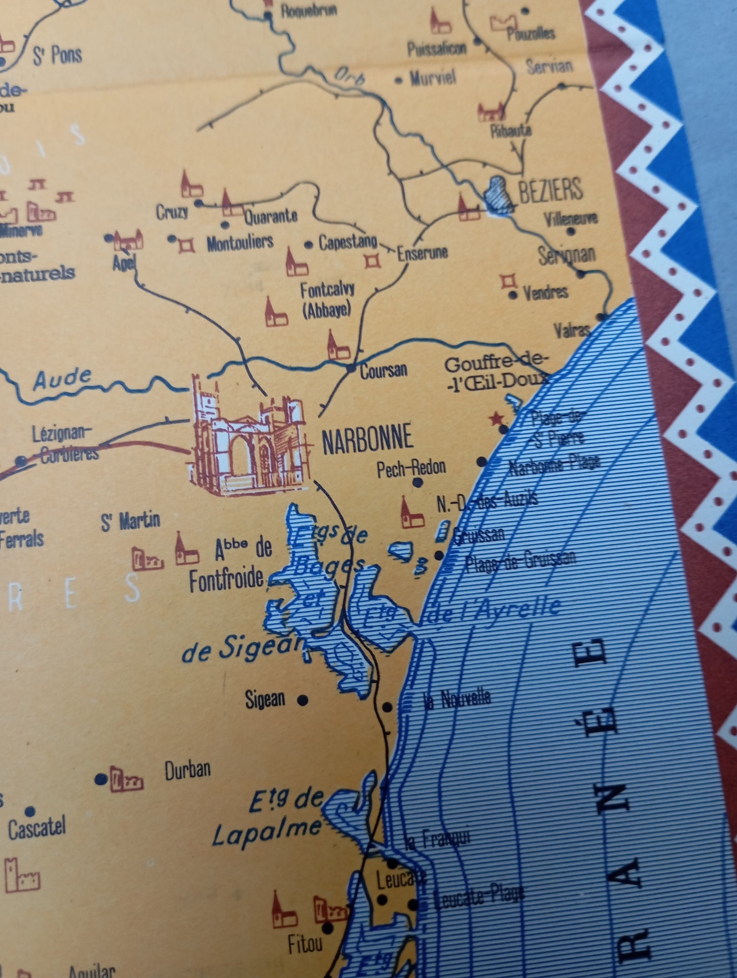
This illustrated map of the Toulouse region and its surrounding areas is framed by a decorative red, white, and blue border, evoking a zigzag pattern. The title "TOULOUSE" is inscribed in a stylized cartouche at the bottom left. The map highlights major roads, towns, and water features. It is interspersed with numerous illustrations of monuments, castles, ruins, and tourist sites. Icons of mills, caves, and Roman monuments are also present. Numbers on the map indicate tourist circuits. At the bottom right, a key details the symbols used. The map measures 52 cm by 44 cm.
Condition :
Good condition Please note, my maps are old and are not always in perfect condition!
List of main places represented:
Toulouse, Albi, Castres, Carcassonne, Narbonne, Béziers, Castres, Mazamet, Foix, Limoux, Castelnaudary, Montauban, Albi, Tarn, Montagne Noire, The Gorges of the Cèze, Montségur


-

Secure payment
-

Careful shipping
-

No reproduction
-

Satisfied or refunded


-

“Hello, thank you for sending this, the cards are superb!”
Jean-Philippe
-
"They are very beautiful, just need to frame them! Thank you"
Baptiste
-
"Fast shipping and very good tracking."
Alice
-
"My husband loved the maps I gave him for Christmas!"
Solène
