


Map of Excursions of the Riviera dei Fiori (Italy) by Aldo Cigheri - ca. 1950
Map of Excursions of the Riviera dei Fiori (Italy) by Aldo Cigheri - ca. 1950
Couldn't load pickup availability
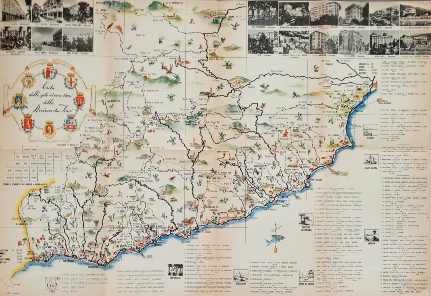
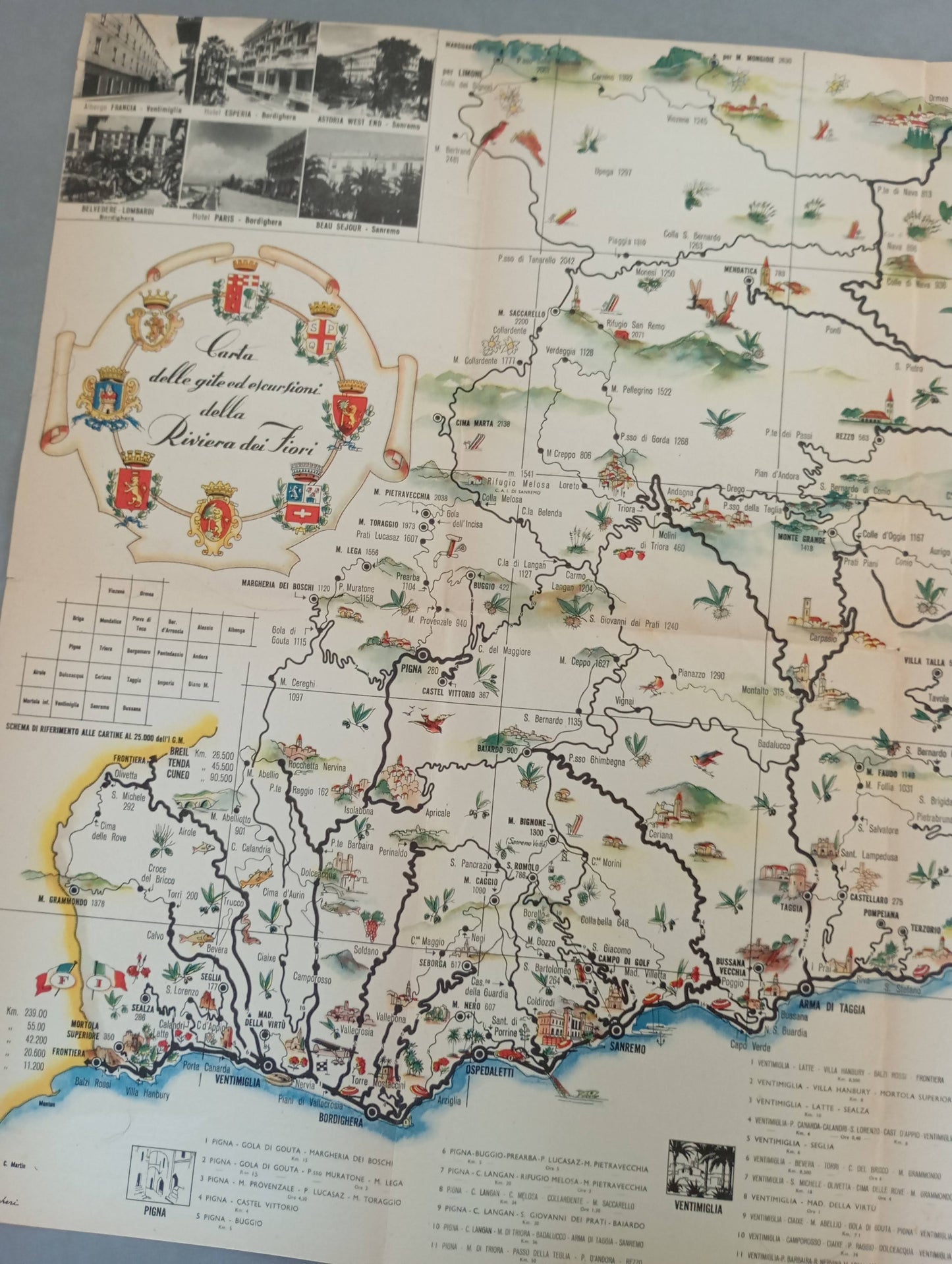
This illustrated map depicts the Riviera dei Fiori region, a picturesque stretch of the Italian coast. It highlights the region's major cities and tourist attractions, with detailed illustrations of the coastal landscapes and urban areas. The map is adorned with photographs and drawings that highlight the architectural and natural features of the Riviera dei Fiori, providing an informative and aesthetically pleasing view. The map also includes practical visitor information, such as distances between cities and landmarks, making it a useful tool for tourists looking to explore this region. The vibrant colors and artistic details add to the map's visual appeal while providing accurate geographical information. Dimensions: 39 cm x 56 cm.
Condition :
Good condition, some flaws, see photos. Please note, my maps are old and not always in perfect condition!
List of main places represented:
Nice, Montecarlo, Menton, San Remo, Bordighera, Ospedaletti, Taggia, Riva, Santo Stefano, Pietrabruna, Civezza, Terzorio, Santo Stefano al Mare, Cipressa, Costarainera, San Lorenzo al Mare, Imperia, Porto Maurizio, Oneglia, Diano Marina, Diano Castello, Diano San Pietro, Diano Arentino, Diano Serreta, Diano Calderina, Diano Gorleri, Capo Berta, Diano Marina, Andora, Alassio, Laigueglia, Cervo, Villa Faraldi, San Bartolomeo al Mare, Tovo, Borghetto Santo Spirito, Loano, Boissano, Toirano, Pietra Ligure, Magliolo, Giustenice, Borgio Verezzi, Finale Ligure, Noli, Spotorno, Bergeggi, Vado, Savona, Albisola, Celle Ligure, Varazze, Arenzano, Cogoleto, Voltri, Pegli, Sestri Ponente, Cornigliano, Sampierdarena, Genova.
m

-

Secure payment
-

Careful shipping
-

No reproduction
-

Satisfied or refunded


-

“Hello, thank you for sending this, the cards are superb!”
Jean-Philippe
-
"They are very beautiful, just need to frame them! Thank you"
Baptiste
-
"Fast shipping and very good tracking."
Alice
-
"My husband loved the maps I gave him for Christmas!"
Solène
