


Geographical map of the Polar War Routes by 7 Jours, ca. 1940
Geographical map of the Polar War Routes by 7 Jours, ca. 1940
Couldn't load pickup availability
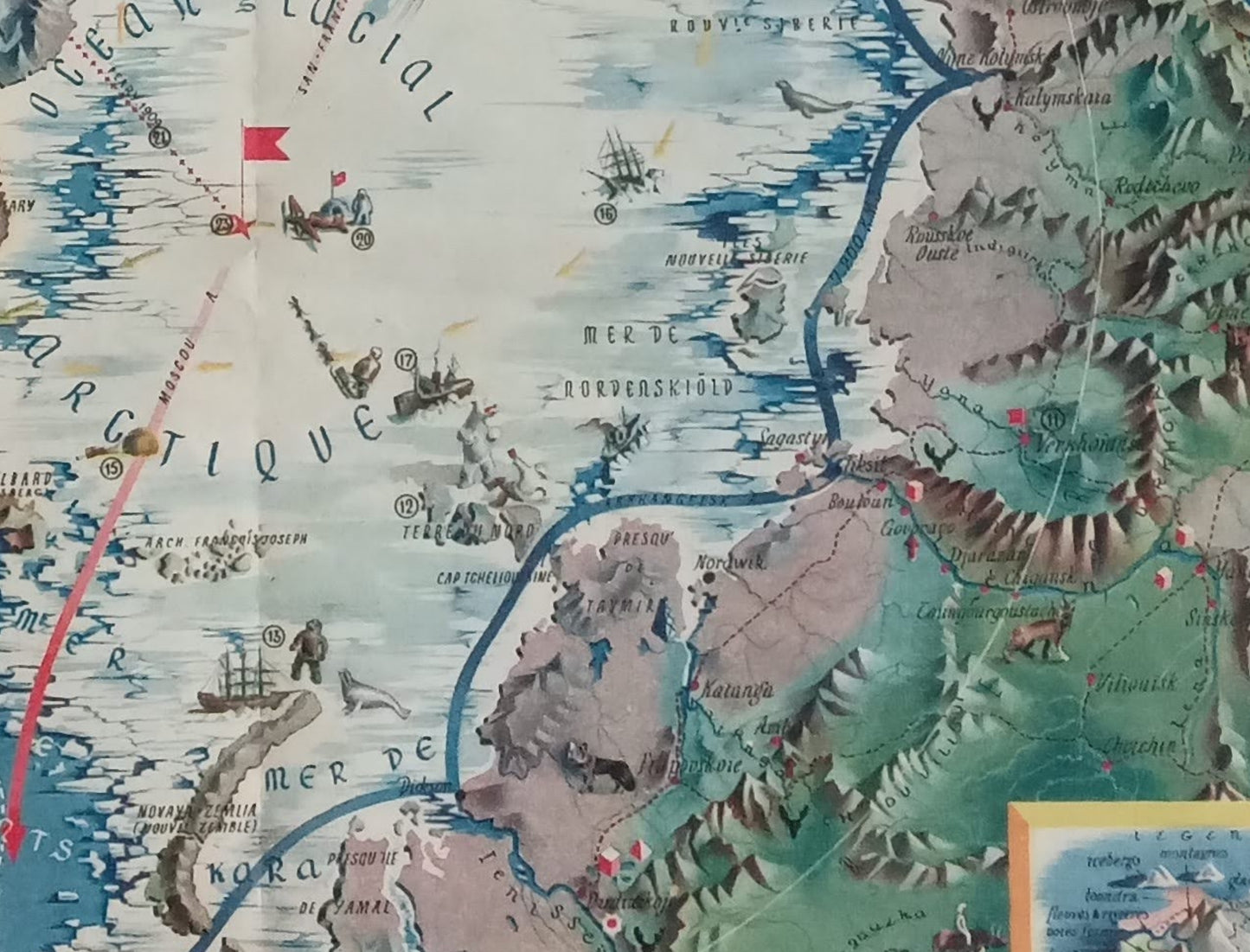
An old, illustrated, geographical map centered on the Arctic Ocean, published by the French magazine 7 Jours (indicated by the logo and the word "7 JOURS" on the right). Titled "WAR ROUTES OF THE POLES," this map highlights the polar region and strategic sea and air routes during the Second World War (circa 1940). The style is both geographical and pictorial, depicting the terrain, ice, wildlife (bears, seals, caribou), and ships and aircraft, illustrating the various communication routes and conflict zones. Specific routes are marked in red with legends (e.g., Northeast Passage, Canada Route, Balkan Route), and the map features numbered points with symbols. It covers regions such as Greenland, Siberia (Russia), Canada, and Alaska. The border is framed by blocks of text in red. The map is in excellent condition for a piece of this period. The map measures 57 cm by 41 cm.
Condition :
Good condition, fairly thin paper, map from a magazine. Please note, my maps are vintage and not always in perfect condition!
List of the main locations represented:
Arctic Ocean, Greenland, Baffin Bay, Beaufort Sea, Kara Sea, Nordenskiold Sea, Svalbard, Franz Josef Land, New Siberia, Canada, Alaska, Russia (Siberia), Moscow, Sverdrup Archipelago.


-

Secure payment
-

Careful shipping
-

No reproduction
-

Satisfied or refunded


-

“Hello, thank you for sending this, the cards are superb!”
Jean-Philippe
-
"They are very beautiful, just need to frame them! Thank you"
Baptiste
-
"Fast shipping and very good tracking."
Alice
-
"My husband loved the maps I gave him for Christmas!"
Solène
