


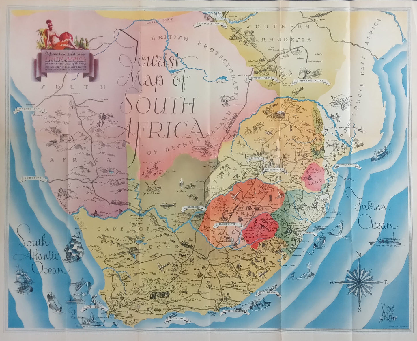
Tourist Map of South Africa - 1937
Tourist Map of South Africa - 1937
Couldn't load pickup availability
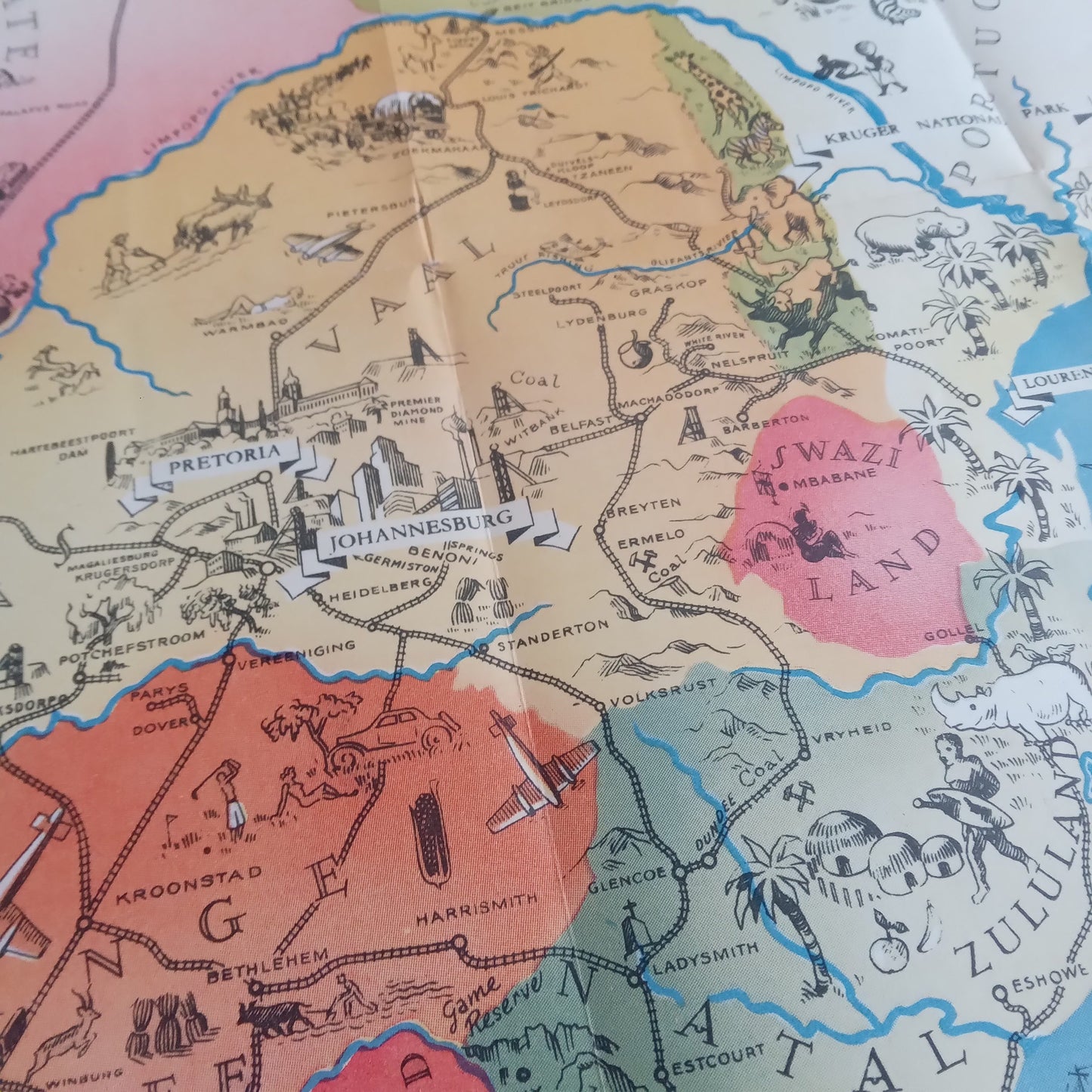
This 1937 tourist map of South Africa offers a detailed and colorful view of the country and its surrounding regions. The map is richly illustrated with geographical details, roads, cities, and tourist attractions. The different regions are colored to distinguish them, and illustrations of landscapes, flora, and fauna add a picturesque touch to the map. Features such as mountains, rivers, and coastal areas are also highlighted, providing a comprehensive and attractive representation of South Africa.
Condition :
Very good condition. Please note, my maps are old and not always in perfect condition!
List of main places represented:
Cape Town, Johannesburg, Pretoria, Durban, Port Elizabeth, Bloemfontein, Kimberley, East London, Pietermaritzburg, Swaziland, Bechuanaland, Rhodesia, Cape of Good Hope, Natal, Transvaal, Orange Free State, Kalahari Desert, Indian Ocean, South Atlantic Ocean.


-

Secure payment
-

Careful shipping
-

No reproduction
-

Satisfied or refunded


-

“Hello, thank you for sending this, the cards are superb!”
Jean-Philippe
-
"They are very beautiful, just need to frame them! Thank you"
Baptiste
-
"Fast shipping and very good tracking."
Alice
-
"My husband loved the maps I gave him for Christmas!"
Solène
