


Old tourist map of France illustrated by M. Carion - 1968
Old tourist map of France illustrated by M. Carion - 1968
Couldn't load pickup availability
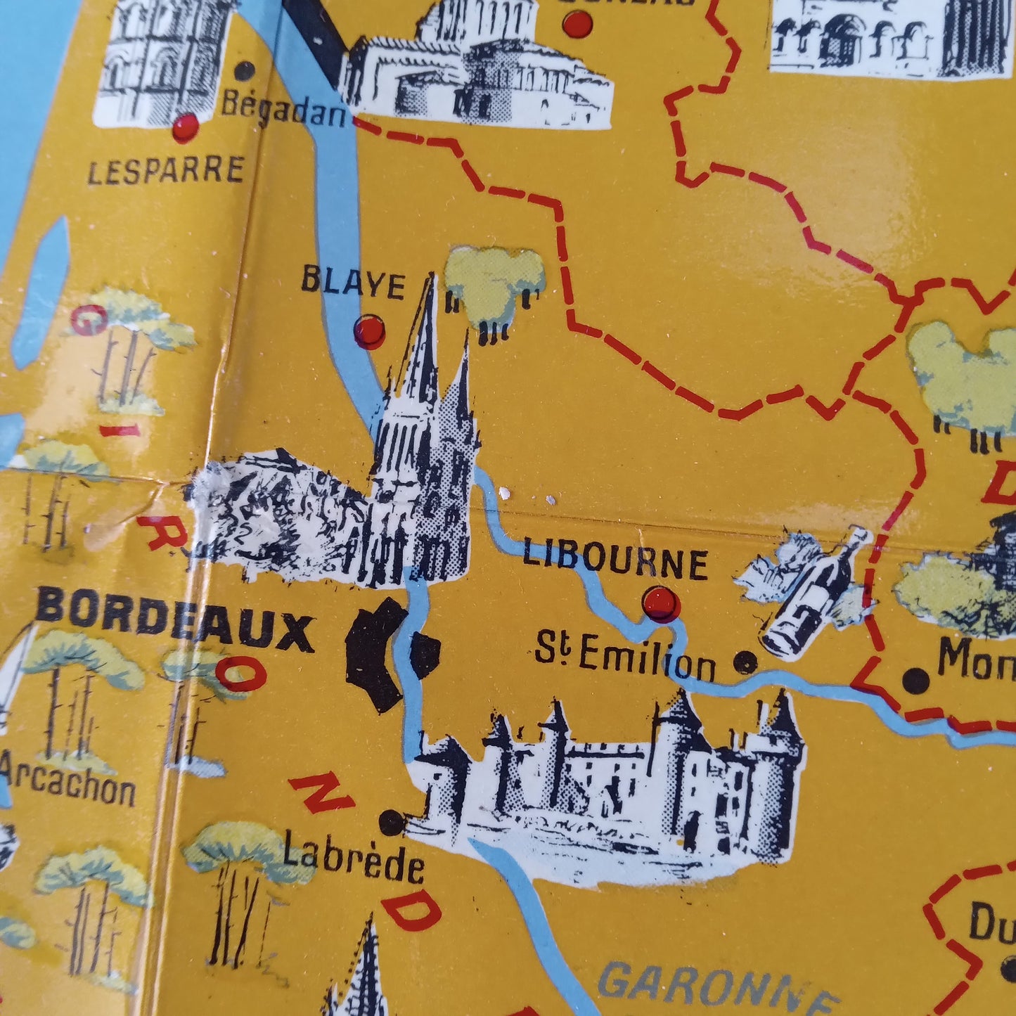
This pictorial map of France, drawn by M. Carion for Éditions Georges Lesot, is a touristy and richly illustrated representation of the country dating from 1968, as indicated by the legal deposit. On a yellow background for the land and blue for the seas (English Channel, Atlantic Ocean and Mediterranean), the map is dotted with numerous black and white vignettes representing the monuments, castles and emblematic sites of French cities and regions. An insert at the bottom left presents a detailed map of Corsica. The main cities are indicated by red dots and connected by dotted road axes. This poster is a fine example of the decorative and geographical maps of the period, highlighting France's architectural heritage. The map measures 95 cm by 95 cm.
Condition :
Very good condition. Please note, my maps are old and are not always in perfect condition!
List of main places represented:
France, Corsica, Paris, Bordeaux, Libourne, Saint-Émilion, Arcachon, Blaye, Nantes, Saint-Nazaire, Guérande, Vannes, Lorient, Rennes, Josselin, Redon, Saint-Malo, Dinan, Cherbourg, Saint-Lô, Coutances, Avranches, Mont Saint-Michel, Bayeux, Belle-Île, Noirmoutier Island, Groix Island, Jersey, Guernsey, Ajaccio, Bastia, Calvi, Corte, Bonifacio.


-

Secure payment
-

Careful shipping
-

No reproduction
-

Satisfied or refunded


-

“Hello, thank you for sending this, the cards are superb!”
Jean-Philippe
-
"They are very beautiful, just need to frame them! Thank you"
Baptiste
-
"Fast shipping and very good tracking."
Alice
-
"My husband loved the maps I gave him for Christmas!"
Solène
