


Tourist map of the Basses-Alpes – 1950s
Tourist map of the Basses-Alpes – 1950s
Couldn't load pickup availability
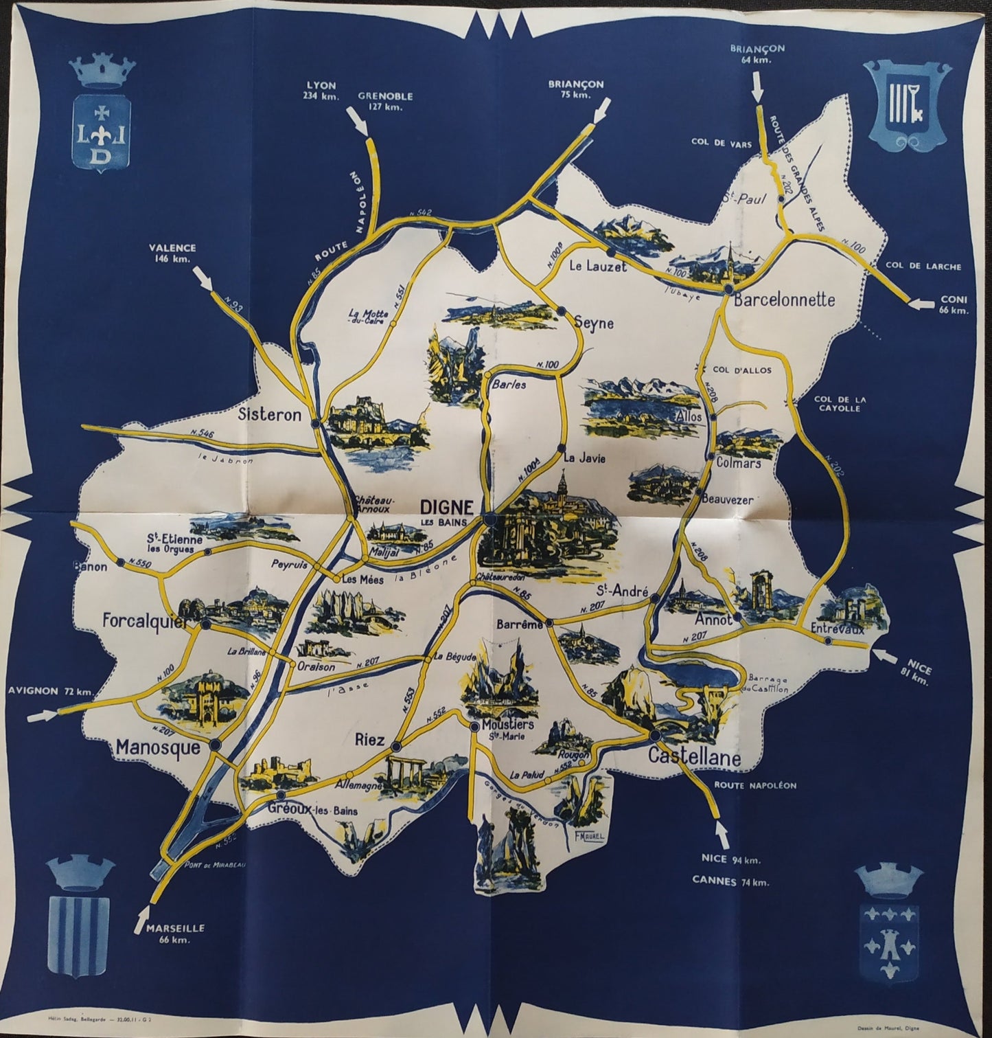
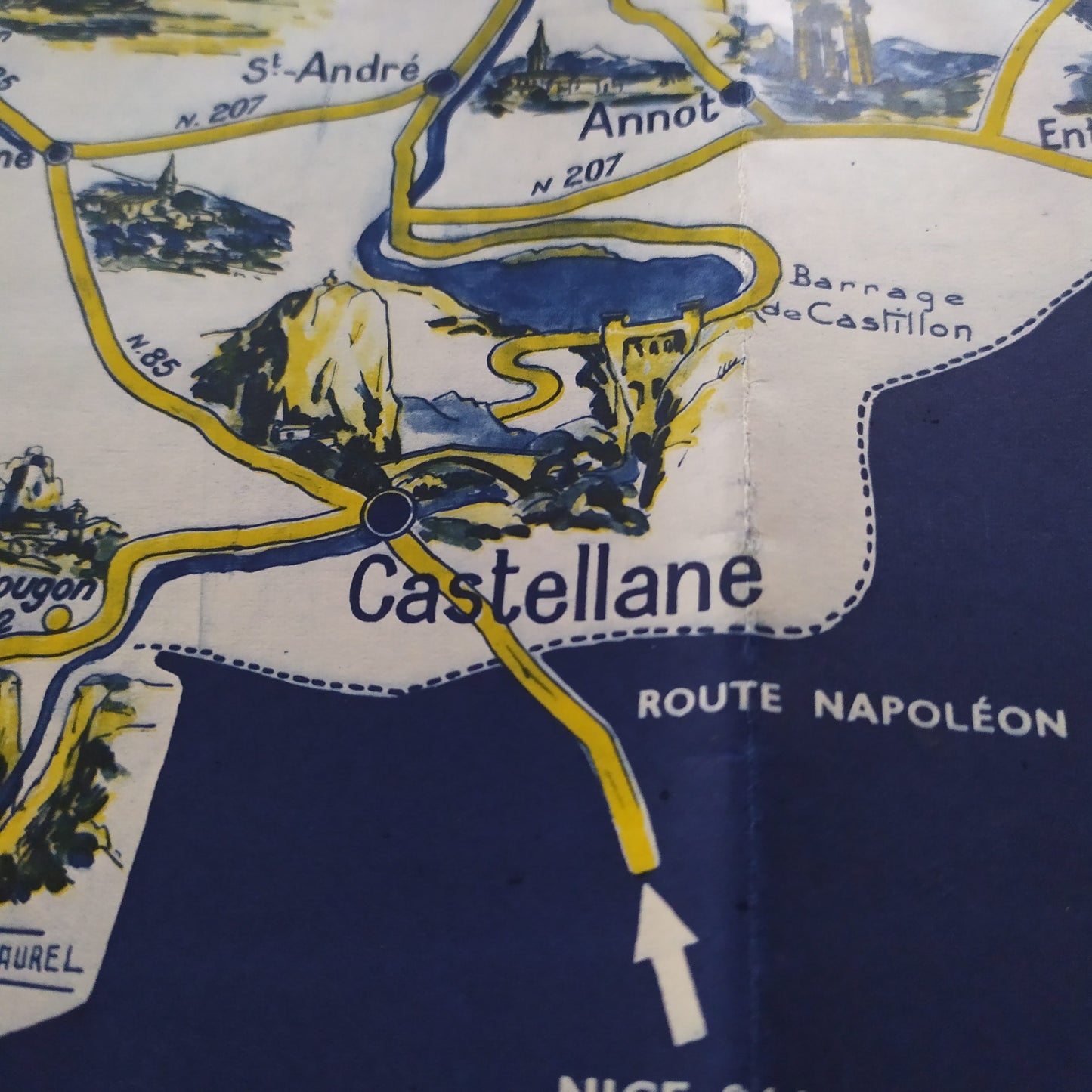
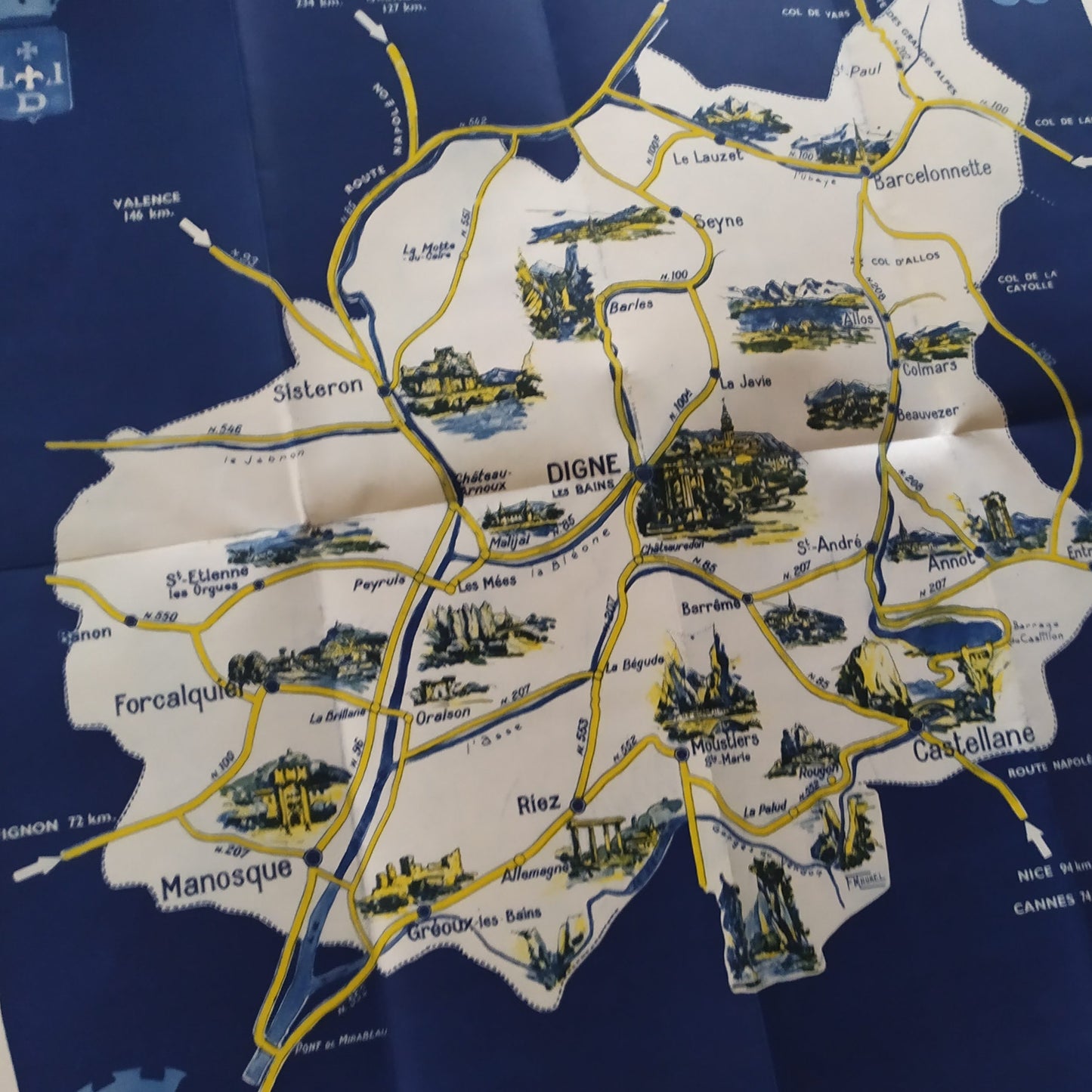
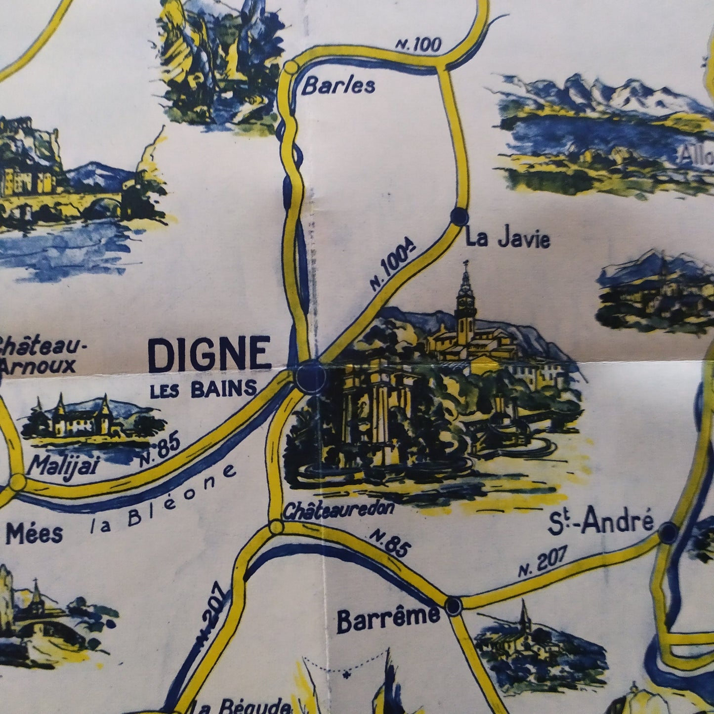
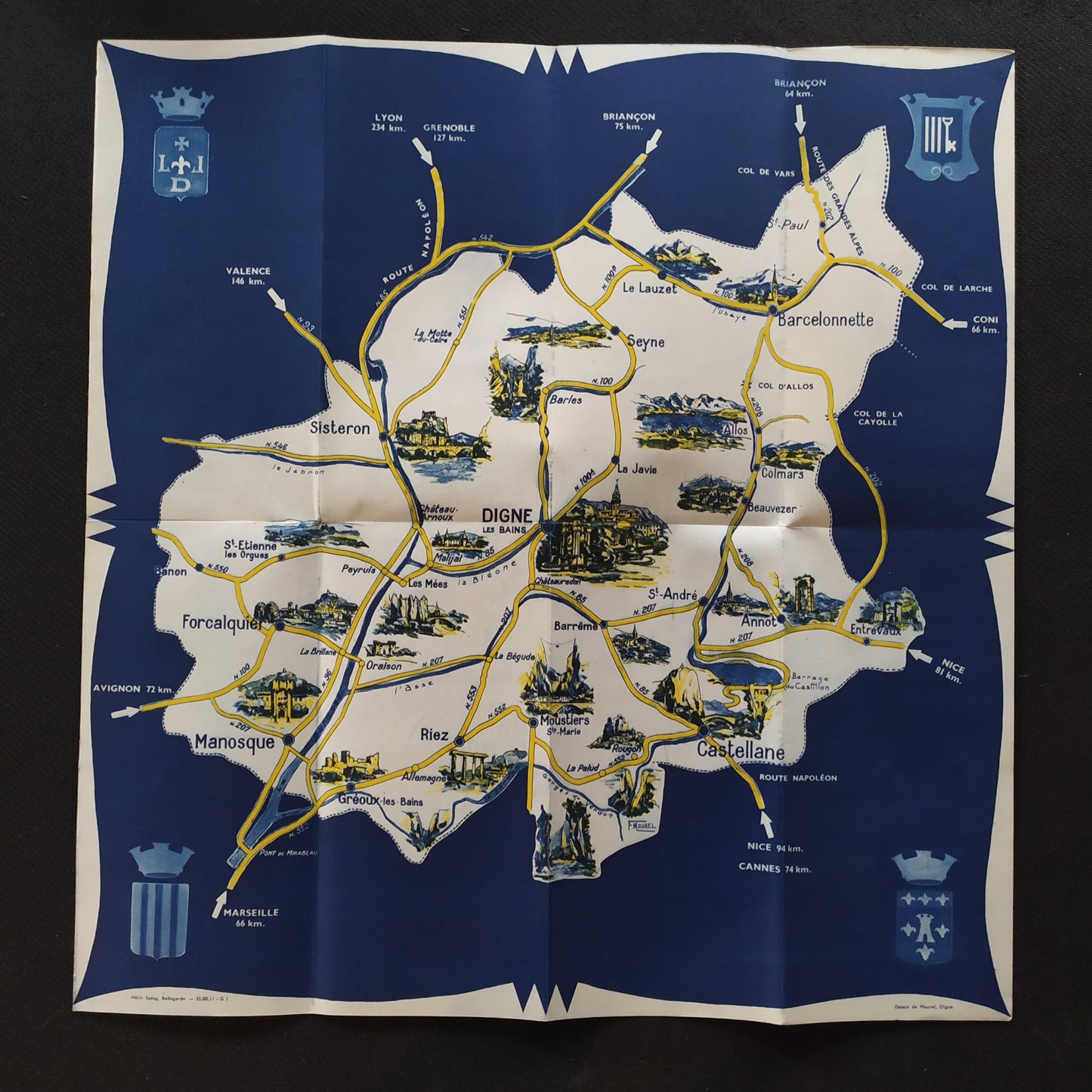
This illustrated map of the Basses-Alpes (now Alpes-de-Haute-Provence), published in the 1950s, offers an artistic representation of the department, with its main roads and towns, such as Digne-les-Bains, Barcelonnette, Castellane, Manosque, and Sisteron. Each town is accompanied by small, typical illustrations: monuments, mountain landscapes, or rural scenes. The midnight blue background highlights the road lines in yellow and the details in black and white, in an elegant and contrasting graphic style. Distances to major neighboring cities (Marseille, Nice, Lyon, Grenoble, etc.) are also indicated in kilometers at the ends. The whole is framed by the region's coats of arms. Dimensions: 44 x 42 cm.
Condition :
Very good condition. Please note, my maps are old and not always in perfect condition!
List of main places represented:
Digne-les-Bains, France, Europe, Alpes-de-Haute-Provence, Route Napoléon, Sisteron, Forcalquier, Manosque, Riez, Castellane, Annot, Entrevaux, Barcelonnette, Seyne, La Javie, Durance, Verdon, Lake Allos, Col de la Cayolle, Saint-Étienne-les-Orgues, Peyruis, Les Mées, Malijai, Moustiers-Sainte-Marie, Barrême, Saint-André-les-Alpes, Nice, Cannes, Marseille, Avignon, Valence, Lyon, Grenoble, Briançon, Gap

-

Secure payment
-

Careful shipping
-

No reproduction
-

Satisfied or refunded


-

“Hello, thank you for sending this, the cards are superb!”
Jean-Philippe
-
"They are very beautiful, just need to frame them! Thank you"
Baptiste
-
"Fast shipping and very good tracking."
Alice
-
"My husband loved the maps I gave him for Christmas!"
Solène
