


Tourist map of Spain and Portugal - 1968
Tourist map of Spain and Portugal - 1968
Couldn't load pickup availability
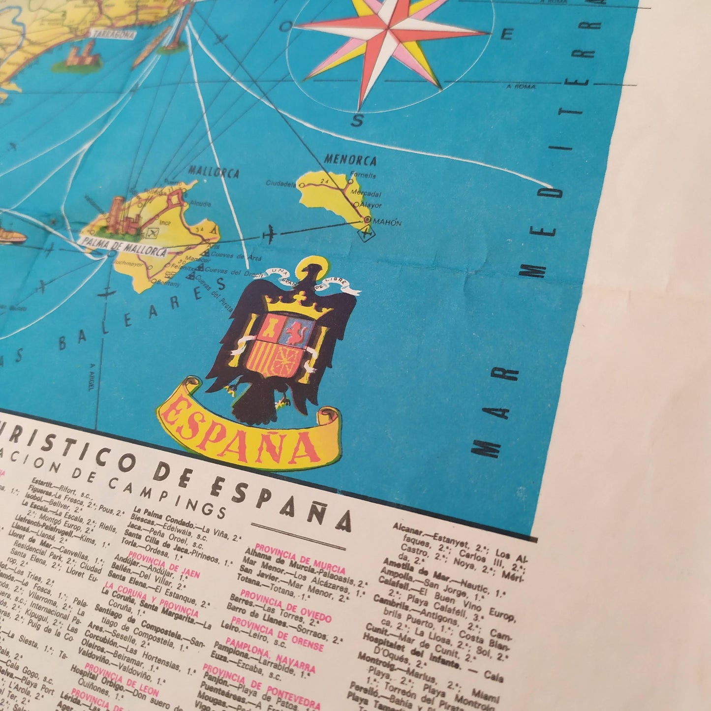
This illustrated geographical map of Spain and Portugal offers an overview of the Iberian Peninsula in 1968. It highlights the main roads of the time, as well as major cities, represented by illustrations of their most emblematic monuments. There is also an inset for the Canary Islands and a representation of the Balearic Islands. The map is decorated with the coats of arms of Spain and Portugal. A detailed section is devoted to a list of campsites ("Relacion de Campings") classified by province, making it a particularly interesting document for lovers of travel from this period. Maritime routes in the Mediterranean Sea and the Atlantic Ocean are also indicated. The map measures 45 cm by 60 cm.
Condition :
Good condition Please note, my maps are old and are not always in perfect condition!
List of main places represented:
Spain, Portugal, Mallorca, Menorca, Ibiza, Formentera, Canary Islands, Madrid, Barcelona, Seville, Granada, Valencia, Zaragoza, Bilbao, La Coruña, Lisbon, Porto.


-

Secure payment
-

Careful shipping
-

No reproduction
-

Satisfied or refunded


-

“Hello, thank you for sending this, the cards are superb!”
Jean-Philippe
-
"They are very beautiful, just need to frame them! Thank you"
Baptiste
-
"Fast shipping and very good tracking."
Alice
-
"My husband loved the maps I gave him for Christmas!"
Solène
