


Vintage tourist map of San Francisco - ca. 1960
Vintage tourist map of San Francisco - ca. 1960
Couldn't load pickup availability
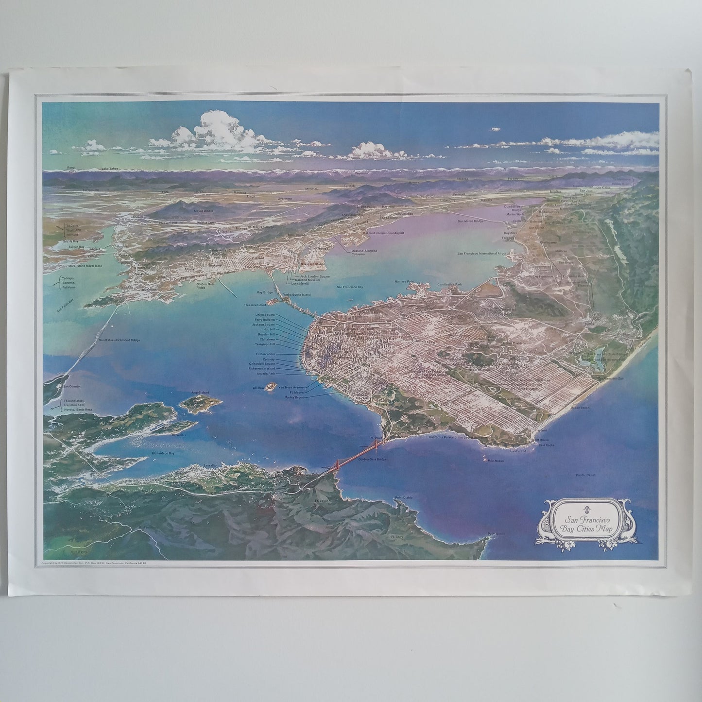
This vintage map of San Francisco is an aerial or oblique view, offering a pictorial and extremely detailed perspective of the city and its bay. Produced around the 1960s, this work is not a simple geographical map but a highly realistic illustration that highlights the urban planning and relief of the peninsula. The city is depicted with a remarkable level of detail for buildings, parks, and streets, creating a three-dimensional effect. Major points of interest are identified by numbered leader lines, particularly along the waterfront. The retro aesthetic is marked by the nuanced colors that capture the natural environment of the San Francisco Bay, contrasting with the dense grid of the city. It is a collector's item that perfectly illustrates the urban expansion of the time and the tourist appeal of the city. The map measures 56 cm by 73 cm.
Condition :
Good condition. Please note, my maps are old and are not always in perfect condition! Shipped in a tube.
List of main places represented:
San Francisco, Golden Gate Bridge, Bay Bridge, San Francisco Bay, Pacific Ocean, Alcatraz, Treasure Island, Golden Gate Fields, Sausalito, Oakland, Berkeley, Oakland Alameda Coliseum, San Francisco International Airport, Oakland International Airport, Fisherman's Wharf, Chinatown, Union Square, Russian Hill, Telegraph Hill, Mount Tamalpais, Point Diablo, Point Bonita.


-

Secure payment
-

Careful shipping
-

No reproduction
-

Satisfied or refunded


-

“Hello, thank you for sending this, the cards are superb!”
Jean-Philippe
-
"They are very beautiful, just need to frame them! Thank you"
Baptiste
-
"Fast shipping and very good tracking."
Alice
-
"My husband loved the maps I gave him for Christmas!"
Solène
