


Tourist map of the Alps – 1950s
Tourist map of the Alps – 1950s
Couldn't load pickup availability
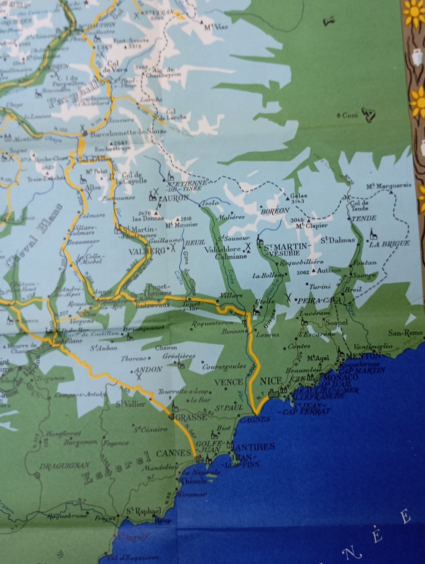
This illustrated map of the Alps, dating from the 1950s, presents in a stylized manner the main tourist routes of the Franco-Italian-Swiss Alpine region. It shows the major roads in yellow, the national borders, as well as a contrasting representation of the mountain ranges (in white and light blue) and the plains (in green). Lake Geneva is clearly visible to the north, while the Mediterranean coastline appears to the south. Notable cities include Turin, Grenoble, Geneva, Nice, and Lausanne. A legend is integrated into a decorative box at the top left, indicating, among other things, the main roads, secondary roads, tunnels, and passes. The map is framed by a floral frieze typical of the period. Dimensions: 83 x 53 cm.
Condition :
Good condition. Please note, my maps are old and not always in perfect condition!


-

Secure payment
-

Careful shipping
-

No reproduction
-

Satisfied or refunded


-

“Hello, thank you for sending this, the cards are superb!”
Jean-Philippe
-
"They are very beautiful, just need to frame them! Thank you"
Baptiste
-
"Fast shipping and very good tracking."
Alice
-
"My husband loved the maps I gave him for Christmas!"
Solène
