


Vintage tourist map of Morocco - ca. 1960
Vintage tourist map of Morocco - ca. 1960
Couldn't load pickup availability
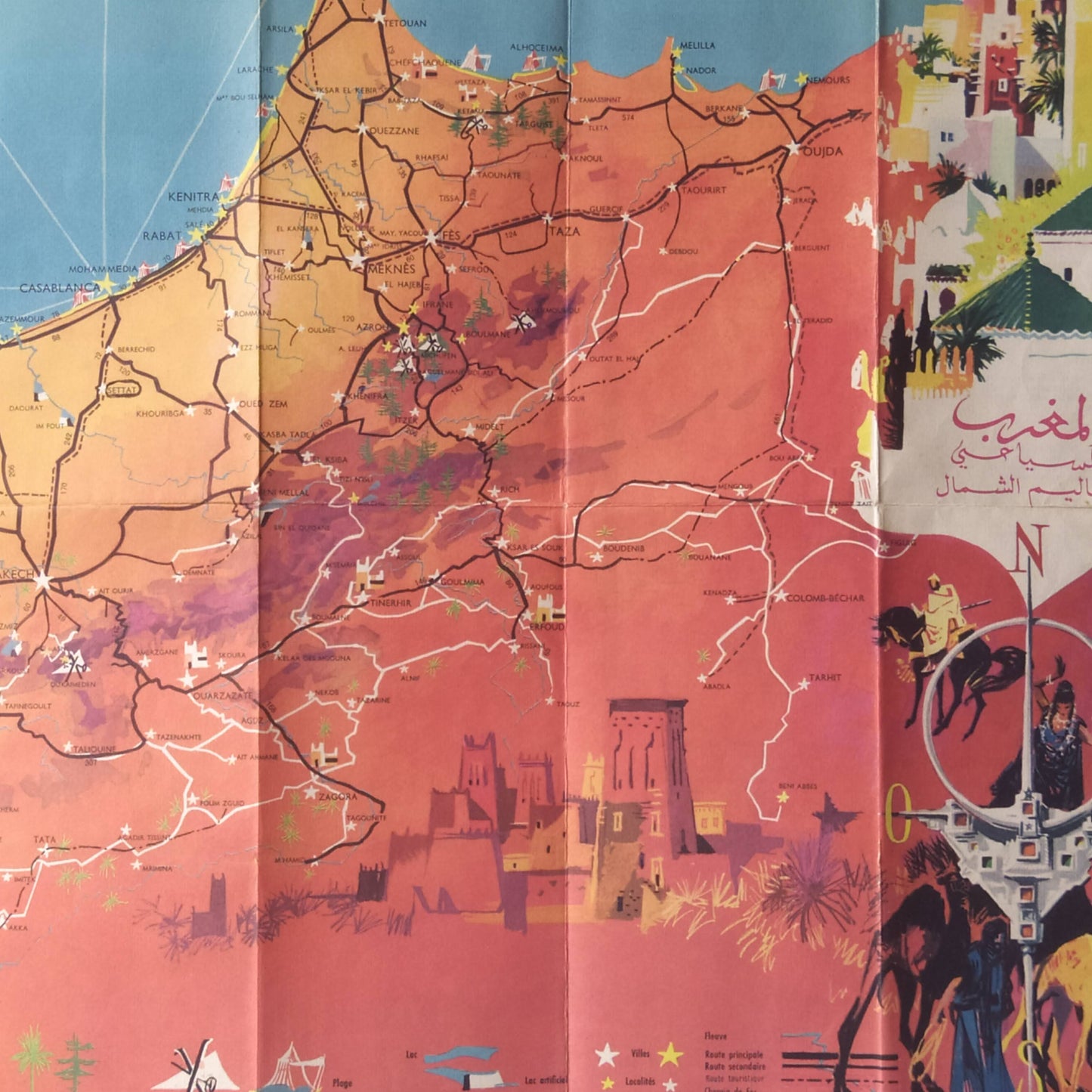
This tourist map of Morocco, published by the Moroccan National Tourist Office, is a pictorial and vibrant representation of the country. It highlights major cities, roads, railways, and borders with neighboring countries. Numerous illustrations, inspired by local folklore, frame the map, showing people in traditional dress, scenes of local life, and monuments. Travel scenes, including planes and ships, are also featured. The map measures 59 cm by 43 cm.
Condition :
Good condition. Please note, my maps are old and not always in perfect condition!
List of main places represented:
Morocco, Algeria, Spain, Mauritania, Sahara, Casablanca, Rabat, Marrakech, Meknes, Fez, Oujda, Taza, Essaouira, Agadir, Ouarzazate, Kenitra, Tiznit.


-

Secure payment
-

Careful shipping
-

No reproduction
-

Satisfied or refunded


-

“Hello, thank you for sending this, the cards are superb!”
Jean-Philippe
-
"They are very beautiful, just need to frame them! Thank you"
Baptiste
-
"Fast shipping and very good tracking."
Alice
-
"My husband loved the maps I gave him for Christmas!"
Solène
