


Vintage tourist map of Europe by Air France - ca. 1950
Vintage tourist map of Europe by Air France - ca. 1950
Couldn't load pickup availability
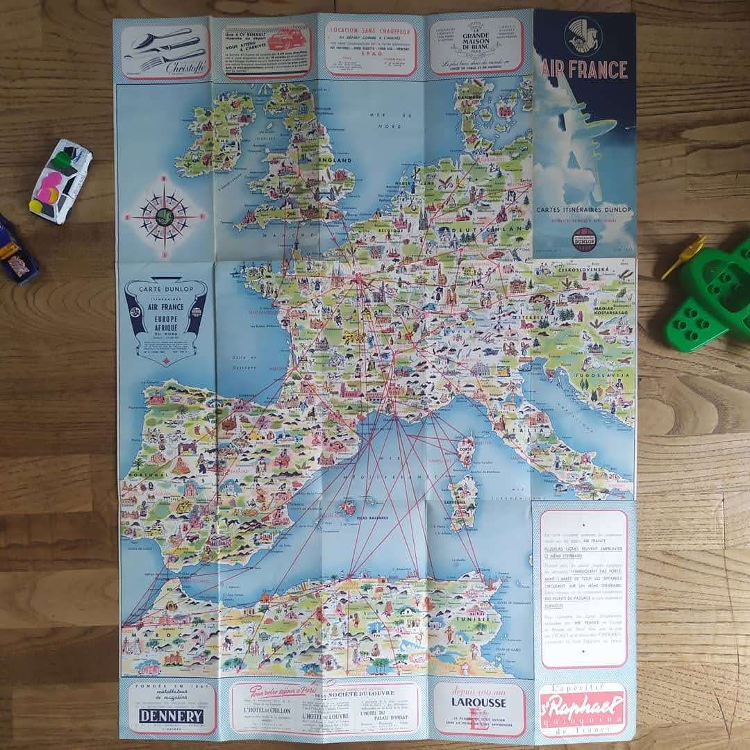
This map, published by Air France and Dunlop in the 1950s, is a magnificent pictorial representation of Europe and North Africa. Very colorful, it is richly illustrated with monuments, characters, and cultural symbols typical of each region, which gives it an undeniable retro charm. The airline routes of the Air France network are marked in red, connecting the main cities and destinations of the time. The map is framed by advertisements for renowned French houses such as Christofle, Larousse, Dennery, and the Hôtel Crillon, testifying to the elegance and luxury associated with air travel during this period. It is a decorative and historical piece, perfect for collectors and travel enthusiasts. The map measures 55 cm by 76 cm.
Condition :
Good condition Please note, my maps are old and are not always in perfect condition!
List of main places represented:
France, England, Scotland, Ireland, Spain, Portugal, Italy, Sardinia, Sicily, Corsica, Greece, Germany, Belgium, Netherlands, Luxembourg, Switzerland, Austria, Denmark, Sweden, Norway, Morocco, Algeria, Tunisia, Mediterranean Sea, Atlantic Ocean, North Sea.


-

Secure payment
-

Careful shipping
-

No reproduction
-

Satisfied or refunded


-

“Hello, thank you for sending this, the cards are superb!”
Jean-Philippe
-
"They are very beautiful, just need to frame them! Thank you"
Baptiste
-
"Fast shipping and very good tracking."
Alice
-
"My husband loved the maps I gave him for Christmas!"
Solène
