


Tourist map of Finistère by A. Lesot - ca. 1930
Tourist map of Finistère by A. Lesot - ca. 1930
Couldn't load pickup availability
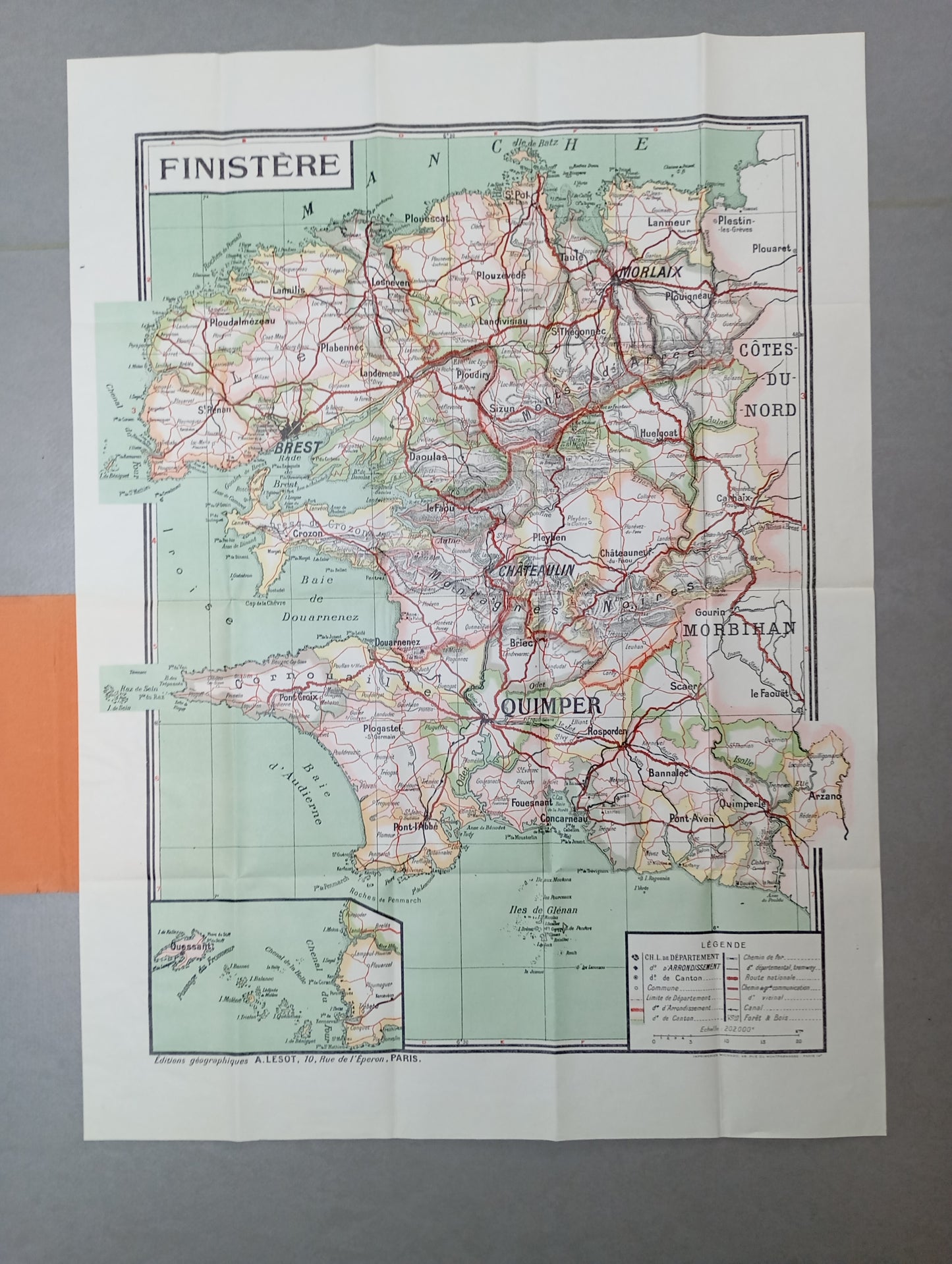
This geographical map of Finistère, published by Editions Géographiques A. Lesot, presents a detailed representation of the department, highlighting its main cities, communication routes, and reliefs. The map is in color, with a light green background for the relief and roads drawn in red for better readability. It includes a legend that identifies the departmental capitals, the district and cantonal capitals, as well as the national and major communication roads. The mention "Éditions Géographiques A. LESOT, 10, rue de l'Opéra, Paris" is clearly visible at the bottom of the map, attesting to its origin. The map measures 75.5 cm by 56 cm.
Condition :
Very good condition. Please note, my maps are old and are not always in perfect condition!
List of main places represented:
Brest, Quimper, Morlaix, Châteaulin, Douarnenez, Concarneau, Pont-l'Abbé, Pleyben, Landerneau, Plouigneau, Fouesnant, Plougastel-Daouarnenez, Roscoff, Audierne Bay, Douarnenez Bay, Glénan Islands, Ouessant Island, Crozon Peninsula, Morlaix Bay.


-

Secure payment
-

Careful shipping
-

No reproduction
-

Satisfied or refunded


-

“Hello, thank you for sending this, the cards are superb!”
Jean-Philippe
-
"They are very beautiful, just need to frame them! Thank you"
Baptiste
-
"Fast shipping and very good tracking."
Alice
-
"My husband loved the maps I gave him for Christmas!"
Solène
