


Illustrated tourist map of the Île de France - ca. 1950
Illustrated tourist map of the Île de France - ca. 1950
Couldn't load pickup availability
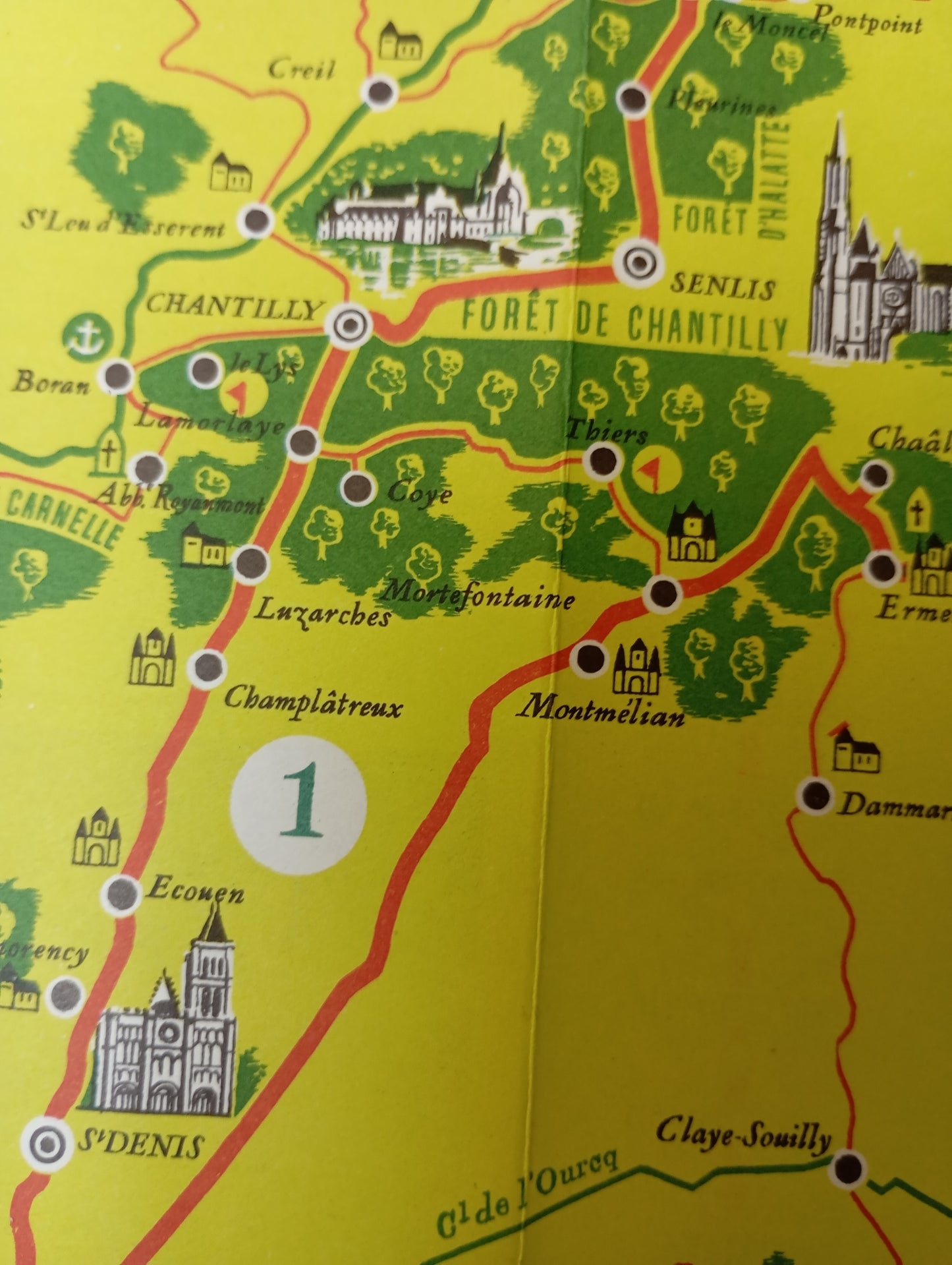
This tourist map of the Île-de-France region is designed to highlight sightseeing routes around Paris. The map background is apple green, with forest areas represented by masses of dark green trees. The map is outlined with a decorative green border. Several numbered routes are outlined in red, with landmarks for châteaux, churches, and other monuments richly illustrated with detailed drawings. The Seine, Oise, and Marne rivers, as well as other waterways, are clearly marked. The key, located at the top left, explains the symbols used. The name "PARIS" is prominently displayed in the center of the map. The map measures 52 cm by 44 cm.
Condition :
Good condition Please note, my maps are old and are not always in perfect condition!
List of main places represented:
Paris, Versailles, Saint-Germain-en-Laye, Saint-Denis, Saint-Cloud, Chantilly, Fontainebleau, Senlis, Melun, Rambouillet, Mantes, Dourdan, Chevreuse, Meaux, Provins, Créteil, Corbeil, Écouen, Fontainebleau Forest, Chantilly Forest


-

Secure payment
-

Careful shipping
-

No reproduction
-

Satisfied or refunded


-

“Hello, thank you for sending this, the cards are superb!”
Jean-Philippe
-
"They are very beautiful, just need to frame them! Thank you"
Baptiste
-
"Fast shipping and very good tracking."
Alice
-
"My husband loved the maps I gave him for Christmas!"
Solène
