


Retro tourist map of Normandy by Robert Rivière - 1936
Retro tourist map of Normandy by Robert Rivière - 1936
Couldn't load pickup availability
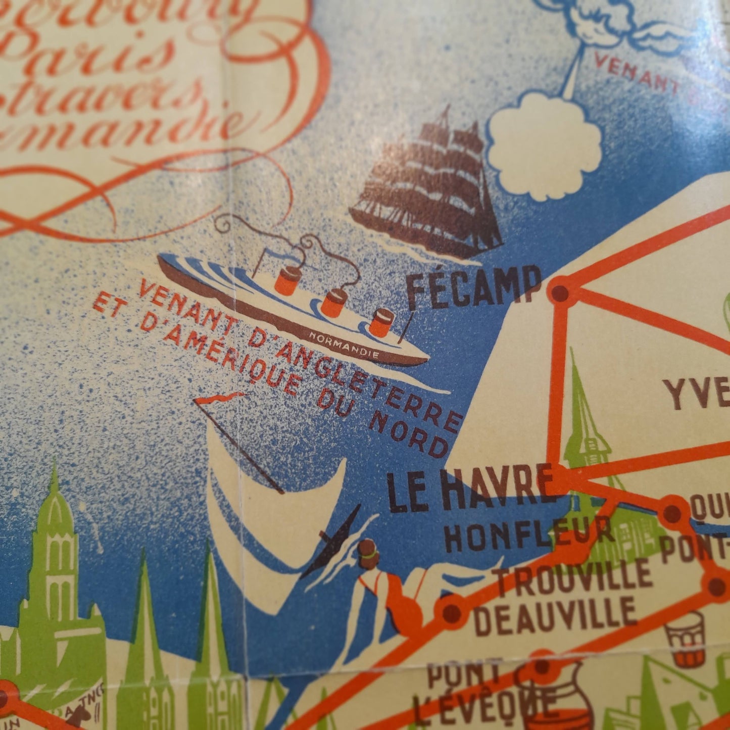
This tourist and pictorial map of Normandy was drawn by Robert Rivière in 1936. Entitled "From Cherbourg to Paris through Normandy", it represents the main routes of the region, marked by red lines connecting the stopover towns. The map is richly illustrated with vignettes that evoke the economic and cultural assets of Normandy: we see silhouettes of cathedrals, Mont Saint-Michel, local specialties, cows, horses, as well as maritime links with England and North America, symbolized in particular by the famous ocean liner "Normandie". Published under the patronage of the 4th Economic Region of Lower Normandy, this map is a true testimony to the promotion of tourism in the region during the 1930s. The map measures 48 cm by 36 cm.
Condition :
Good condition Please note, my maps are old and are not always in perfect condition!
List of main places represented:
Cherbourg, Le Havre, Rouen, Caen, Dieppe, Evreux, Alençon, Lisieux, Bayeux, Saint-Lô, Granville, Mont Saint-Michel, Deauville, Trouville, Honfleur, Fécamp, Vire, Avranches, Argentan, Falaise, Bagnoles-de-l'Orne.


-

Secure payment
-

Careful shipping
-

No reproduction
-

Satisfied or refunded


-

“Hello, thank you for sending this, the cards are superb!”
Jean-Philippe
-
"They are very beautiful, just need to frame them! Thank you"
Baptiste
-
"Fast shipping and very good tracking."
Alice
-
"My husband loved the maps I gave him for Christmas!"
Solène
