


Tourist map of Trébeurden and its surroundings ca. 1950
Tourist map of Trébeurden and its surroundings ca. 1950
Couldn't load pickup availability
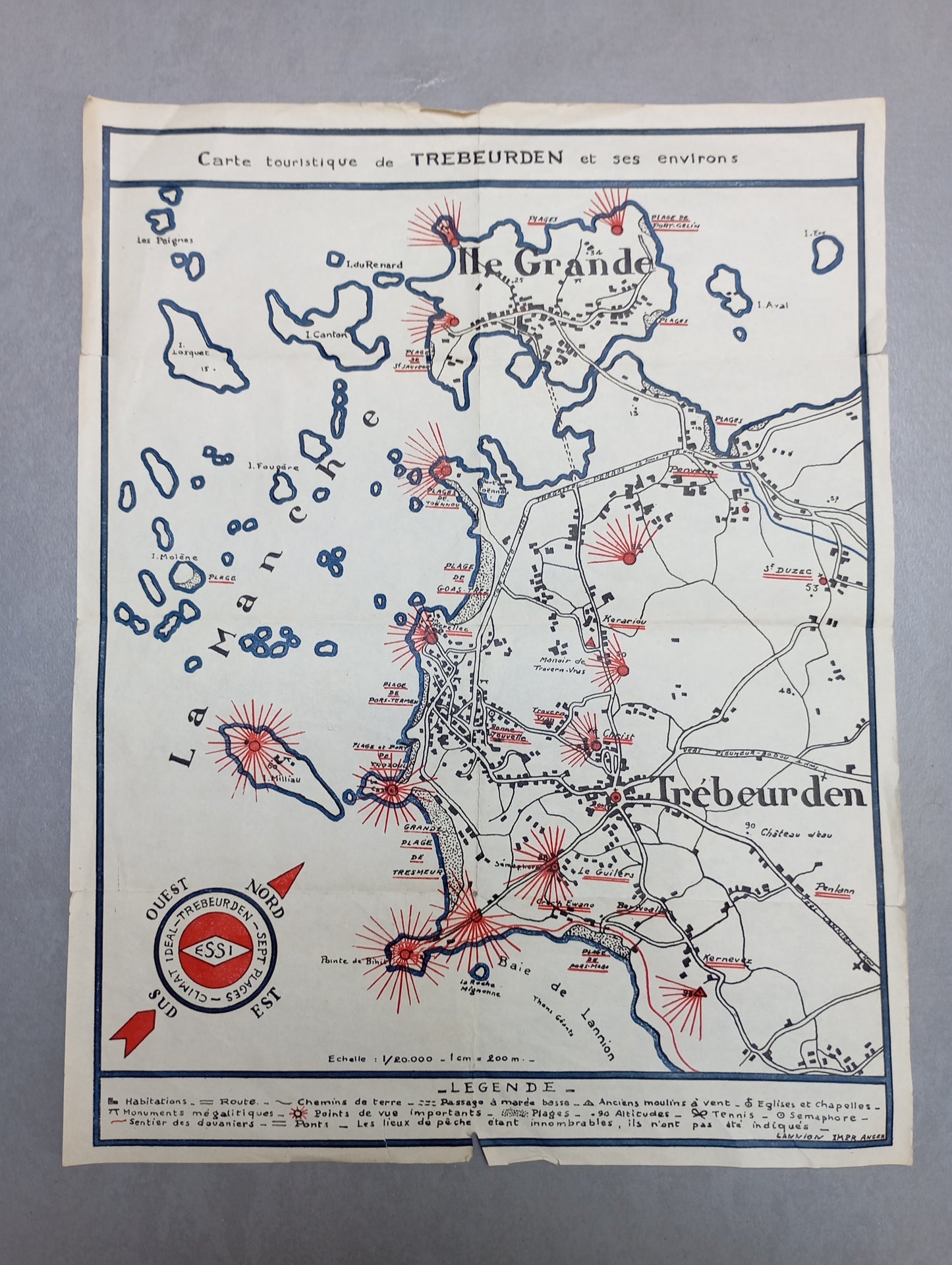
This map is a tourist map of Trébeurden and the surrounding area. It highlights the coast, Lannion Bay, Île Grande, and the surrounding islands. Points of interest are marked with radiant red symbols, indicating megalithic monuments, important viewpoints, and fishing spots. There is a detailed key that provides information on dwellings, roads, dirt tracks, and beaches. The map is in black and white with red and blue accents, giving a distinctive, ancient look. A compass rose on the side reads "Ideal - Trébeurden - Climate - Seven Beaches." The map measures 27 cm by 34 cm.
List of main places represented:
Trébeurden, Lannion, Grande Island, Miliau Island, Bihit Point, Tresmeur Beach, Goas Lagorn Beach, Travern-Vras Manor, Keriou, Good News, Christ, Le Guillets, St-Uzec, Kerariou, Lannion Bay.
Condition:
Good condition, see photos. Please note, my maps are old and are not always in perfect condition!


-

Secure payment
-

Careful shipping
-

No reproduction
-

Satisfied or refunded


-

“Hello, thank you for sending this, the cards are superb!”
Jean-Philippe
-
"They are very beautiful, just need to frame them! Thank you"
Baptiste
-
"Fast shipping and very good tracking."
Alice
-
"My husband loved the maps I gave him for Christmas!"
Solène
