


Vintage tourist map of Rhodes Island - ca. 1930
Vintage tourist map of Rhodes Island - ca. 1930
Couldn't load pickup availability
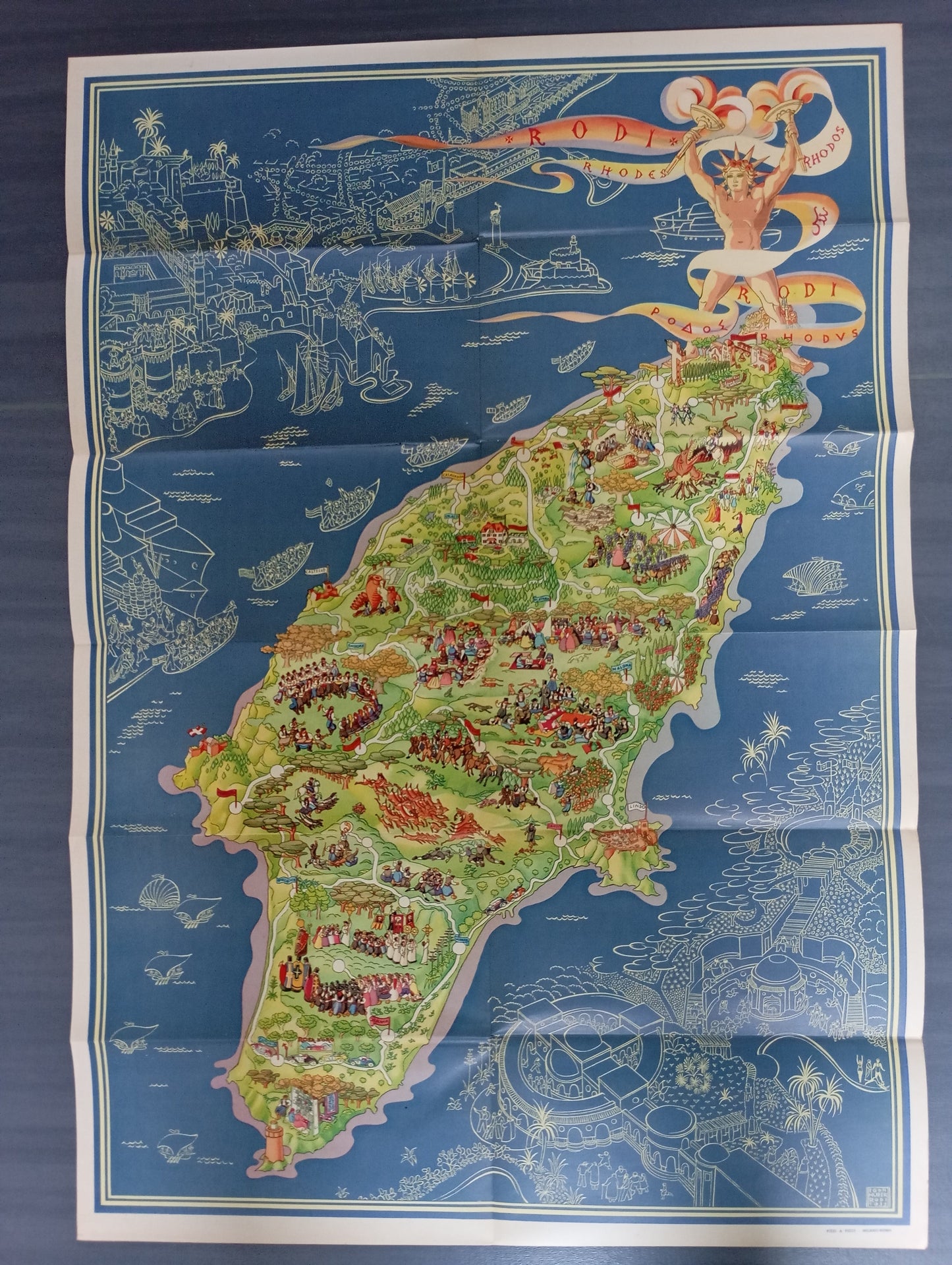
This illustrated map of the island of Rhodes is a visually rich cartographic piece. The island is depicted in vibrant color, standing out against a deep blue seascape. The map is filled with detailed pictorial scenes depicting the life, history, and folklore of Rhodes: dancers in traditional costumes, knights, scenes of agricultural life, and mythological creatures are depicted. In the lower right-hand section, there is a dramatic illustration of the Colossus of Rhodes holding a phylactery inscribed with "Rhodos." The surrounding waters are adorned with cream-colored line drawings, showing ancient ships, sea creatures, and a stylized plan of the port city. The map measures 70 cm by 49 cm.
Condition :
Very good condition. Please note, my maps are old and are not always in perfect condition!
List of main places represented:
Rhodes, Ialissos, Embona, S. Isidoro, Castello, Calavarda, Cattavia.


-

Secure payment
-

Careful shipping
-

No reproduction
-

Satisfied or refunded


-

“Hello, thank you for sending this, the cards are superb!”
Jean-Philippe
-
"They are very beautiful, just need to frame them! Thank you"
Baptiste
-
"Fast shipping and very good tracking."
Alice
-
"My husband loved the maps I gave him for Christmas!"
Solène
