


Vintage Tourist Map of San Francisco (German Edition) - ca. 1980
Vintage Tourist Map of San Francisco (German Edition) - ca. 1980
Couldn't load pickup availability
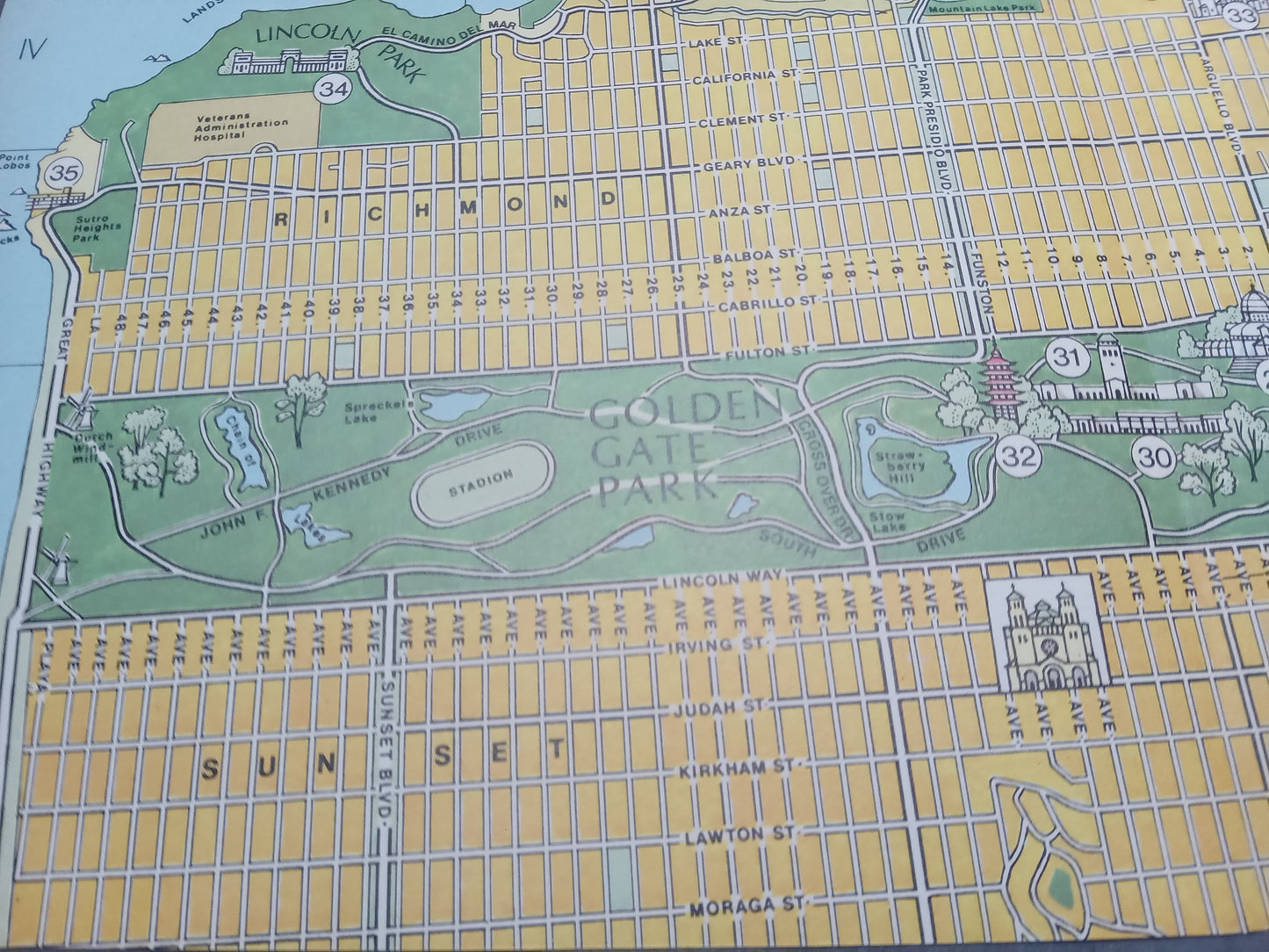
This vintage, illustrated map of San Francisco offers a bird's-eye view of the city with a distinctive 1980s graphic style. The map uses a vibrant color palette, with yellow dominating the urban grid, green for the parks (including the immense Golden Gate Park and Lincoln Park), and blue for the bay and ocean. The cartography combines a plan view for the street grid with a slightly perspective or relief (pictorial) representation of the major neighborhoods (Downtown, Nob Hill, Russian Hill), monuments, and topography, making it easy to find your way around. Many landmarks are numbered to refer to a legend (not visible here, but implied). The street structure is very clear, highlighting the main avenues. An inset in the upper right corner shows the extended Bay Area. The retro style is reinforced by the stylized yet precise building designs. The map measures 32 cm by 26 cm.
Condition :
Good condition Please note, my maps are old and are not always in perfect condition!
List of main places represented:
San Francisco, Golden Gate, Presidio, Golden Gate Park, Richmond, Sunset, Downtown, Nob Hill, Russian Hill, Chinatown, The Embarcadero, San Francisco Bay, Oakland, Marin County (inset).


-

Secure payment
-

Careful shipping
-

No reproduction
-

Satisfied or refunded


-

“Hello, thank you for sending this, the cards are superb!”
Jean-Philippe
-
"They are very beautiful, just need to frame them! Thank you"
Baptiste
-
"Fast shipping and very good tracking."
Alice
-
"My husband loved the maps I gave him for Christmas!"
Solène
