


Antique map of South Africa by Bacon's - ca. 1900
Antique map of South Africa by Bacon's - ca. 1900
Couldn't load pickup availability
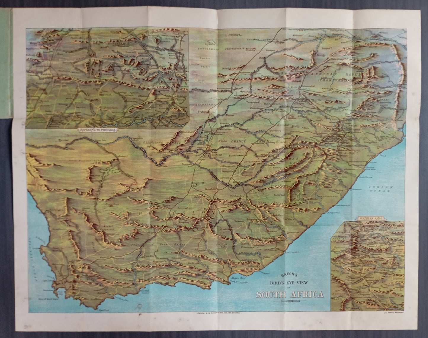
This bird's eye view map of South Africa, published by Bacon's, provides a detailed depiction of the region's relief and topography at the beginning of the 20th century. Mountain ranges, such as the Lange Bergen, are beautifully illustrated with a shading effect that adds depth to the map. It covers the territories of the Cape Colony, the Orange Free State, the South African Republic (Transvaal), and Natal. The railway network, crucial at the time, is finely traced, connecting major towns. The map also notes historic battle sites, including Isandula and Rorke's Drift (1879), testifying to the region's conflicts. An inset map details the southern part of Natal. The map measures 87 cm by 68 cm.
Condition :
Very good condition. Please note, my maps are old and are not always in perfect condition!
List of main places represented:
Cape Town, Simonstown, Paarl, Stellenbosch, Worcester, Tulbagh, Calvinia, Sutherland, Ladysmith, Newcastle, Dundee, Estcourt, Utrecht, Vryheid, Cape of Good Hope, Natal, Orange Free State, Republic of South Africa (Transvaal), Cape Colony.


-

Secure payment
-

Careful shipping
-

No reproduction
-

Satisfied or refunded


-

“Hello, thank you for sending this, the cards are superb!”
Jean-Philippe
-
"They are very beautiful, just need to frame them! Thank you"
Baptiste
-
"Fast shipping and very good tracking."
Alice
-
"My husband loved the maps I gave him for Christmas!"
Solène
