


Vintage Map of Africa: Westermann's 1950s Visual Exploration
Vintage Map of Africa: Westermann's 1950s Visual Exploration
Couldn't load pickup availability
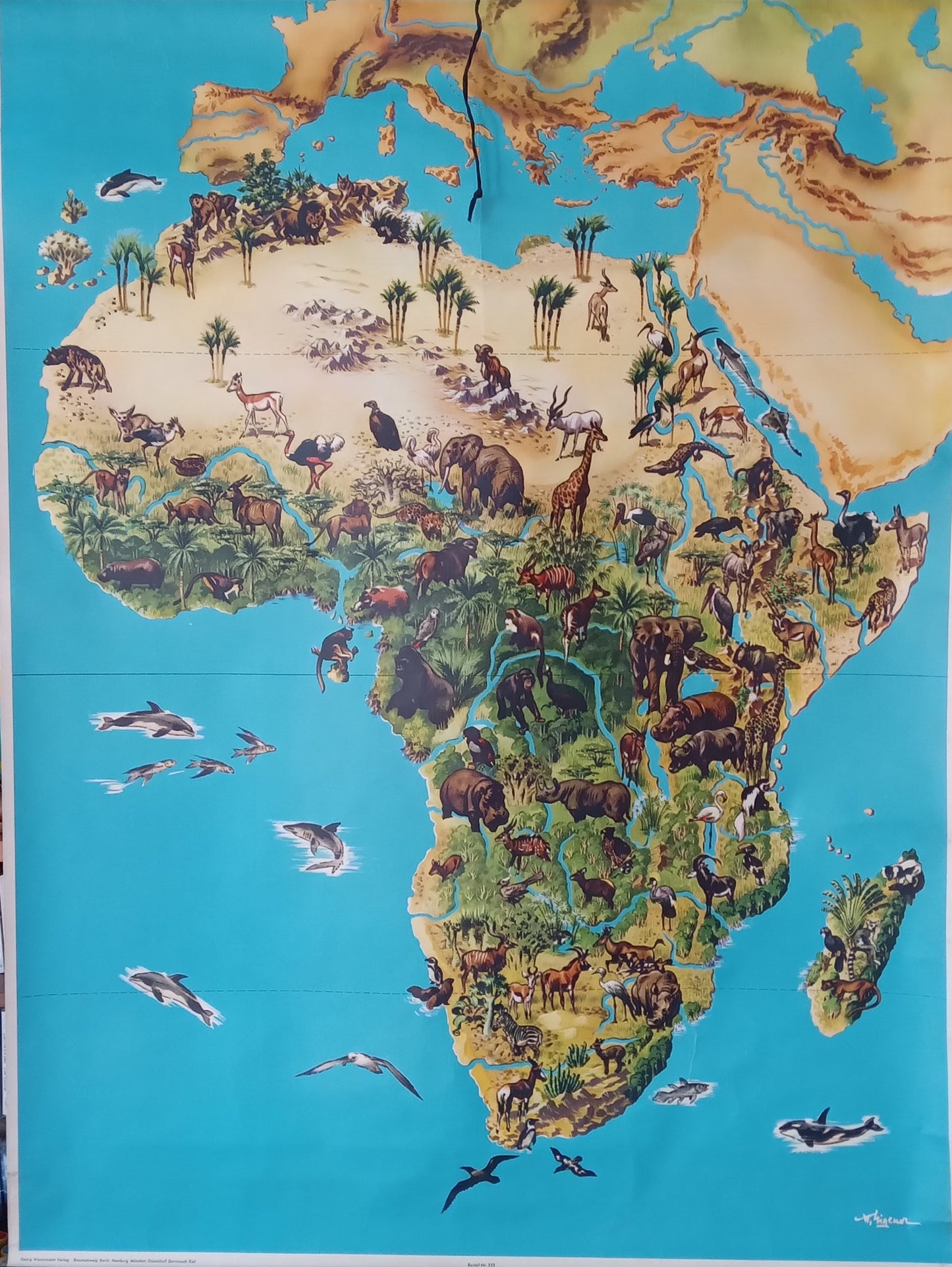
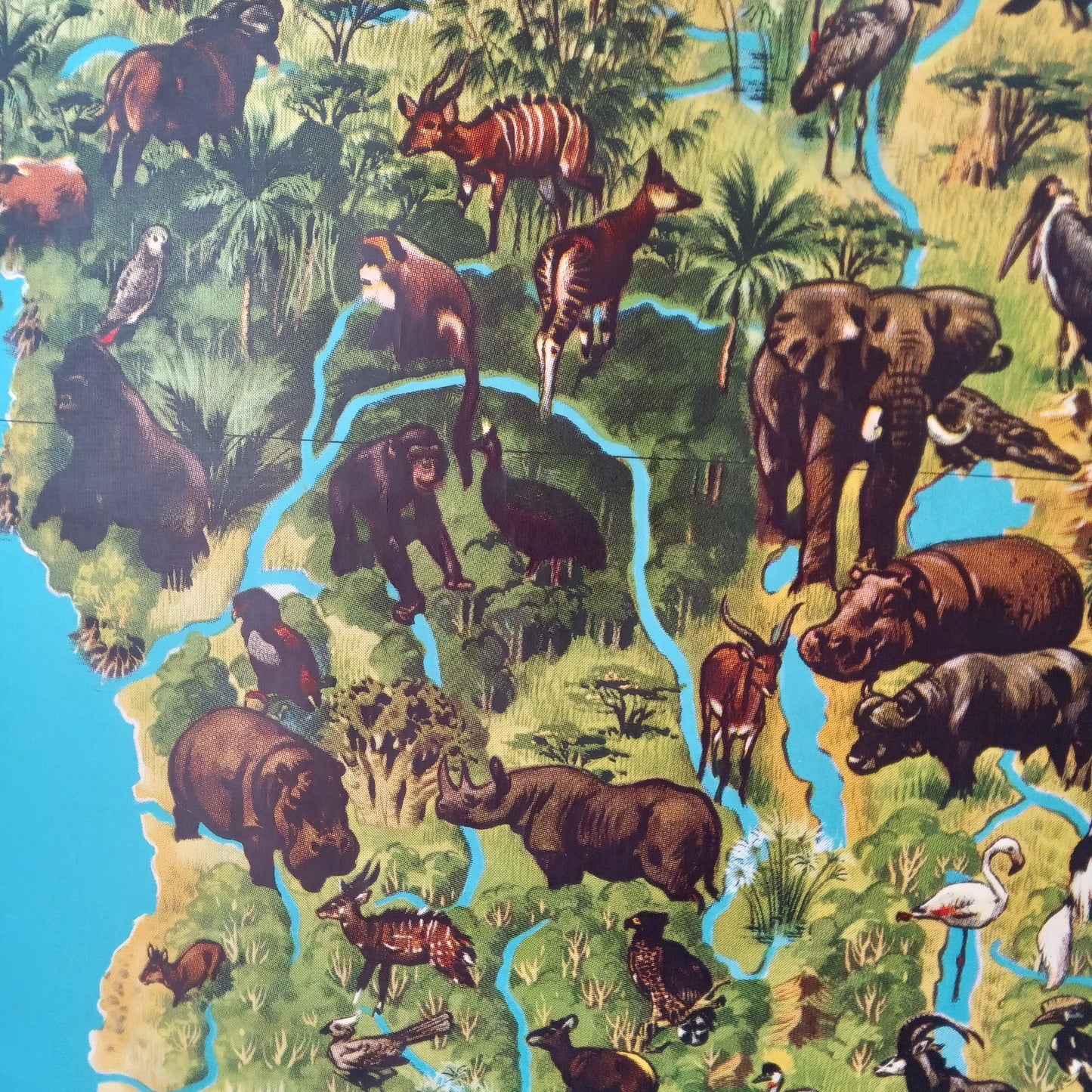
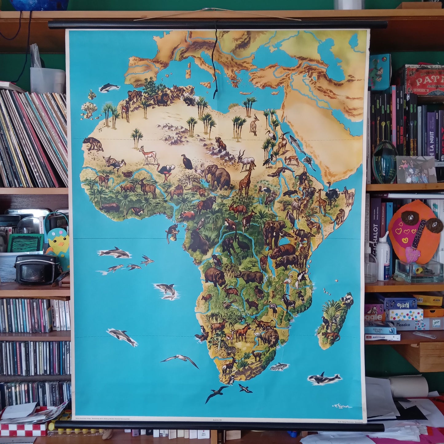
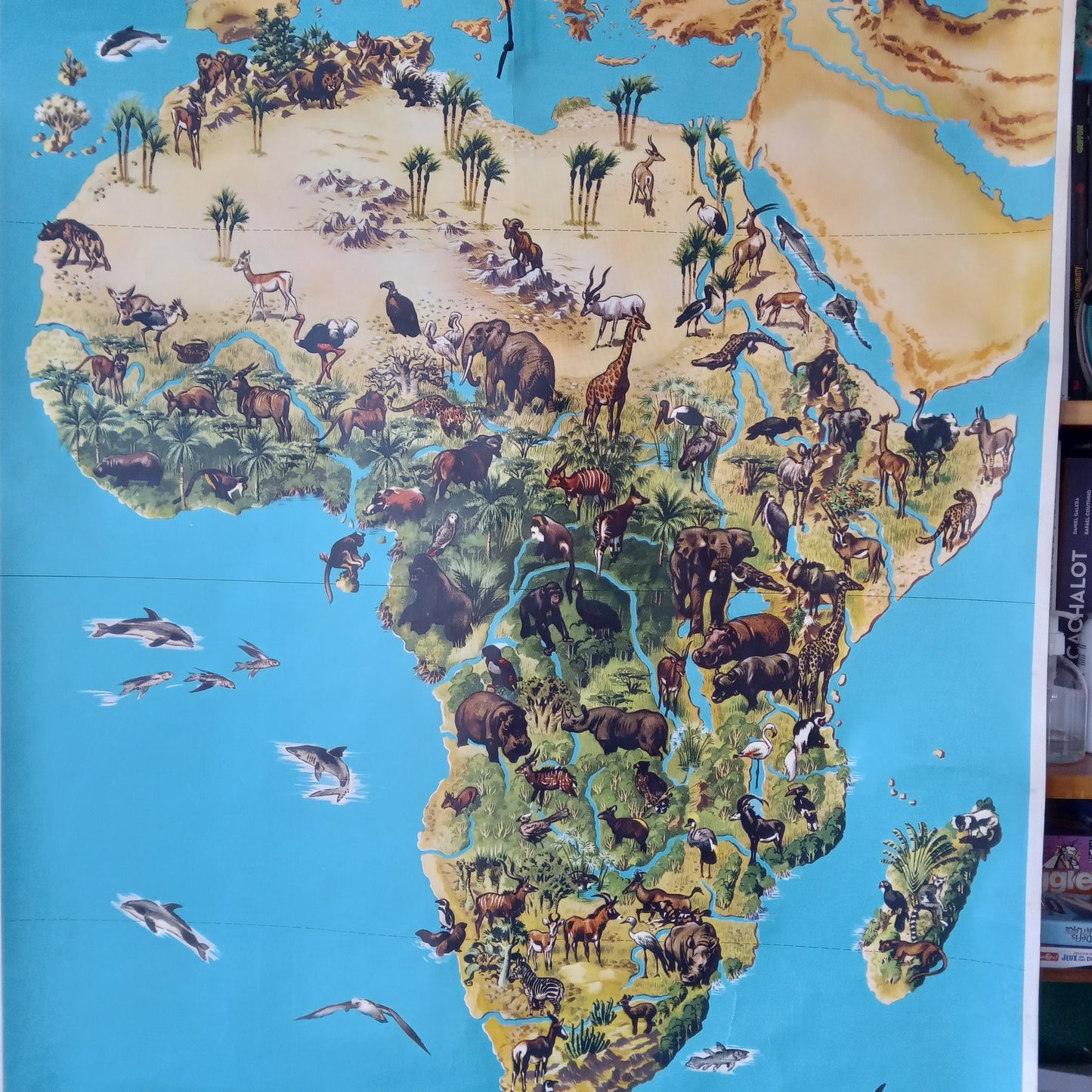
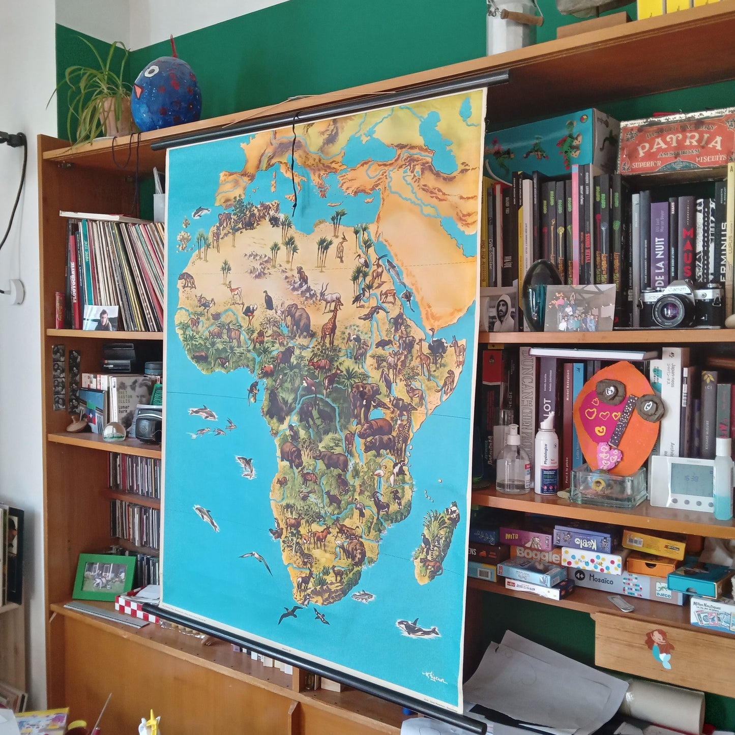
Dive into this vintage 1950s map, published by Westermann, which offers a captivating visual exploration of Africa. With its colorful and detailed illustrations, this map highlights the continent's diverse landscapes, wildlife, and geographical features. The vivid depictions of animals, varied landscapes, and cultural scenes make it a valuable educational tool and a fascinating work of art. Ideal for history, geography, and art enthusiasts, this map is a treasure trove for those interested in exploring Africa's rich history through time. Dimensions: 120 x 90 cm.
Condition :
Very good condition. Please note, my maps are old and are not always in perfect condition! Sent in a tube.
List of main places:
Africa, Egypt, Libya, Tunisia, Algeria, Morocco, Western Sahara, Mauritania, Mali, Niger, Chad, Sudan, South Sudan, Ethiopia, Eritrea, Djibouti, Somalia, Kenya, Uganda, Tanzania, Rwanda, Burundi, Democratic Republic of Congo, Republic of Congo, Gabon, Cameroon, Equatorial Guinea, Sao Tome and Principe, Angola, Zambia, Zimbabwe, Mozambique, Malawi, Botswana, Namibia, South Africa, Lesotho, Eswatini, Madagascar, Comoros, Seychelles, Mauritius, Reunion, Mayotte, Senegal, Gambia, Guinea-Bissau, Guinea, Sierra Leone, Liberia, Ivory Coast, Burkina Faso, Ghana, Togo, Benin, Nigeria, Canary Islands.

-

Secure payment
-

Careful shipping
-

No reproduction
-

Satisfied or refunded


-

“Hello, thank you for sending this, the cards are superb!”
Jean-Philippe
-
"They are very beautiful, just need to frame them! Thank you"
Baptiste
-
"Fast shipping and very good tracking."
Alice
-
"My husband loved the maps I gave him for Christmas!"
Solène
