


Illustrated map of Germany by Walter Riemer - 1936
Illustrated map of Germany by Walter Riemer - 1936
Couldn't load pickup availability
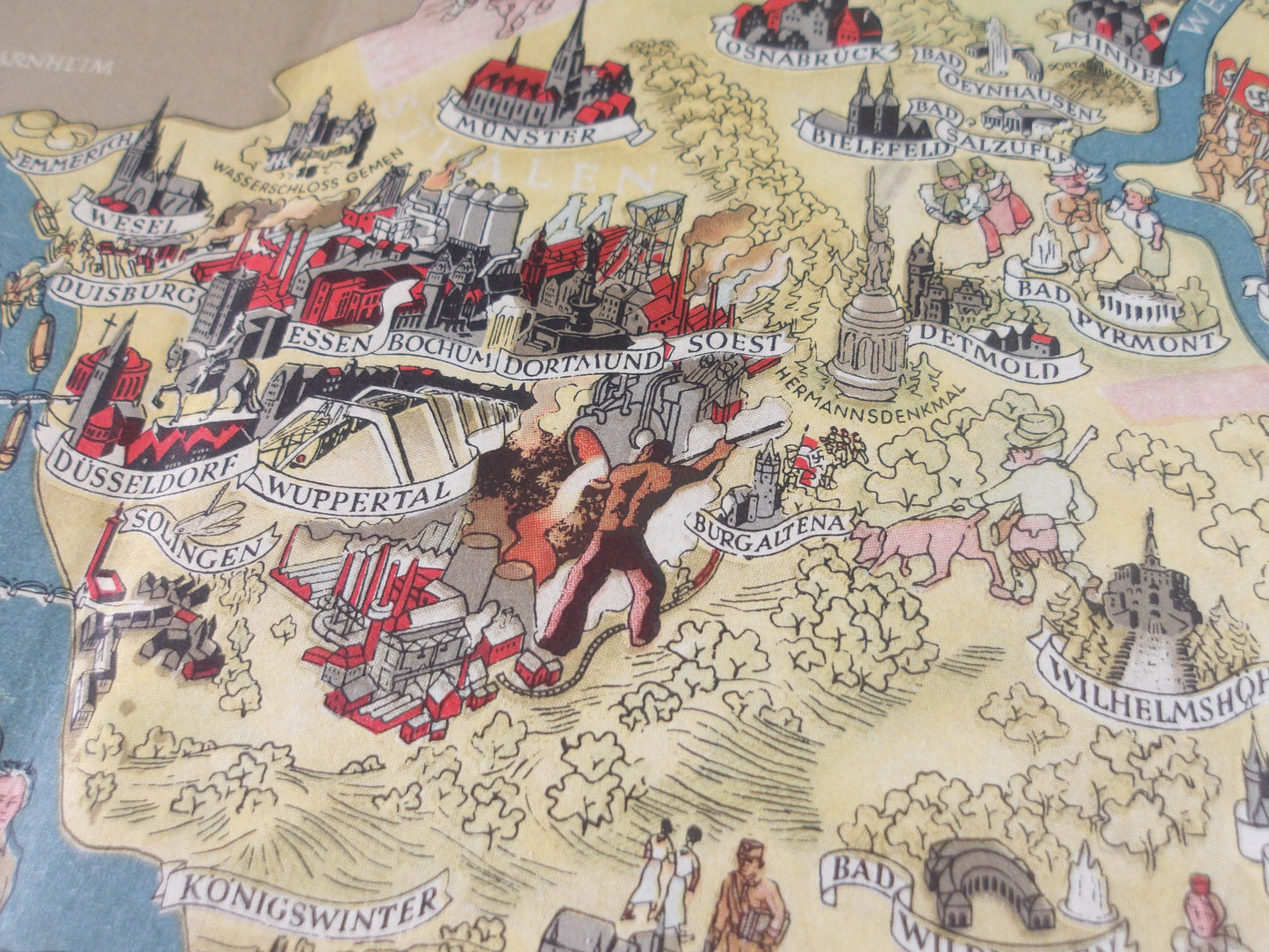
This illustrated map of Germany, created by Walter Riemer in 1936, is an artistic and detailed representation of the country. The map highlights major cities, monuments, and tourist attractions through careful illustrations and annotations. The regions are represented with soft colors and patterns that evoke the charm and diversity of the German landscape. Rivers and waterways are clearly marked, providing a geographical and cultural overview. This map, with its retro style and meticulous details, is a testament to the cartographic art of the time and invites you to explore the riches of Germany. This map was probably designed to promote tourism in Germany, highlighting the country's natural and cultural beauties. Dimensions: 60*81 cm.
State :
Very good condition. Please note, this card is old and may show signs of wear normal for its age!
List of main places represented:
Berlin, Munich, Hamburg, Cologne, Frankfurt, Stuttgart, Düsseldorf, Dortmund, Essen, Bremen, Hanover, Leipzig, Dresden, Nuremberg


-

Secure payment
-

Careful shipping
-

No reproduction
-

Satisfied or refunded


-

“Hello, thank you for sending this, the cards are superb!”
Jean-Philippe
-
"They are very beautiful, just need to frame them! Thank you"
Baptiste
-
"Fast shipping and very good tracking."
Alice
-
"My husband loved the maps I gave him for Christmas!"
Solène
