


Illustrated map of Brittany circa 1950
Illustrated map of Brittany circa 1950
Couldn't load pickup availability
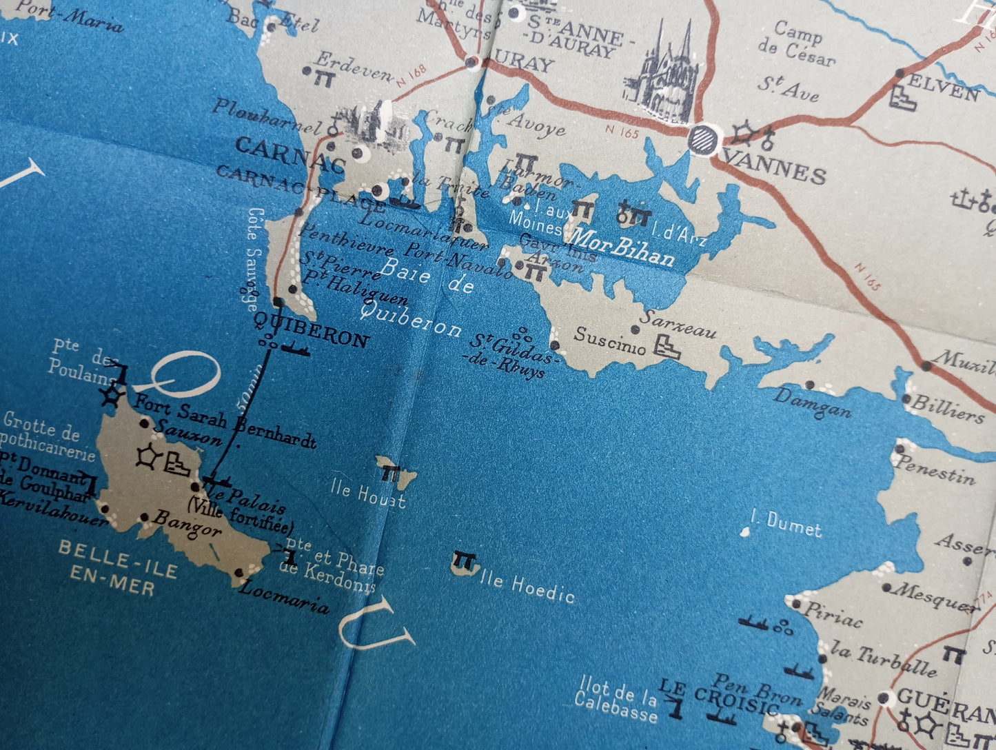
This map of Brittany, dating from the 1950s, presents the region as a whole with a clean graphic style. Major roads, railways, and towns are indicated. Ports, historic monuments, and tourist attractions are symbolized according to the legend located in a decorative cartouche at the bottom left. The map outline is decorated with a checkered frame, and the surrounding maritime areas are colored in deep blue, providing an elegant contrast to the light beige background. The map dimensions are 83 cm by 51 cm.
List of main places represented:
Brest, Quimper, Douarnenez, Concarneau, Vannes, Lorient, Quiberon, Carnac, Saint-Brieuc, Saint-Malo, Rennes, Morbihan, Finistère, Côtes-du-Nord (now Côtes-d'Armor), Ille-et-Vilaine, Loire-Atlantique, Belle-Île-en-Mer, Ouessant Island, Crozon Peninsula.
Condition :
Good condition Please note, my maps are old and are not always in perfect condition!


-

Secure payment
-

Careful shipping
-

No reproduction
-

Satisfied or refunded


-

“Hello, thank you for sending this, the cards are superb!”
Jean-Philippe
-
"They are very beautiful, just need to frame them! Thank you"
Baptiste
-
"Fast shipping and very good tracking."
Alice
-
"My husband loved the maps I gave him for Christmas!"
Solène
