


Illustrated map of the Belgian Congo – 1950s
Illustrated map of the Belgian Congo – 1950s
Couldn't load pickup availability
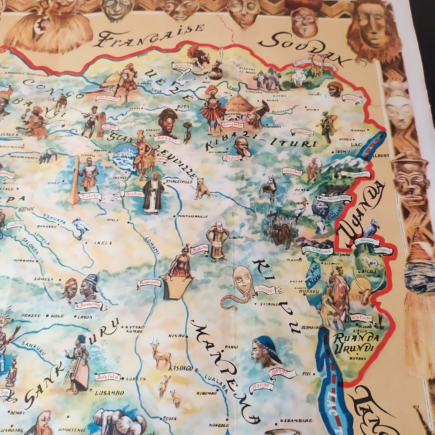
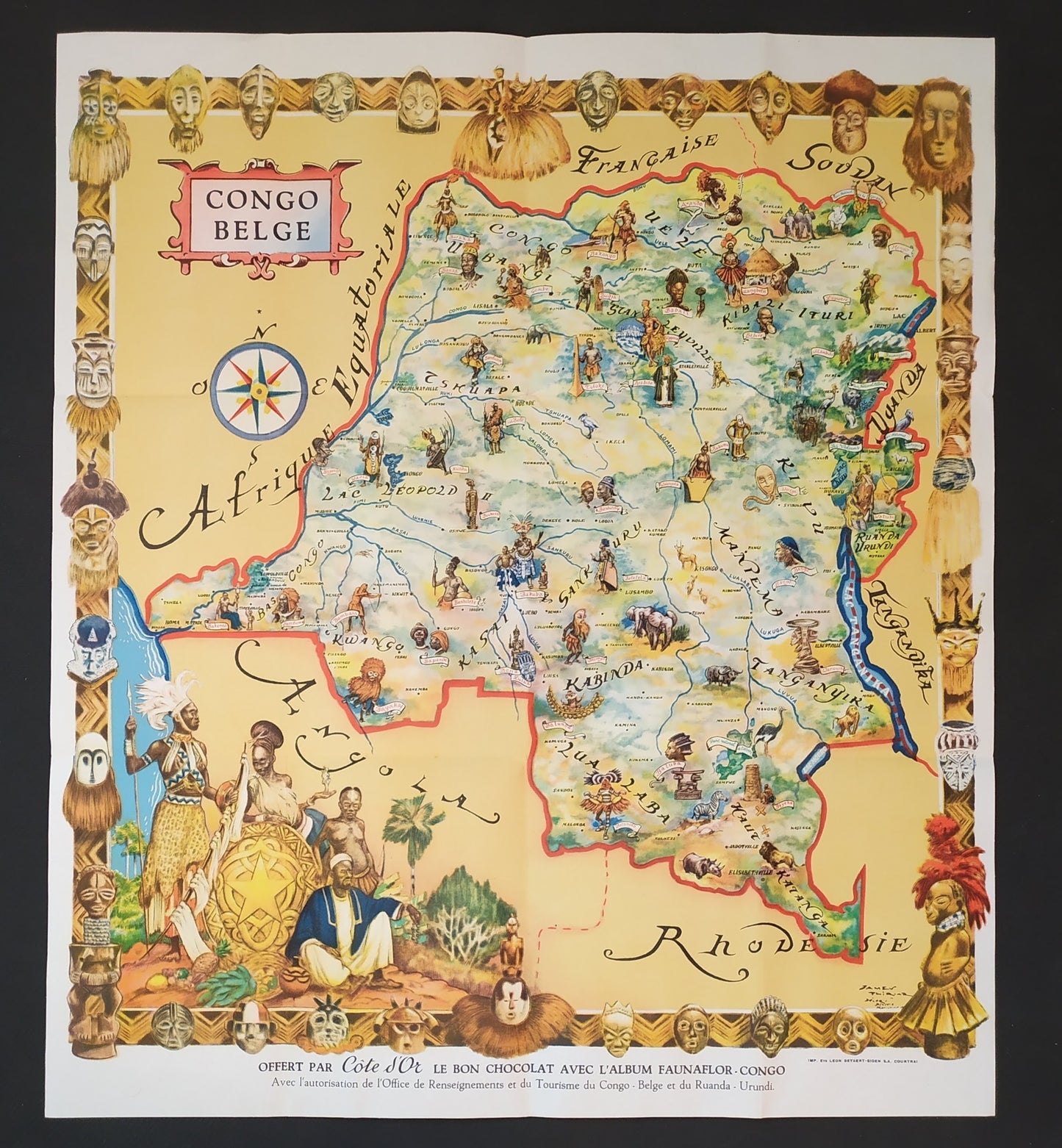
This map of the Belgian Congo, published in the 1950s, was produced with the permission of the Belgian Congo and Ruanda-Urundi Information and Tourism Office. It depicts the territory with numerous illustrations depicting fauna, flora, human activities, and local populations. Major cities such as Léopoldville, Élisabethville, Stanleyville, and Coquilhatville are indicated, as well as the main rivers and geographical areas. The border is decorated with traditional masks and figures, highlighting the colonial aesthetic of the time. Dimensions: 55 x 50 cm.
Condition :
Very good condition. Please note, my maps are old and not always in perfect condition!
List of main places represented:
Albertville, Bukavu, Goma, Jadotville, Kikwit, Lisala, Mbandaka, Port-Francqui, Basankusu, Gemena, Inongo, Kabalo, Kamina, Kongolo, Libenge, Likasi, Lusambo, Mweka, Niangara, Paulis, Ponthierville, Uvira, Watsa, Lake Albert, Lake Edward, Lake Kivu, Lomami, Ubangi, Uele, Ituri, Katanga.


-

Secure payment
-

Careful shipping
-

No reproduction
-

Satisfied or refunded


-

“Hello, thank you for sending this, the cards are superb!”
Jean-Philippe
-
"They are very beautiful, just need to frame them! Thank you"
Baptiste
-
"Fast shipping and very good tracking."
Alice
-
"My husband loved the maps I gave him for Christmas!"
Solène
