


Vintage map of Spain and Portugal - ca. 1960
Vintage map of Spain and Portugal - ca. 1960
Couldn't load pickup availability
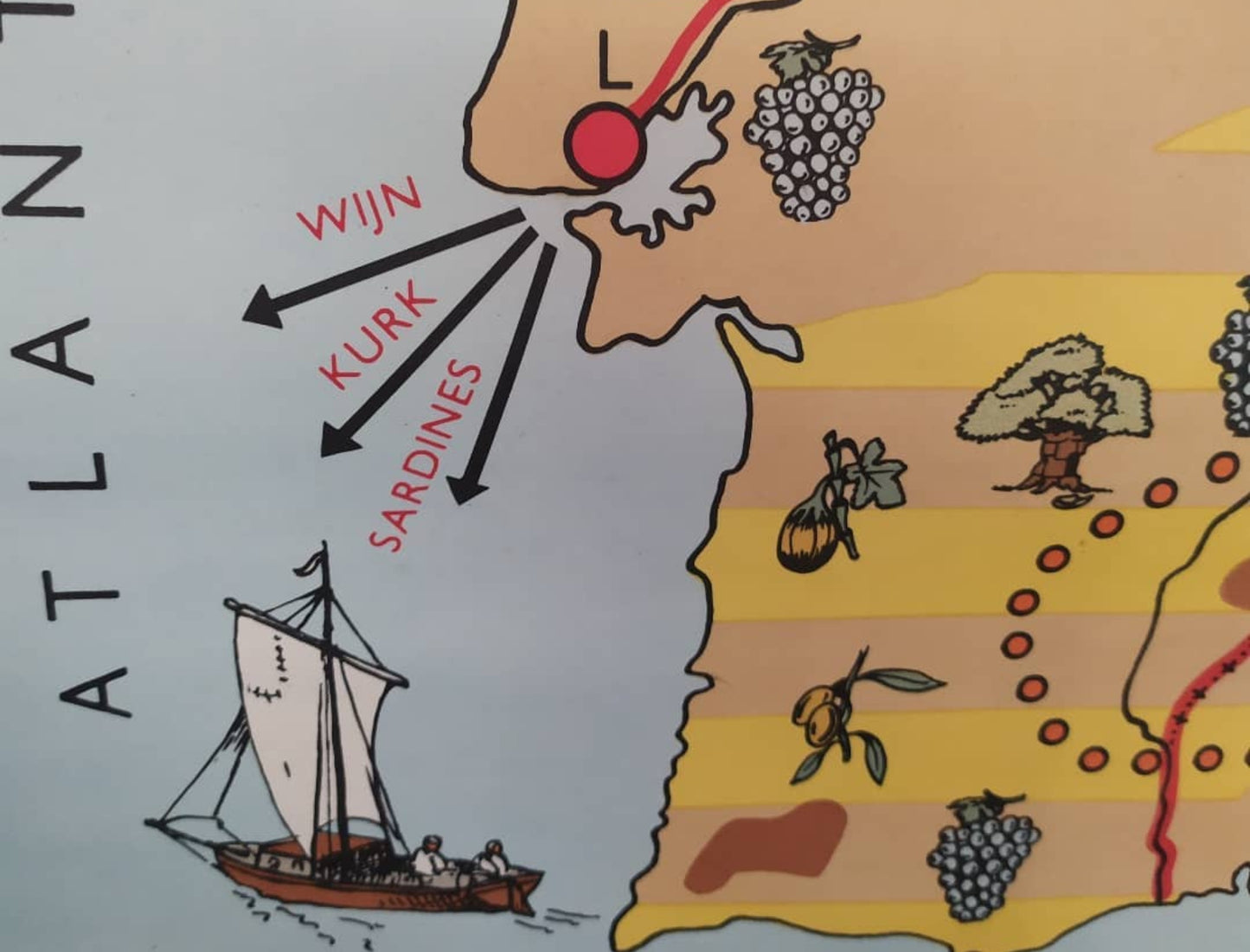
This vintage school poster depicts the Iberian Peninsula with a detailed economic and geographical approach. Published by Dijkstra's Uitgeverij Zeist and created by W. Bakker and H. Rusch, this pictorial map in Dutch highlights the natural resources and local products of the 1960s. The document uses a rich legend to identify areas of pastureland, irrigated crops (southern fruits), arable land, and steppe regions. Numerous illustrations dot the landscape: bunches of grapes for wine, olive trees, cork oaks, sardines for fishing, as well as industrial symbols for coal, iron, and copper mines. Mountain ranges such as the Sierra Nevada and the Cantabrian Mountains are also depicted. The map is mounted on two original wooden rods with its hanging cord. The map measures 110 cm by 85 cm.
Condition :
Good condition. Please note, my maps are old and not always in perfect condition! Shipped in a tube.
List of the main locations represented:
Spain, Portugal, Balearic Islands (Mallorca, Menorca, Ibiza/Pityusen), Madrid, Barcelona, Valencia, Lisbon, Gibraltar, France, Morocco, Algeria, Bay of Biscay, Atlantic Ocean, Mediterranean Sea.


-

Secure payment
-

Careful shipping
-

No reproduction
-

Satisfied or refunded


-

“Hello, thank you for sending this, the cards are superb!”
Jean-Philippe
-
"They are very beautiful, just need to frame them! Thank you"
Baptiste
-
"Fast shipping and very good tracking."
Alice
-
"My husband loved the maps I gave him for Christmas!"
Solène
