


Vintage Illustrated Map of Swiss Railways - 1937
Vintage Illustrated Map of Swiss Railways - 1937
Couldn't load pickup availability
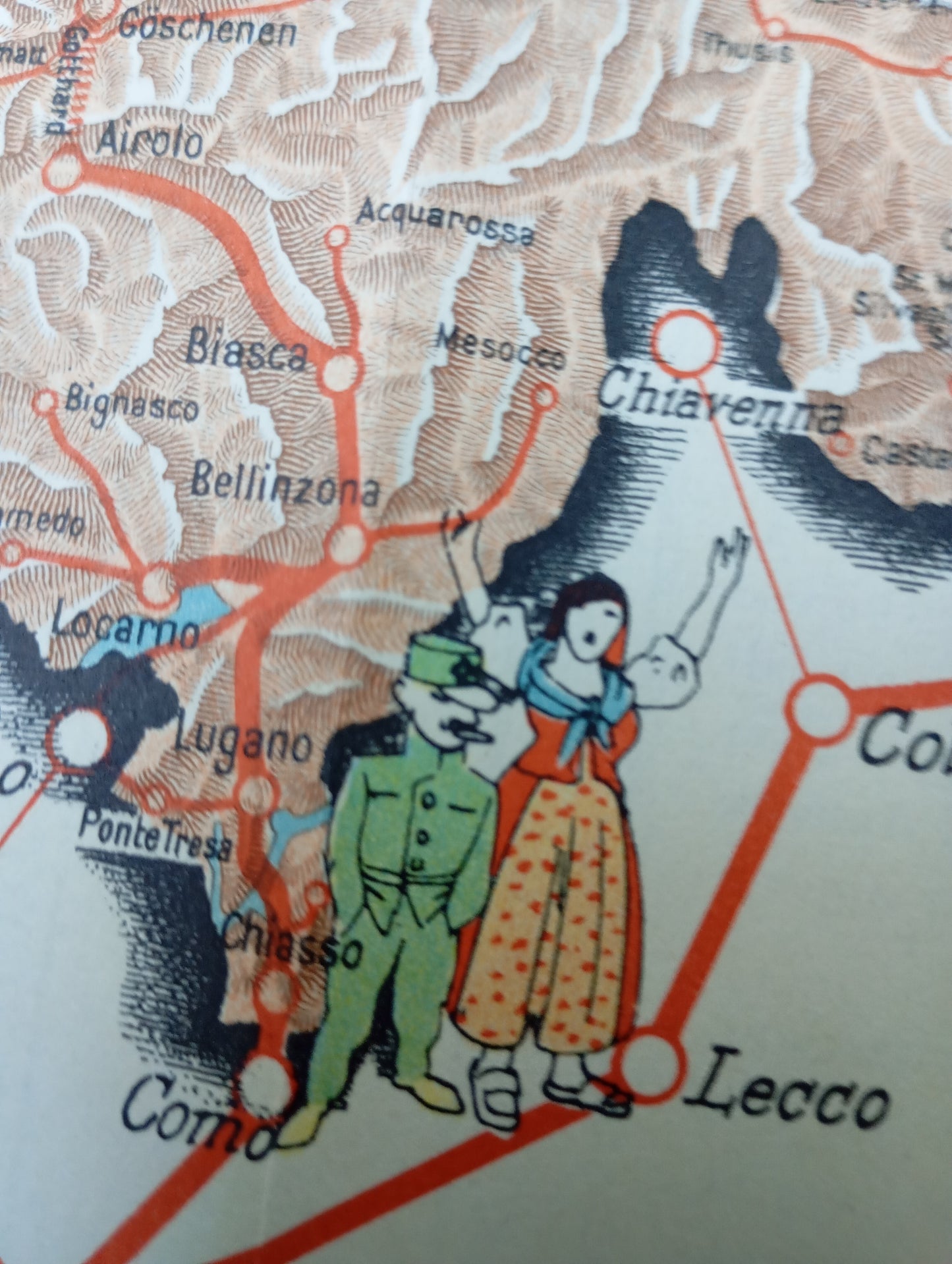
This illustrated tourist map of Swiss railways highlights the country's international rail connections. It presents a pictorial view of Switzerland, with the train network superimposed. The illustration style is particularly playful and narrative, with small vignettes depicting scenes from everyday life, tourist activities such as skiing and hiking, as well as cultural figures and symbols from each region. It features characters in traditional costumes, emblematic animals, and monuments. The map is designed to be both an informative guide to train routes and a decorative piece that inspires travel. It measures 50 cm by 46 cm.
Condition :
Good condition Please note, my maps are old and are not always in perfect condition!
List of main places represented:
Basel, Bern, Lucerne, Geneva, Zurich, Lugano, Lausanne, Montreux, Fribourg, St. Gallen, Chur, Locarno.


-

Secure payment
-

Careful shipping
-

No reproduction
-

Satisfied or refunded


-

“Hello, thank you for sending this, the cards are superb!”
Jean-Philippe
-
"They are very beautiful, just need to frame them! Thank you"
Baptiste
-
"Fast shipping and very good tracking."
Alice
-
"My husband loved the maps I gave him for Christmas!"
Solène
