


Vintage map of Machu Picchu Park - ca. 1950
Vintage map of Machu Picchu Park - ca. 1950
Couldn't load pickup availability
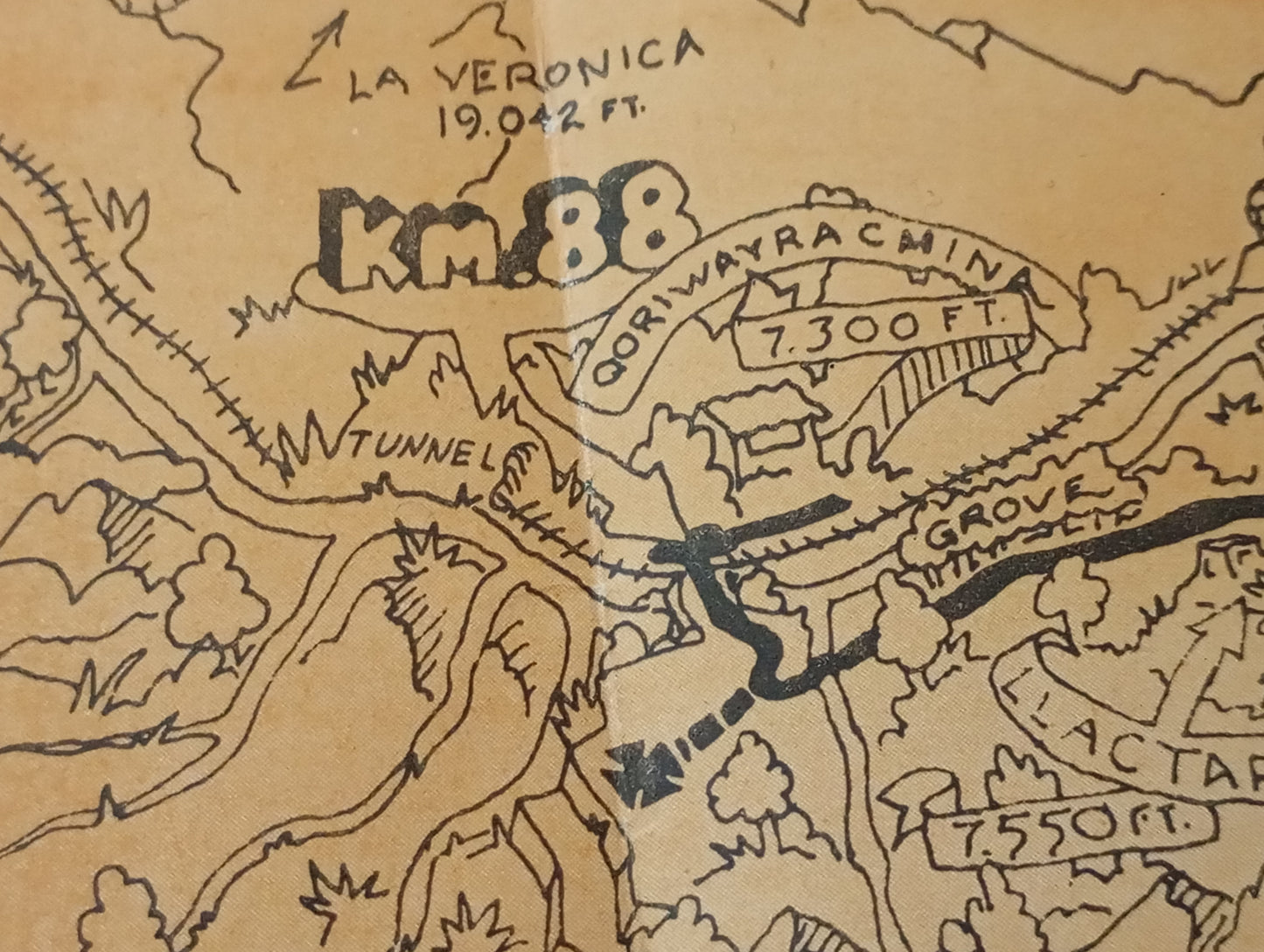
This illustrated map, titled "Machu Picchu National Archaeological Park," depicts the "Inca Trail and the main ruins from kilometer 88 to Machu Picchu." Its hand-drawn style, with illustrations of mountains, forests, the Urubamba River, and the railway, gives it a unique aesthetic. The map highlights the various trails (Inca Trail, other trails, difficult trails), the railway, campsites, caves, and drinking water points. Illustrations of places such as Wayna Picchu, the Temple of the Moon, and the Inca Bridge are included. The map measures 39 cm by 32 cm.
Condition :
Good condition. Please note, my maps are old and not always in perfect condition!
List of main places represented:
Machu Picchu, Wayna Picchu, Temple of the Moon, Puente Inca, Aguas Calientes, Intipunku, Abra de Runkuraqay, Urubamba River, Km 88, La Veronica.


-

Secure payment
-

Careful shipping
-

No reproduction
-

Satisfied or refunded


-

“Hello, thank you for sending this, the cards are superb!”
Jean-Philippe
-
"They are very beautiful, just need to frame them! Thank you"
Baptiste
-
"Fast shipping and very good tracking."
Alice
-
"My husband loved the maps I gave him for Christmas!"
Solène
