


Vintage map of Waterton-Glacier International Peace Park in the United States - 1939
Vintage map of Waterton-Glacier International Peace Park in the United States - 1939
Couldn't load pickup availability
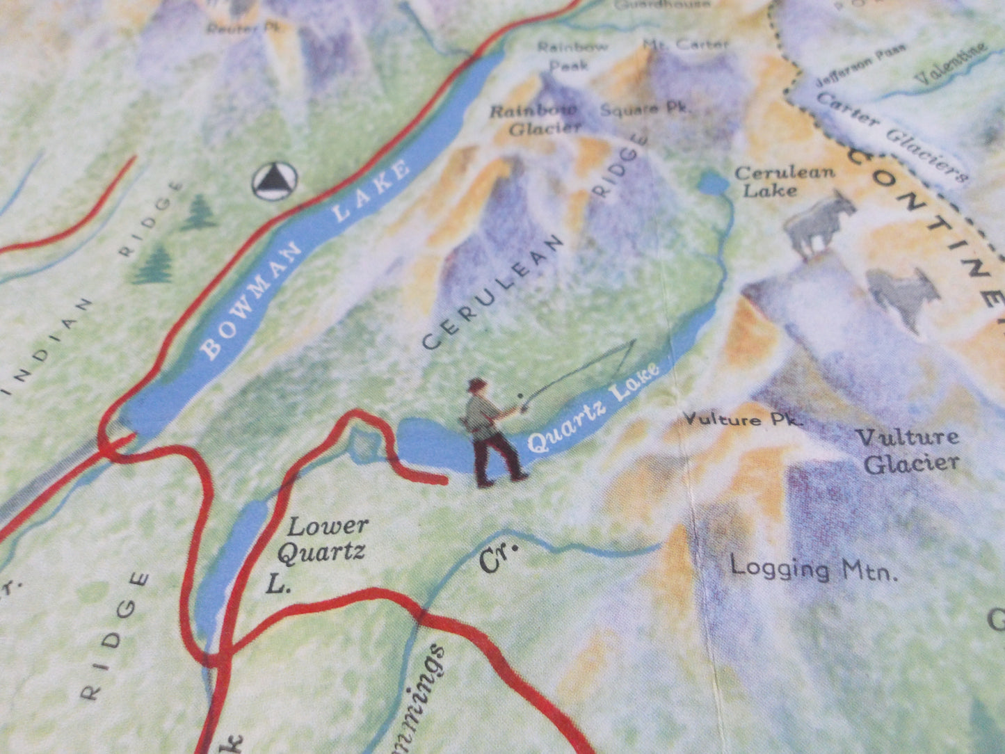
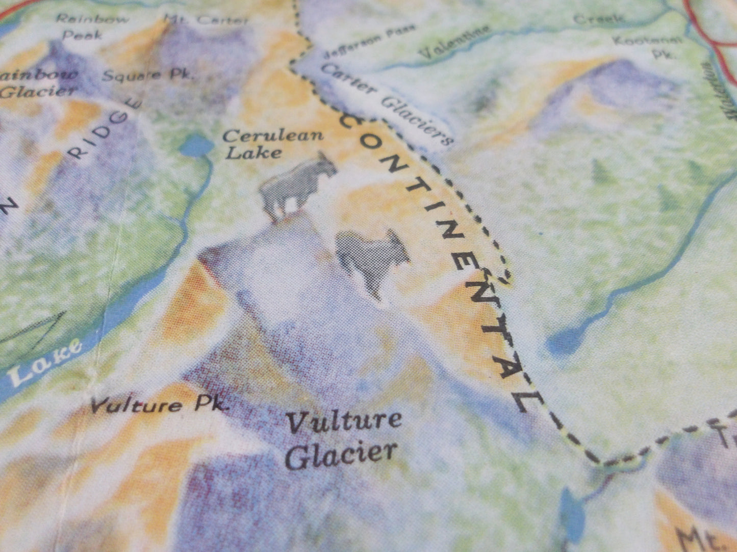
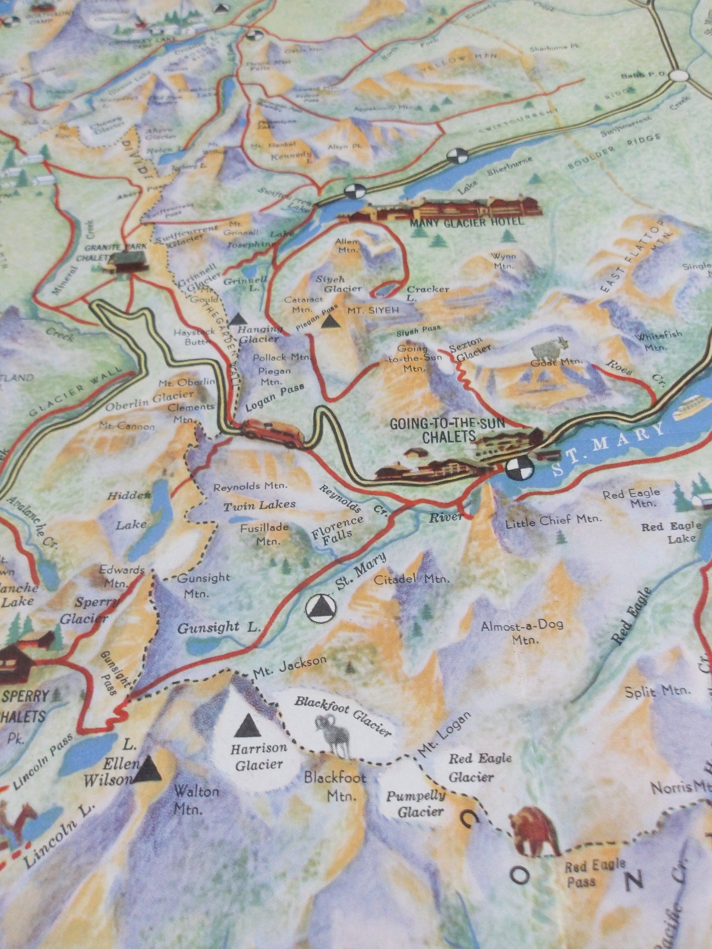
This pictural 1939 map, published by the Great Northern Railway, depicts Waterton-Glacier International Peace Park, also known as "Glacier." The park is formed by the union of Waterton Lakes National Park in Alberta, Canada, and Glacier National Park in Montana, USA. The map covers an area from Cardston, Alberta, south to Nimrod, Montana. Paved roads are highlighted by yellow lines outlined in black, while park trails are outlined in red. Icons indicate towns, lookout posts, ranger stations, and refuge cabins. Illustrated vignettes highlight the cabins, hotels, and campgrounds scattered throughout the park. The lakes, colored in bright blue, stand out against the map's green landscape. Illustrations of park wildlife, including bighorn sheep, grizzly bears, mountain goats, and elk, add charm to the map. Dimensions: 80 x 68 cm
Condition :
Very good condition. Please note, my maps are old and not always in perfect condition!
List of main places represented:
Cardston, Waterton Lakes National Park, Glacier National Park, Nimrod

-

Secure payment
-

Careful shipping
-

No reproduction
-

Satisfied or refunded


-

“Hello, thank you for sending this, the cards are superb!”
Jean-Philippe
-
"They are very beautiful, just need to frame them! Thank you"
Baptiste
-
"Fast shipping and very good tracking."
Alice
-
"My husband loved the maps I gave him for Christmas!"
Solène
