


Vintage map of the Ile de Ré - 1968
Vintage map of the Ile de Ré - 1968
Couldn't load pickup availability
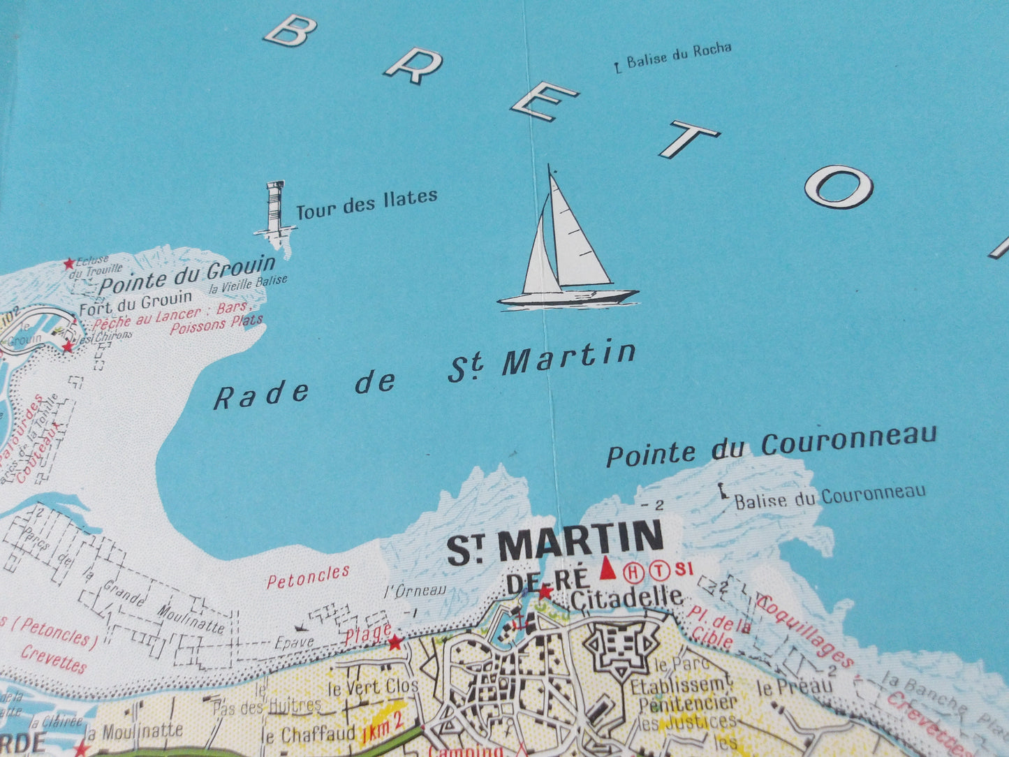
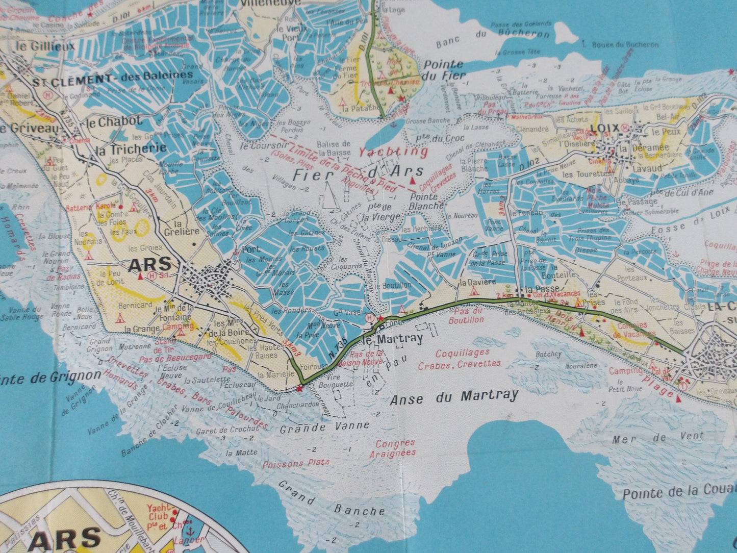
This tourist map of Île de Ré, located on the French Atlantic coast, offers a detailed and colorful view of this popular destination. The map highlights the main geographical areas, points of interest, beaches, ports, and cycle routes that crisscross the island. Two inserts enlarge the maps of the towns of Saint-Martin-de-Ré and Ars-en-Ré, allowing for a better visualization of the streets and tourist sites of these iconic villages.
The Île de Ré is depicted with its natural features and infrastructure, including lighthouses, nature reserves, and recreational areas. The map is designed to help visitors navigate the island, highlighting cultural, historical, and natural attractions.
Condition :
Very good condition. Please note, my maps are old and not always in perfect condition!
List of main places represented:
Saint-Martin-de-Ré, La Flotte, Ars-en-Ré, Saint-Clément-des-Baleines, Les Portes-en-Ré, Loix, Rivedoux-Plage, La Couarde-sur-Mer, Le Bois-Plage-en-Ré, Sainte-Marie-de-Ré

-

Secure payment
-

Careful shipping
-

No reproduction
-

Satisfied or refunded


-

“Hello, thank you for sending this, the cards are superb!”
Jean-Philippe
-
"They are very beautiful, just need to frame them! Thank you"
Baptiste
-
"Fast shipping and very good tracking."
Alice
-
"My husband loved the maps I gave him for Christmas!"
Solène
