


Vintage Indochina map by J. Petit, 1939
Vintage Indochina map by J. Petit, 1939
Couldn't load pickup availability
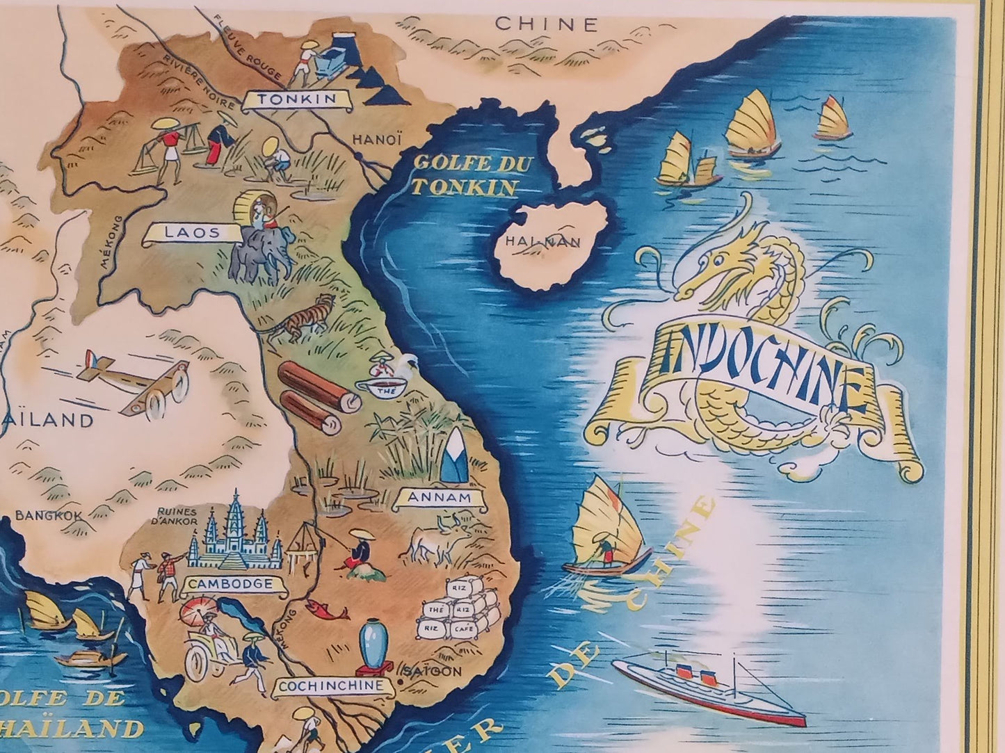
Pictorial and geographical illustrated map of French Indochina, created by J. Petit and dated 1939. This type of map is characteristic of the advertising cartography of the time, mixing geographical information and illustrations for tourist and colonial appeal. The title "INDOCHINE" is magnificently adorned with a stylized Asian dragon on a ribbon floating above the China Sea. The map represents the divisions of the time: Tonkin, Annam, Cochinchina, Laos, and Cambodia, as well as adjacent Thailand and India. Small illustrations depict regional activities and specificities: agriculture, crops (driftwood, rice paddies), monuments (Angkor), means of transportation (boats, airplanes, junks), and physical geography (mountains, rivers). The ocean is represented by a deep blue, while the land uses earth and ochre tones. The printer's name, PETITJEAN IMP. PARIS, is also visible at the bottom right. Dimensions: 34 cm by 25 cm
Condition :
Very good condition Please note, my maps are old and are not always in perfect condition!
List of main places represented:
Tonkin, Annam, Cochinchina, Laos, Cambodia, Thailand (Siam), India, China, Gulf of Tonkin, Gulf of Thailand, China Sea, Sea of Martaban, Ha Long Bay, Hanoi, Saigon, Bangkok, Angkor (Cambodia).


-

Secure payment
-

Careful shipping
-

No reproduction
-

Satisfied or refunded


-

“Hello, thank you for sending this, the cards are superb!”
Jean-Philippe
-
"They are very beautiful, just need to frame them! Thank you"
Baptiste
-
"Fast shipping and very good tracking."
Alice
-
"My husband loved the maps I gave him for Christmas!"
Solène
