


Illustrated map of Japan – 1960s
Illustrated map of Japan – 1960s
Couldn't load pickup availability
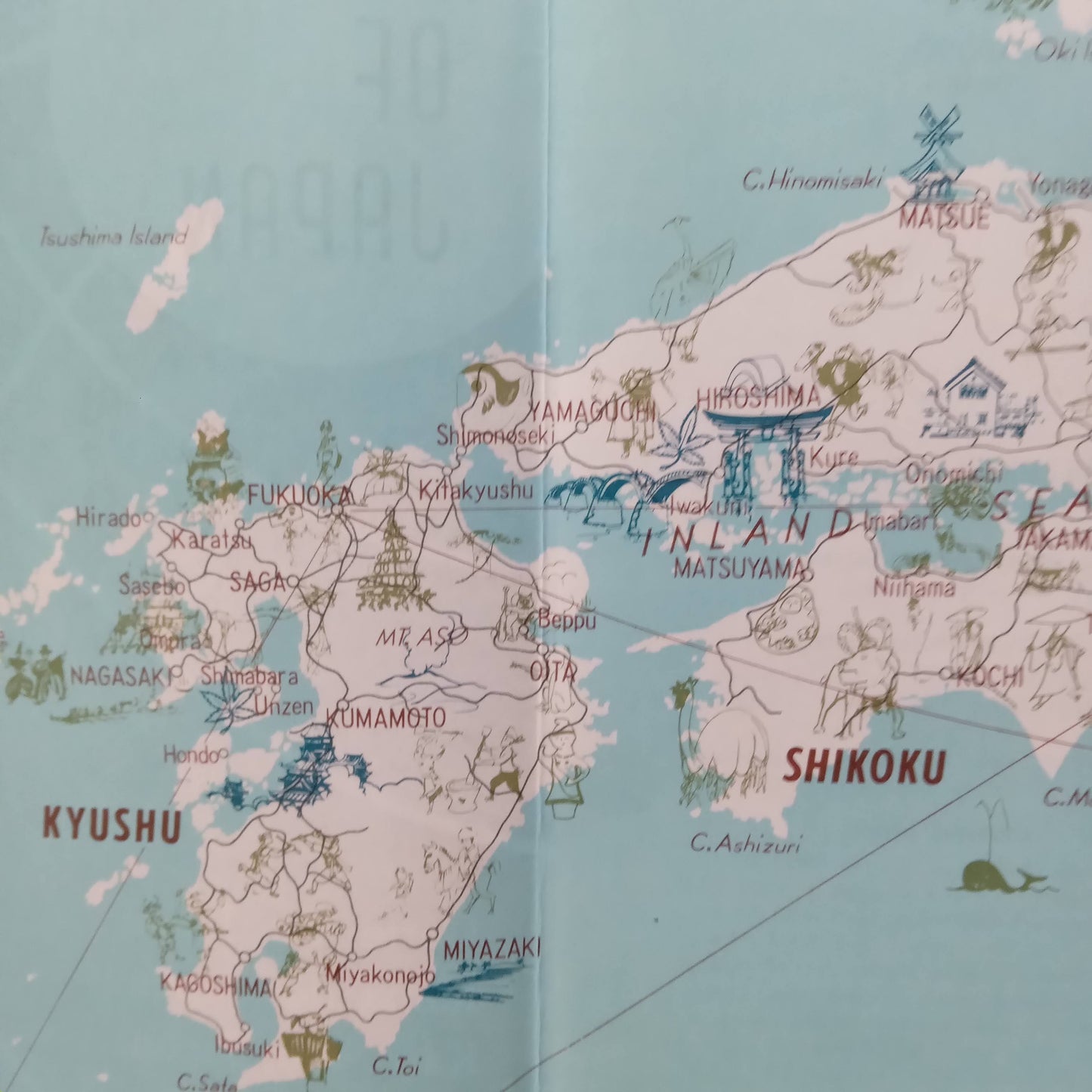
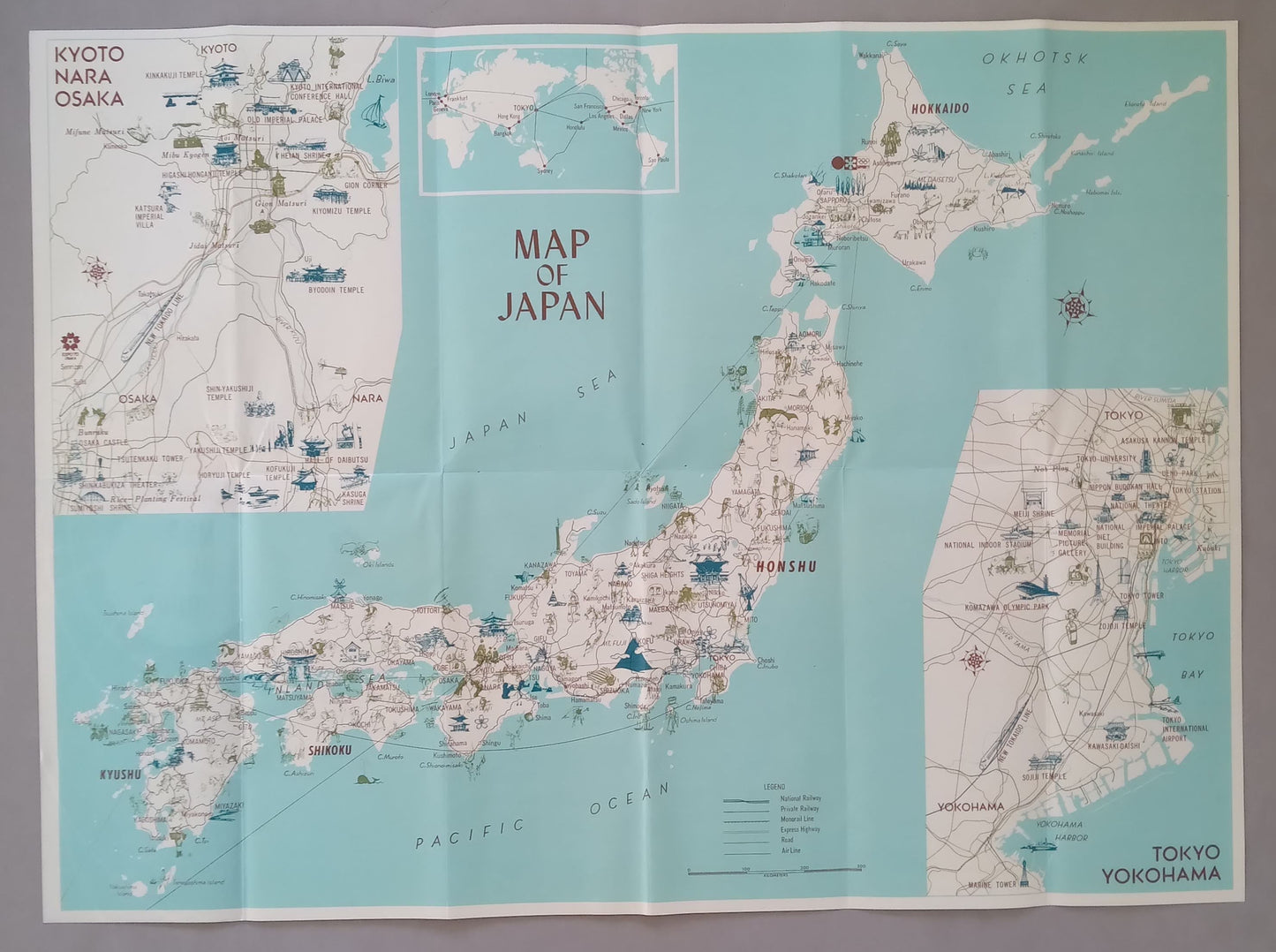
Charming tourist and illustrated map of Japan dating from the 1960s, in 60 x 45 cm format. It highlights the four major islands of the archipelago (Hokkaido, Honshu, Shikoku, Kyushu), with a large number of illustrations representing temples, volcanoes, local specialties, cultural sites and traditional symbols. Two detailed inserts complete the map: one on the Kyoto–Nara–Osaka region, the other on Tokyo–Yokohama, with a focus on railway lines, ports and main tourist attractions. A rare and decorative graphic piece, ideal for lovers of old maps, Japanese culture enthusiasts or collectors of vintage travel souvenirs.
Condition :
Very good condition. Please note, my maps are old and not always in perfect condition!
List of main places represented:
Tokyo, Yokohama, Kyoto, Nara, Osaka, Kobe, Nagoya, Sapporo, Fukuoka, Hiroshima, Sendai, Niigata, Kanazawa, Nagasaki, Gifu, Shizuoka, Saitama, Chiba, Kawasaki, Okayama, Kumamoto, Kagoshima, Matsuyama, Takamatsu, Morioka, Akita, Aomori, Fukushima, Utsunomiya, Maebashi, Kofu, Toyama, Tsu, Wakayama, Tottori, Matsue, Yamaguchi, Kochi, Oita, Miyazaki, Okinawa, Honshu, Hokkaido, Kyushu, Shikoku, Mount Fuji, Lake Biwa, Kii Peninsula, Sea of Japan, Pacific Ocean, Japan, Asia.


-

Secure payment
-

Careful shipping
-

No reproduction
-

Satisfied or refunded


-

“Hello, thank you for sending this, the cards are superb!”
Jean-Philippe
-
"They are very beautiful, just need to frame them! Thank you"
Baptiste
-
"Fast shipping and very good tracking."
Alice
-
"My husband loved the maps I gave him for Christmas!"
Solène
