


Vintage map of the Bordeaux region - ca. 1950
Vintage map of the Bordeaux region - ca. 1950
Couldn't load pickup availability
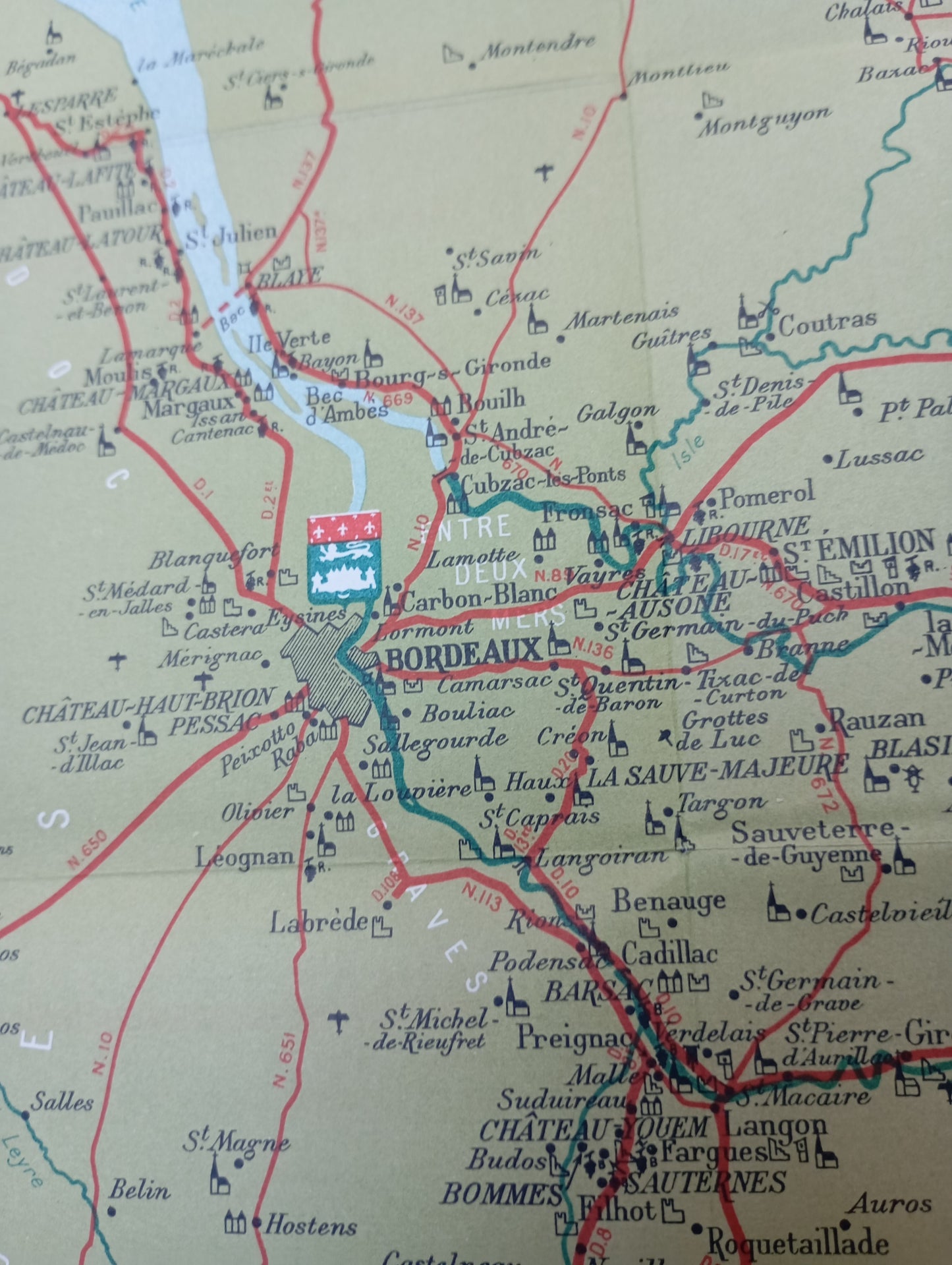
This geographical map, entitled "The Bordeaux" (key and explanation on the back in English), highlights the wine-growing and tourist region around the city of Bordeaux. The map is framed with a decorative pattern of hearts and stylized symbols. The road network and waterways are clearly indicated. Precise illustrations of vineyards, châteaux, and monuments are distributed throughout the map, highlighting the local heritage. A cartouche in the lower right corner provides information on the different types of wine, from Châteaux Classés to Crus Bourgeois, with a list of communes. The map measures 44 cm by 52 cm.
Condition :
Good condition Please note, my maps are old and are not always in perfect condition!
List of main places represented:
Lacanau, Cap Ferret, Arcachon Bay, Biscarrosse, Bordeaux, Lake Lacanau, Hourtin, Médoc, Blaye, Saint-Émilion, Libourne, Pauillac, Margaux, Pessac, Cadillac, Bazas, Blanquefort, Mérignac, Cestas, Podensac, Coutras, Saint-Savin


-

Secure payment
-

Careful shipping
-

No reproduction
-

Satisfied or refunded


-

“Hello, thank you for sending this, the cards are superb!”
Jean-Philippe
-
"They are very beautiful, just need to frame them! Thank you"
Baptiste
-
"Fast shipping and very good tracking."
Alice
-
"My husband loved the maps I gave him for Christmas!"
Solène
