


Vintage map of Turin and the Alps - ca. 1950
Vintage map of Turin and the Alps - ca. 1950
Couldn't load pickup availability
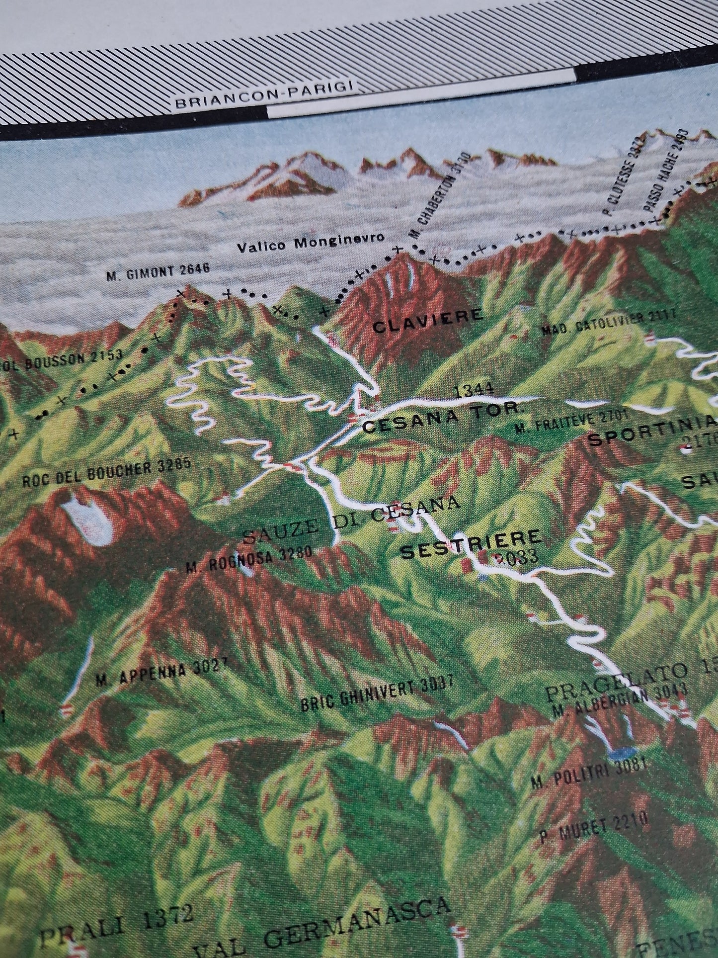
This antique map depicts the region around the city of Turin (Torino) and the surrounding Alpine mountain ranges, highlighting dramatic relief through shading and vivid colors (hypsometry). The city of Turin is clearly identified in the center, surrounded by a dense network of roads and rivers. The northern part of the map is dominated by the Alps, with prominent peaks such as Mont Chaberton (M. Chaberton 3130) and famous ski resorts such as Sestriere and Cesana highlighted by white outlines. Topographical details, including forests and deep valleys, are accurately rendered. A decorative compass rose is placed in the upper right corner. The contrast between the mountainous terrain and the Po Valley where Turin is located is striking. The map measures approximately 54 cm by 43 cm.
Condition :
Good condition Please note, my maps are old and are not always in perfect condition!
List of main places represented:
Torino (Turin), Sestriere, Cesana Torinese, Claviere, Sauze di Cesana, Pragelato, Sportinia, Moncalieri, Pino Torinese, Superga, Stupinigi, Orbassano, Rivoli, Venaria Reale, Chieri, Val Germanasca, Valico Monginevro


-

Secure payment
-

Careful shipping
-

No reproduction
-

Satisfied or refunded


-

“Hello, thank you for sending this, the cards are superb!”
Jean-Philippe
-
"They are very beautiful, just need to frame them! Thank you"
Baptiste
-
"Fast shipping and very good tracking."
Alice
-
"My husband loved the maps I gave him for Christmas!"
Solène
