


Bird's Eye View Map of the Vosges by Charles Bahy - 1940s
Bird's Eye View Map of the Vosges by Charles Bahy - 1940s
Couldn't load pickup availability
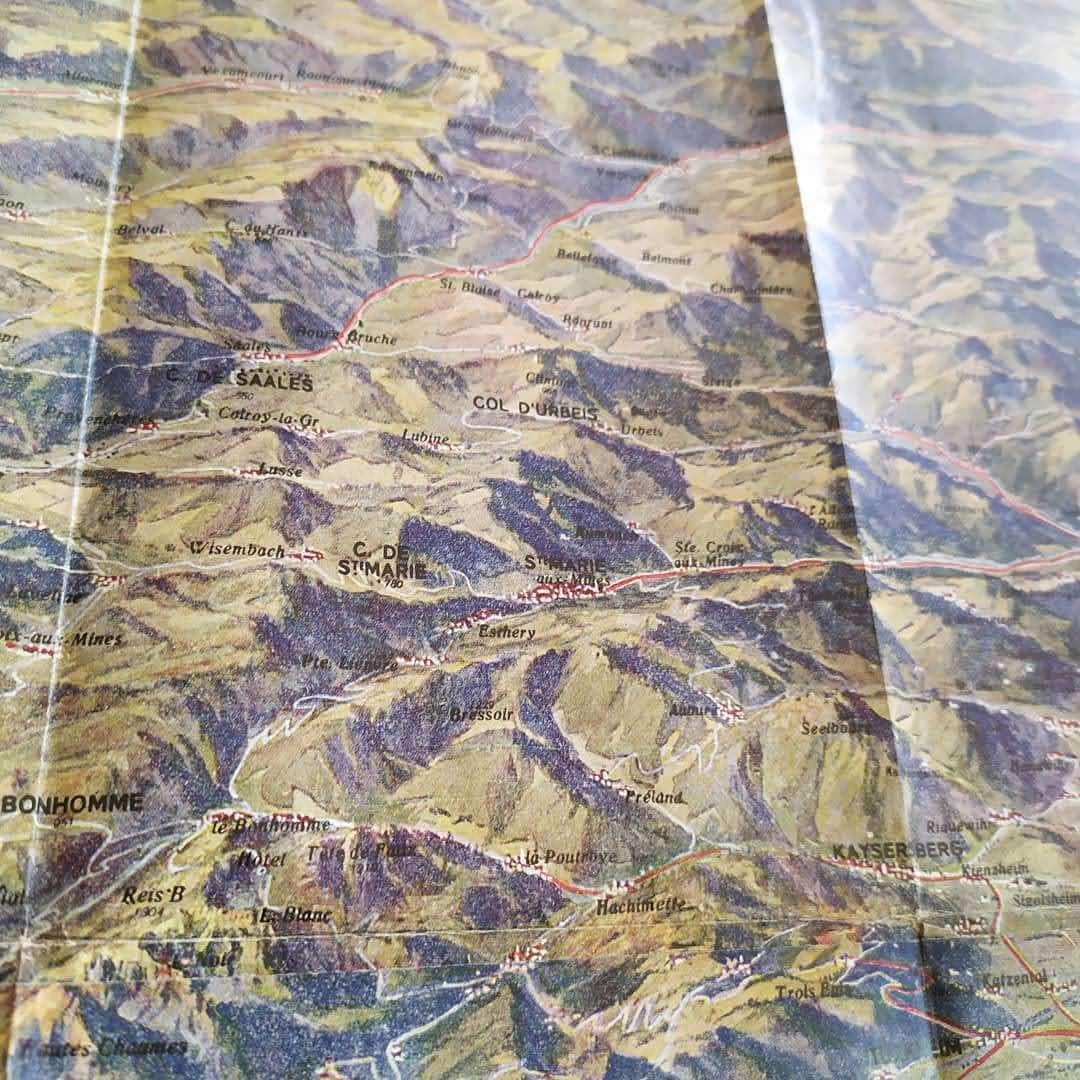
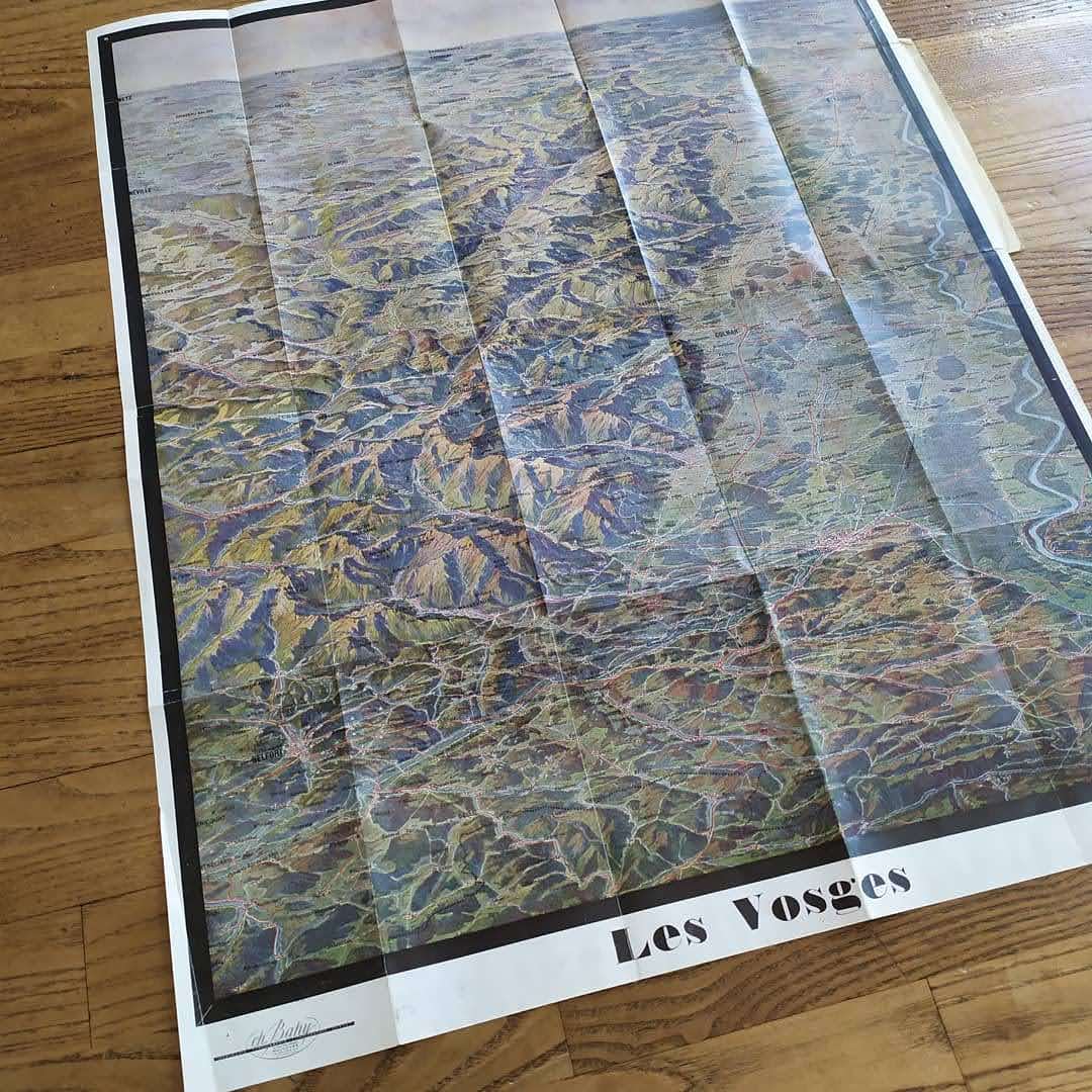
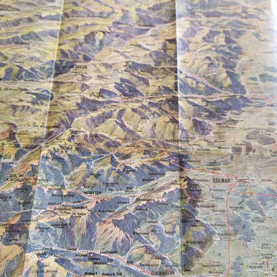
This map of the Vosges Mountains, titled "Les Vosges à Vol d'Oiseau" and created by Charles Bahy, offers a panoramic and detailed view of this mountainous region in eastern France. The map, with its dimensions of 64 x 50 cm, presents the reliefs and landscapes of the Vosges with an aerial perspective, allowing a clear understanding of the topography of the region. Valleys, peaks, forests and rivers are accurately represented, offering an overview of the geographical features of the Vosges. Charles Bahy, cartographer and illustrator, is recognized for his detailed and aesthetic works, often used in tourist guides and geographical publications. This map is a valuable tool for hiking enthusiasts, geographers and nature enthusiasts. Dimensions: 64*50 cm
Condition :
Very good condition. Please note, my maps are old and not always in perfect condition!


-

Secure payment
-

Careful shipping
-

No reproduction
-

Satisfied or refunded


-

“Hello, thank you for sending this, the cards are superb!”
Jean-Philippe
-
"They are very beautiful, just need to frame them! Thank you"
Baptiste
-
"Fast shipping and very good tracking."
Alice
-
"My husband loved the maps I gave him for Christmas!"
Solène
