


Cassini map of Paimboeuf, Pontchâteau and their surroundings - Napoleonic seal
Cassini map of Paimboeuf, Pontchâteau and their surroundings - Napoleonic seal
Couldn't load pickup availability
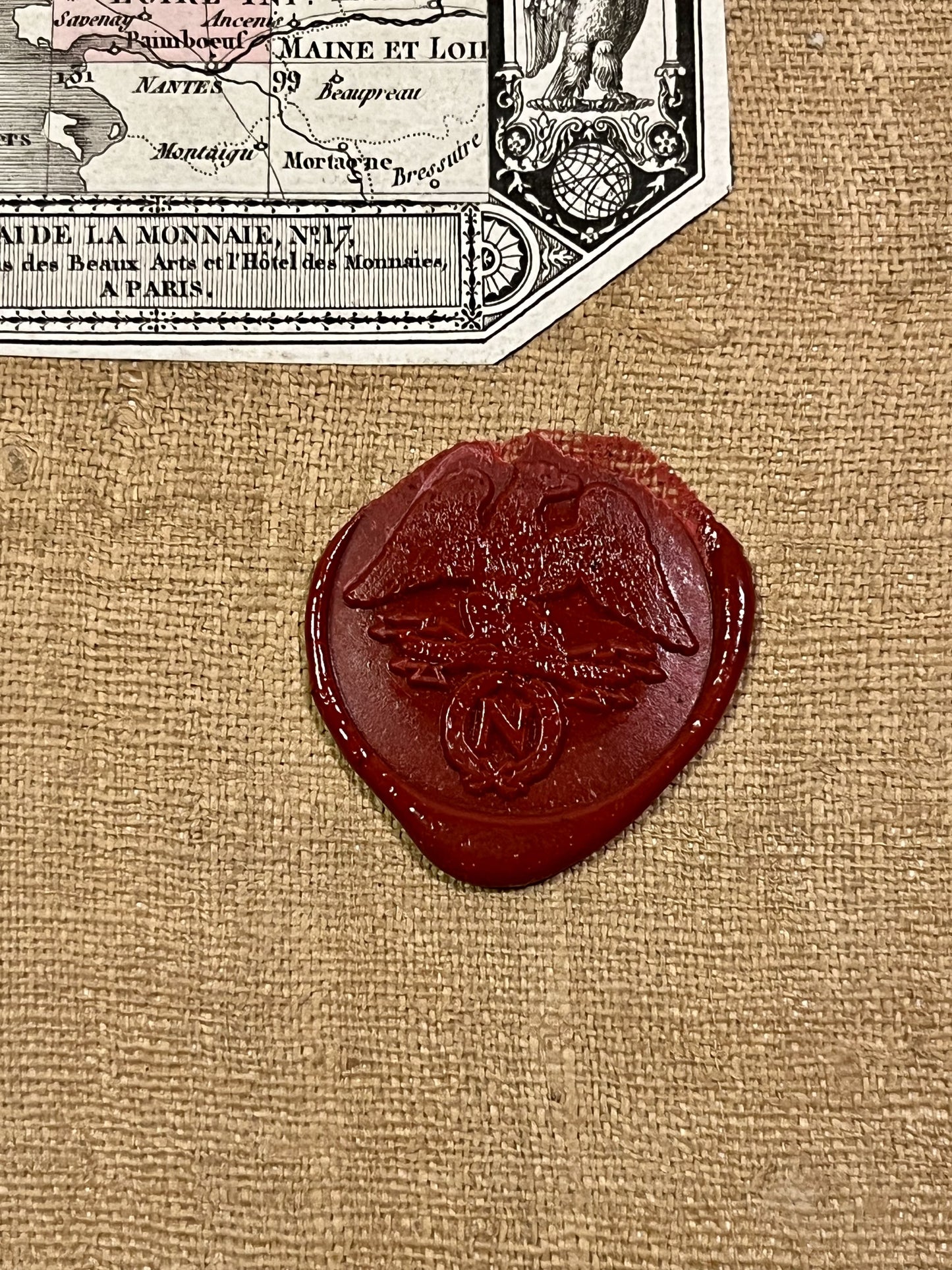
This antique canvas-backed Cassini map entitled "Paimboeuf" (No. 130) depicts a large part of Loire-Atlantique. It was produced by the Cassini family at the end of the 18th century and published at the beginning of the 19th century. Its unfolded dimensions are 92x59cm (18 sections). It bears a magnificent Napoleonic seal.
Condition:
Good condition, canvas worn and torn in places. Please note, my maps are old and not always in perfect condition!
Main cities represented:
Redon, Rieux, La Roche-Bernard, Pontchâteau, Saint-Nazaire, Donges, Paimboeuf, Blain, Carquefou, Nort-sur-Erdre, Nozay, Moisdon-la-Rivière,...


-

Secure payment
-

Careful shipping
-

No reproduction
-

Satisfied or refunded


-

“Hello, thank you for sending this, the cards are superb!”
Jean-Philippe
-
"They are very beautiful, just need to frame them! Thank you"
Baptiste
-
"Fast shipping and very good tracking."
Alice
-
"My husband loved the maps I gave him for Christmas!"
Solène
