


Cassini map of Saint-Omer and its surroundings
Cassini map of Saint-Omer and its surroundings
Couldn't load pickup availability
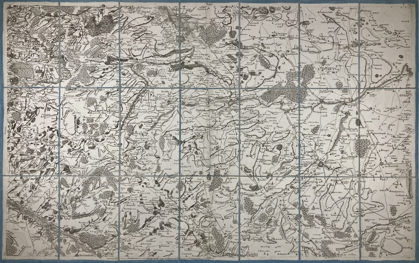
This antique canvas-backed Cassini map entitled "Saint-Omer" (N°5) was produced by the Cassini family. It is dated 1758 and its size is 94x59cm (21 panels).
Condition:
Minimal stains and canvas a little worn in places. Please note, my maps are old and are not always in perfect condition!
List of cities represented:
Le Wast, Licques, Desvres, Tournehem-sur-la-Hem, Saint-Omer, Cassel, Hazebrouck, Bailleul, Armentières, Laventie, Sailly-sur-la-Lys, La Bassée, Béthune, Merville, Estaires, La Gorgue, Saint -Venant, Lillers, Thérouanne, Fauquembergues, Hucqueliers, Hesdin, Fruges, Saint-Pol-sur-Ternoise, Houdain, Lens

-

Secure payment
-

Careful shipping
-

No reproduction
-

Satisfied or refunded


-

“Hello, thank you for sending this, the cards are superb!”
Jean-Philippe
-
"They are very beautiful, just need to frame them! Thank you"
Baptiste
-
"Fast shipping and very good tracking."
Alice
-
"My husband loved the maps I gave him for Christmas!"
Solène
