


General Staff Map of Calais and its surroundings
General Staff Map of Calais and its surroundings
Regular price
100,00 €
Regular price
Sale price
100,00 €
Unit price
per
Taxes included.
Couldn't load pickup availability
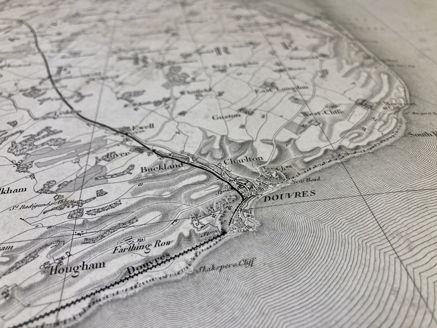
This General Staff map entitled "Calais" (N°1) was printed by the Dépôt de la Guerre before 1887 on thick paper measuring 85x56.5cm.
Condition:
Minimal edge tears and stains. Please note, these maps are old and are not always in perfect condition!
List of towns and villages represented:
Calais, St-Pierre-lès-Calais, Sangatte, Dover, Folkestone, Deal, Sandwich, Canterbury


-

Secure payment
-

Careful shipping
-

No reproduction
-

Satisfied or refunded


-

“Hello, thank you for sending this, the cards are superb!”
Jean-Philippe
-
"They are very beautiful, just need to frame them! Thank you"
Baptiste
-
"Fast shipping and very good tracking."
Alice
-
"My husband loved the maps I gave him for Christmas!"
Solène
