


Large Antique Illustrated Map of California Vintage - 1930s
Large Antique Illustrated Map of California Vintage - 1930s
Couldn't load pickup availability
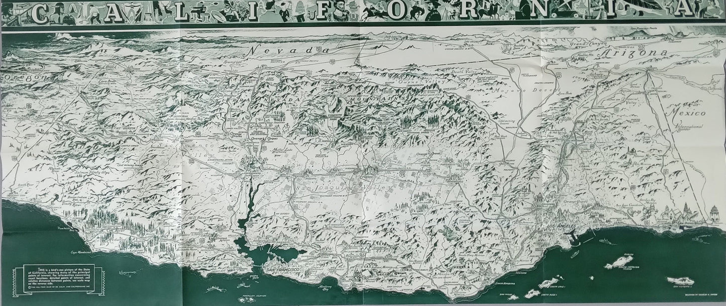
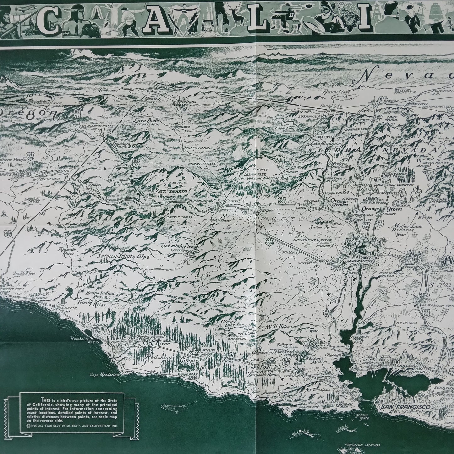
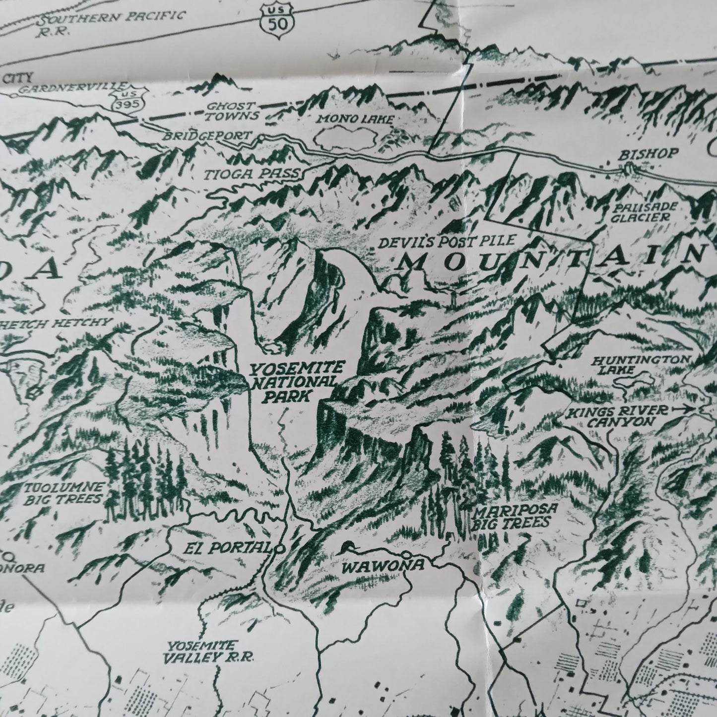
This 1936 panoramic map of California offers a detailed bird's-eye view of the state, highlighting major points of interest and key elements of commerce, such as the oil fields near Long Beach, orange groves, old mining towns, and more. The map presents California's attractions and regions with great detail, covering all parts of the state, although the coast, in the foreground, is particularly emphasized. Parts of Oregon, Nevada, and Arizona are also depicted in the same style. The map's title mentions the state along with illustrations of present and past life in California, from conquistadors to winemakers to skiers. A greeting signed by Frank F. Merriam, Governor of California, dates this map to the period 1934-1939. Size: 96 x 41 cm
Condition :
Very good condition. Please note, my maps are old and not always in perfect condition!
List of main places represented:
Los Angeles, San Diego, San Jose, San Francisco.

-

Secure payment
-

Careful shipping
-

No reproduction
-

Satisfied or refunded


-

“Hello, thank you for sending this, the cards are superb!”
Jean-Philippe
-
"They are very beautiful, just need to frame them! Thank you"
Baptiste
-
"Fast shipping and very good tracking."
Alice
-
"My husband loved the maps I gave him for Christmas!"
Solène
