


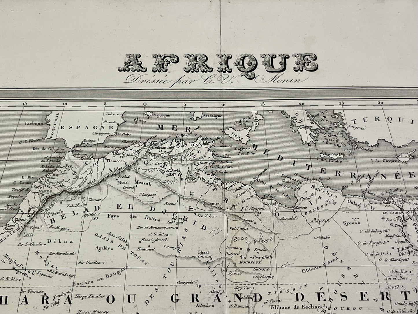
Large antique map of Africa by CV Monin - ca. 1860
Large antique map of Africa by CV Monin - ca. 1860
Couldn't load pickup availability
This antique map of Africa was drawn up by CV Monin in the mid-19th century and its dimensions are 73x54.5cm.
Condition:
Good condition, central crease and minimal tears on the edges. Please note, my maps are old and are not always in perfect condition!
List of countries represented:
Algeria, Angola, Benin, Botswana, Burkina Faso, Burundi, Cameroon, Cape Verde, Central African Republic, Comoros, Republic of Congo, Democratic Republic of Congo, Ivory Coast, Djibouti, Egypt, Eritrea, Ethiopia, Gabon, Gambia, Ghana, Guinea, Guinea-Bissau, Equatorial Guinea, Kenya, Lesotho, Liberia, Libya, Madagascar, Malawi, Mali, Morocco, Mauritius, Mauritania, Mozambique, Namibia, Niger, Nigeria, Uganda, Rwanda, Senegal, Seychelles, Sierra Leone, Somalia, Sudan, South Sudan, Tanzania, Chad, Togo, Tunisia, Zambia, Zimbabwe


-

Secure payment
-

Careful shipping
-

No reproduction
-

Satisfied or refunded


-

“Hello, thank you for sending this, the cards are superb!”
Jean-Philippe
-
"They are very beautiful, just need to frame them! Thank you"
Baptiste
-
"Fast shipping and very good tracking."
Alice
-
"My husband loved the maps I gave him for Christmas!"
Solène
