


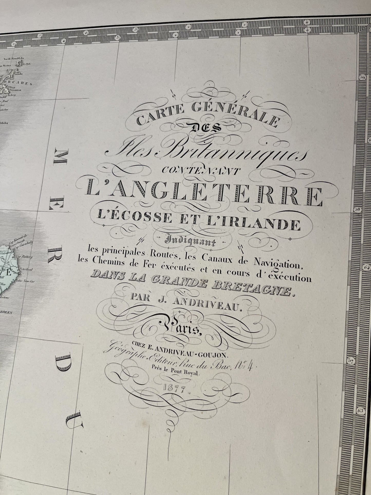
Large antique map of the British Isles by J. Andriveau - 1877
Large antique map of the British Isles by J. Andriveau - 1877
Regular price
95,00 €
Regular price
Sale price
95,00 €
Unit price
per
Taxes included.
Couldn't load pickup availability
This antique map of England, Scotland and Ireland was drawn up by J. Andriveau and published by E. Andriveau-Goujon in 1877. Its dimensions are 101.5x69.5cm.
Condition:
Minimal stains, central fold and tear of a few centimeters on the right of it. Be careful, my maps are old and are not always in perfect condition!


-

Secure payment
-

Careful shipping
-

No reproduction
-

Satisfied or refunded


-

“Hello, thank you for sending this, the cards are superb!”
Jean-Philippe
-
"They are very beautiful, just need to frame them! Thank you"
Baptiste
-
"Fast shipping and very good tracking."
Alice
-
"My husband loved the maps I gave him for Christmas!"
Solène
