


Vintage map of Berlin with the Wall – 1963
Vintage map of Berlin with the Wall – 1963
Couldn't load pickup availability
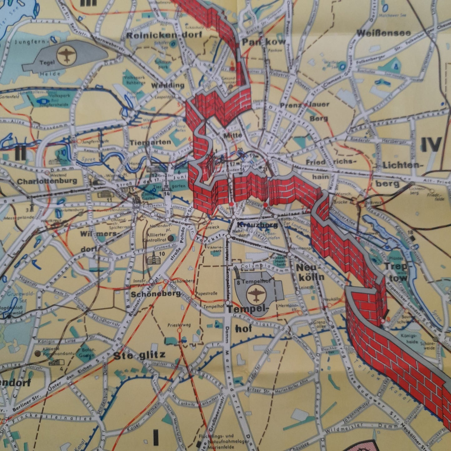
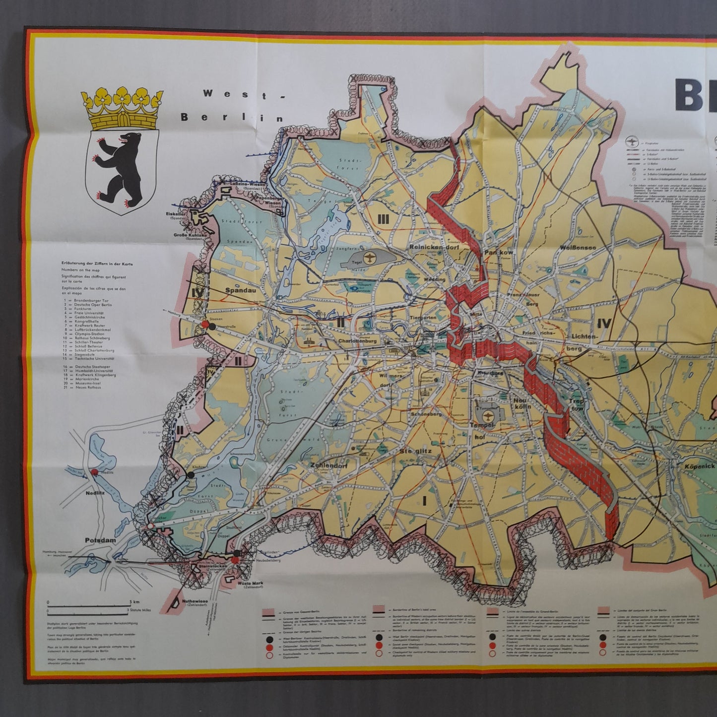
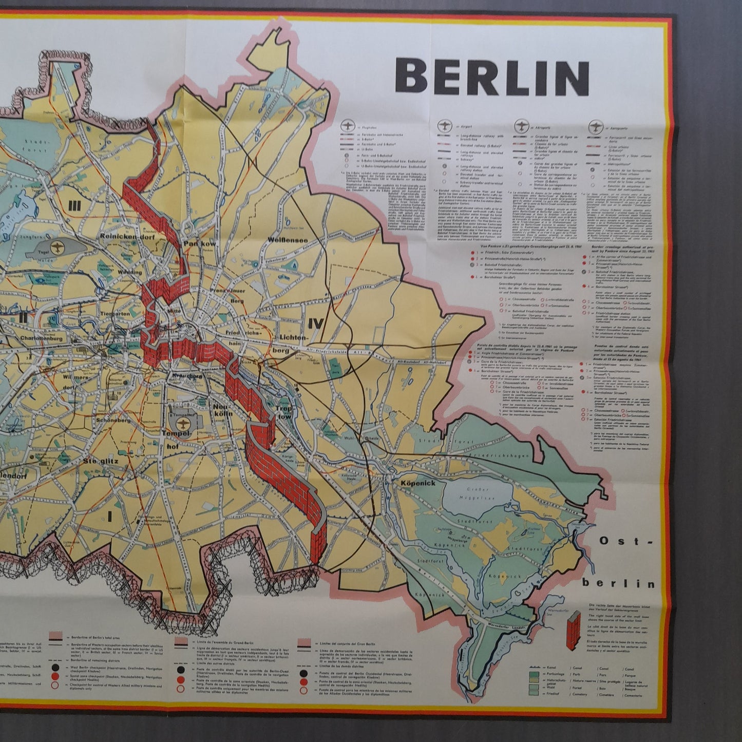
This 1963 map of Berlin shows the city still divided into occupation sectors during the height of the Cold War. The Berlin Wall is depicted in bright red, marking the separation between West Berlin (yellow) and East Berlin (light green). The map is highly detailed, with a street index and a precise key indicating subway lines, S-Bahn lines, military zones, border crossings, and public buildings. The West Berlin coat of arms is visible in the upper left corner. The map is divided into four numbered sectors, reflecting the administrative organization of the time. It is a valuable historical document illustrating the urban geopolitics of Berlin in the early 1960s. Dimensions: 60 x 84 cm.
Condition:
Very good condition. Please note, my maps are old and not always in perfect condition!
List of main places:
Berlin, Germany, Europe, West Berlin, East Berlin, Charlottenburg, Wilmersdorf, Spandau, Reinickendorf, Zehlendorf, Steglitz, Tempelhof, Schöneberg, Kreuzberg, Tiergarten, Mitte, Prenzlauer Berg, Friedrichshain, Lichtenberg, Treptow, Köpenick, Pankow, Wedding, Neukölln, Dahlem, Grunewald, Wannsee, Potsdam, Brandenburg.

-

Secure payment
-

Careful shipping
-

No reproduction
-

Satisfied or refunded


-

“Hello, thank you for sending this, the cards are superb!”
Jean-Philippe
-
"They are very beautiful, just need to frame them! Thank you"
Baptiste
-
"Fast shipping and very good tracking."
Alice
-
"My husband loved the maps I gave him for Christmas!"
Solène
