


New Monumental Plan of the City of Antwerp – 1910
New Monumental Plan of the City of Antwerp – 1910
Couldn't load pickup availability
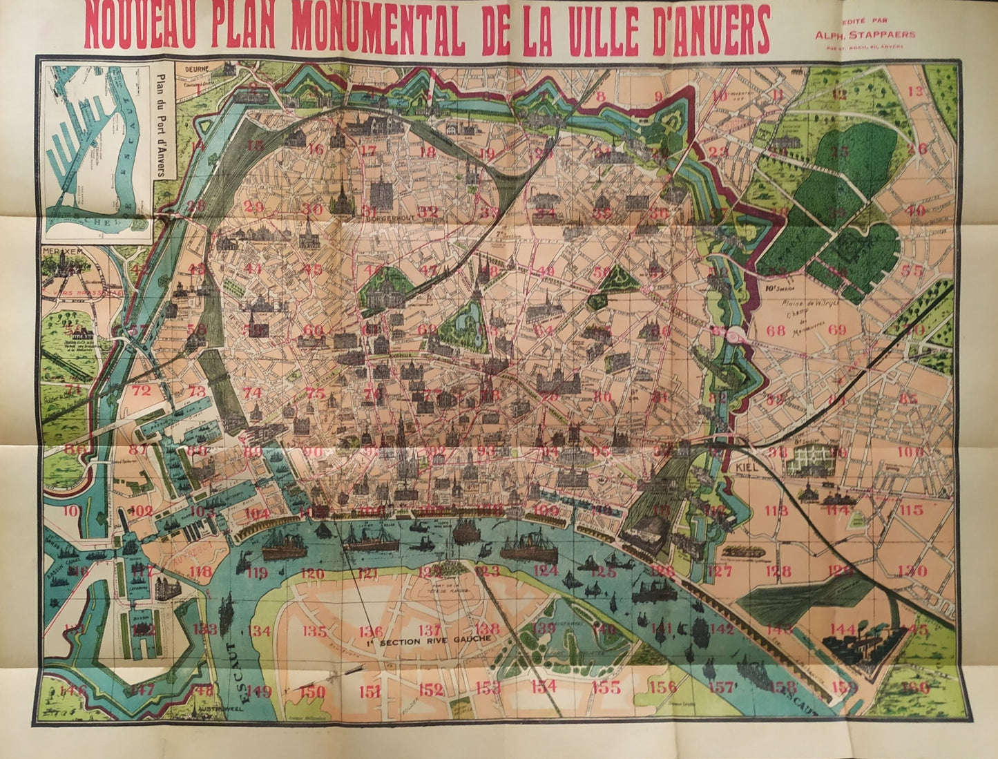
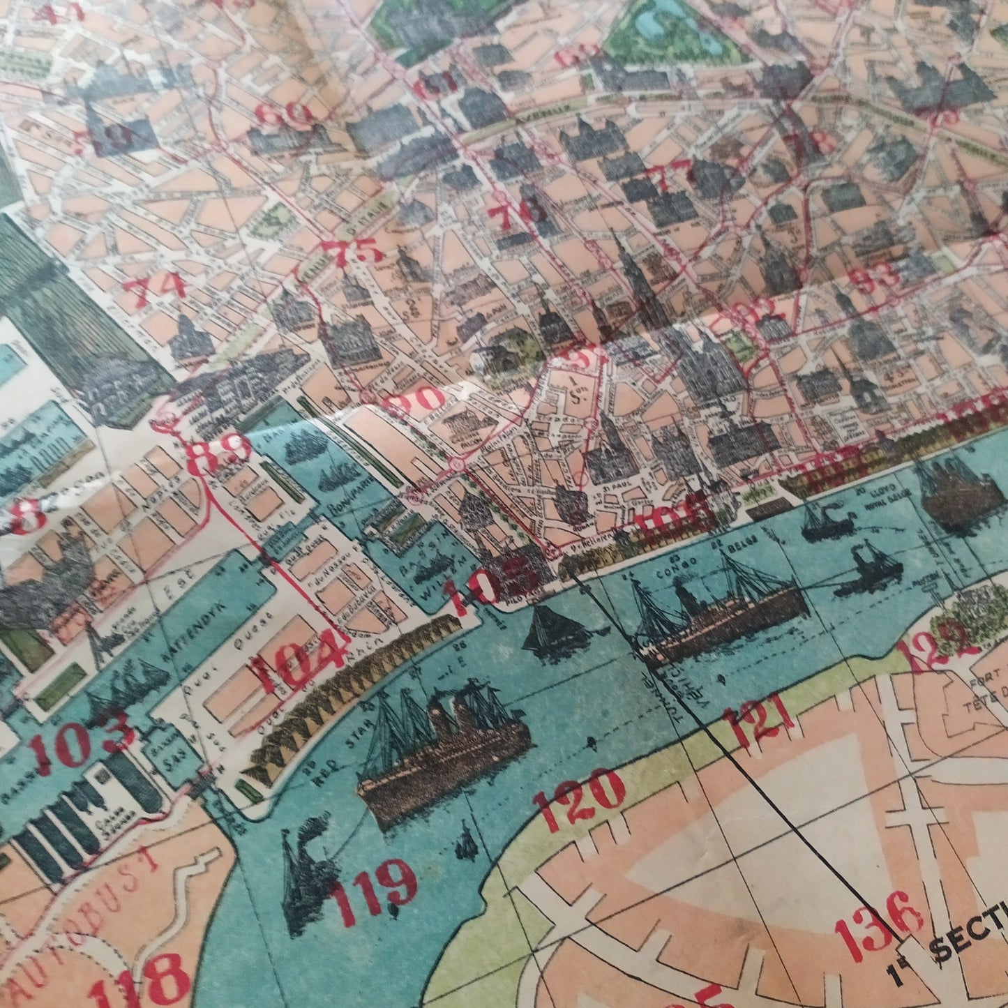
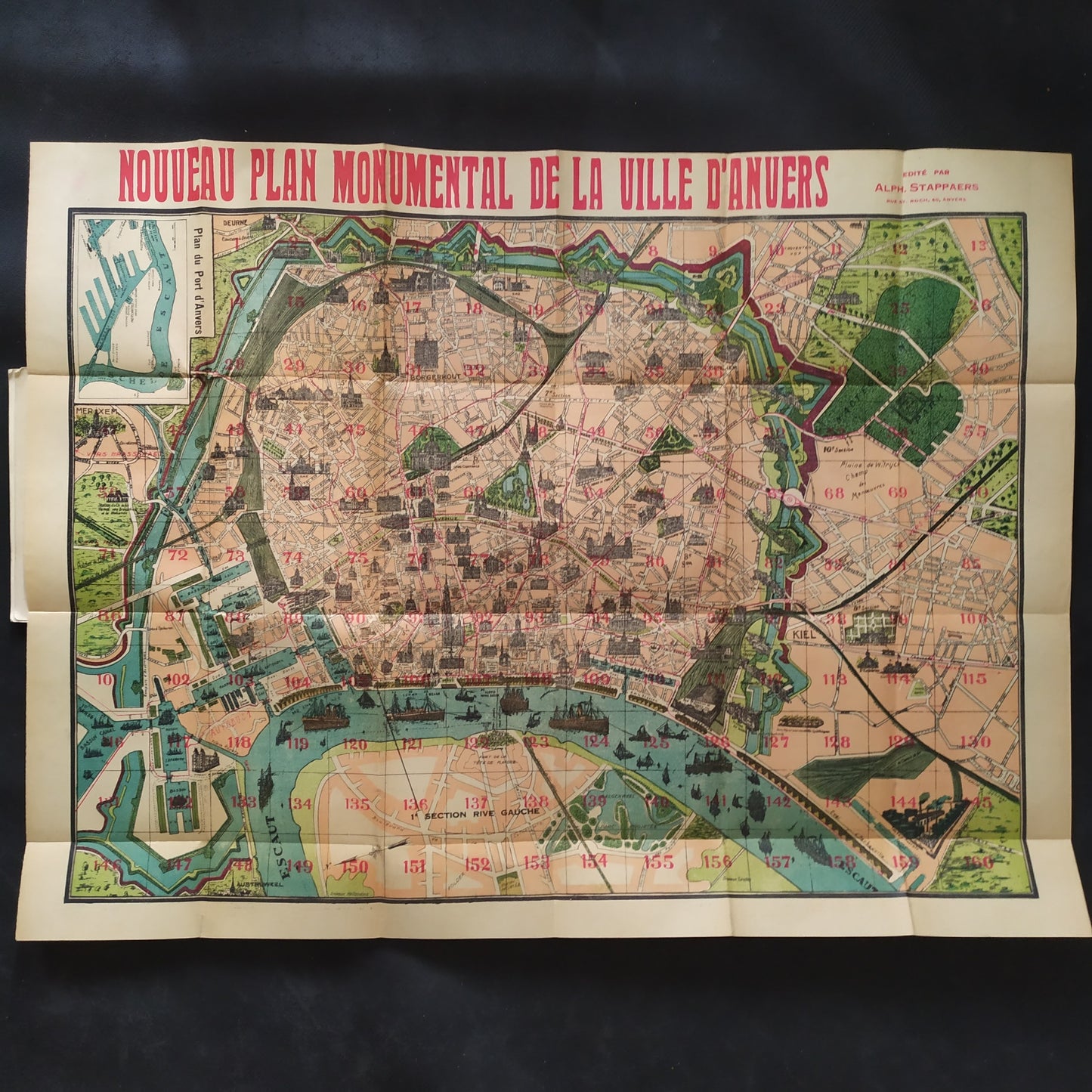
This illustrated map of the city of Antwerp, published in 1910, offers a detailed and richly colored view of the Belgian city, highlighting its monumental architecture. Each district is numbered, and the main buildings (churches, museums, train stations, public buildings) are carefully depicted in perspective. The port of Antwerp, located at the bottom of the map, is depicted with a fleet of steam and sailing ships, highlighting the commercial importance of the city at the time. The map is framed by wide borders and contrasting colors that enhance readability, with a distinctive red typography at the top of the document. The publisher is listed as Albin Stappaerts, Route d'Anvers. Dimensions: 72 x 55 cm.
Condition :
Very good condition. Please note, my maps are old and not always in perfect condition!
Places :
Antwerp, Belgium, Europe, City Center, Zuid, Eilandje, Het Noord, Borgerhout, Berchem, Scheldt.

-

Secure payment
-

Careful shipping
-

No reproduction
-

Satisfied or refunded


-

“Hello, thank you for sending this, the cards are superb!”
Jean-Philippe
-
"They are very beautiful, just need to frame them! Thank you"
Baptiste
-
"Fast shipping and very good tracking."
Alice
-
"My husband loved the maps I gave him for Christmas!"
Solène
