Antique map of Dauphiné by GL. Le Rouge - 1745
Antique map of Dauphiné by GL. Le Rouge - 1745
Couldn't load pickup availability
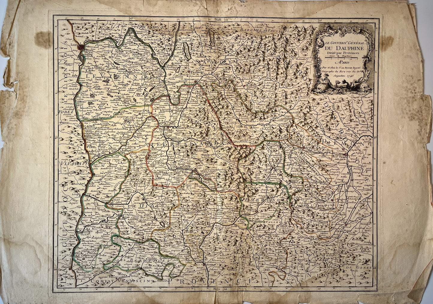
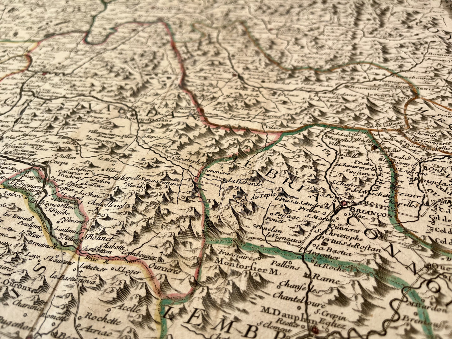
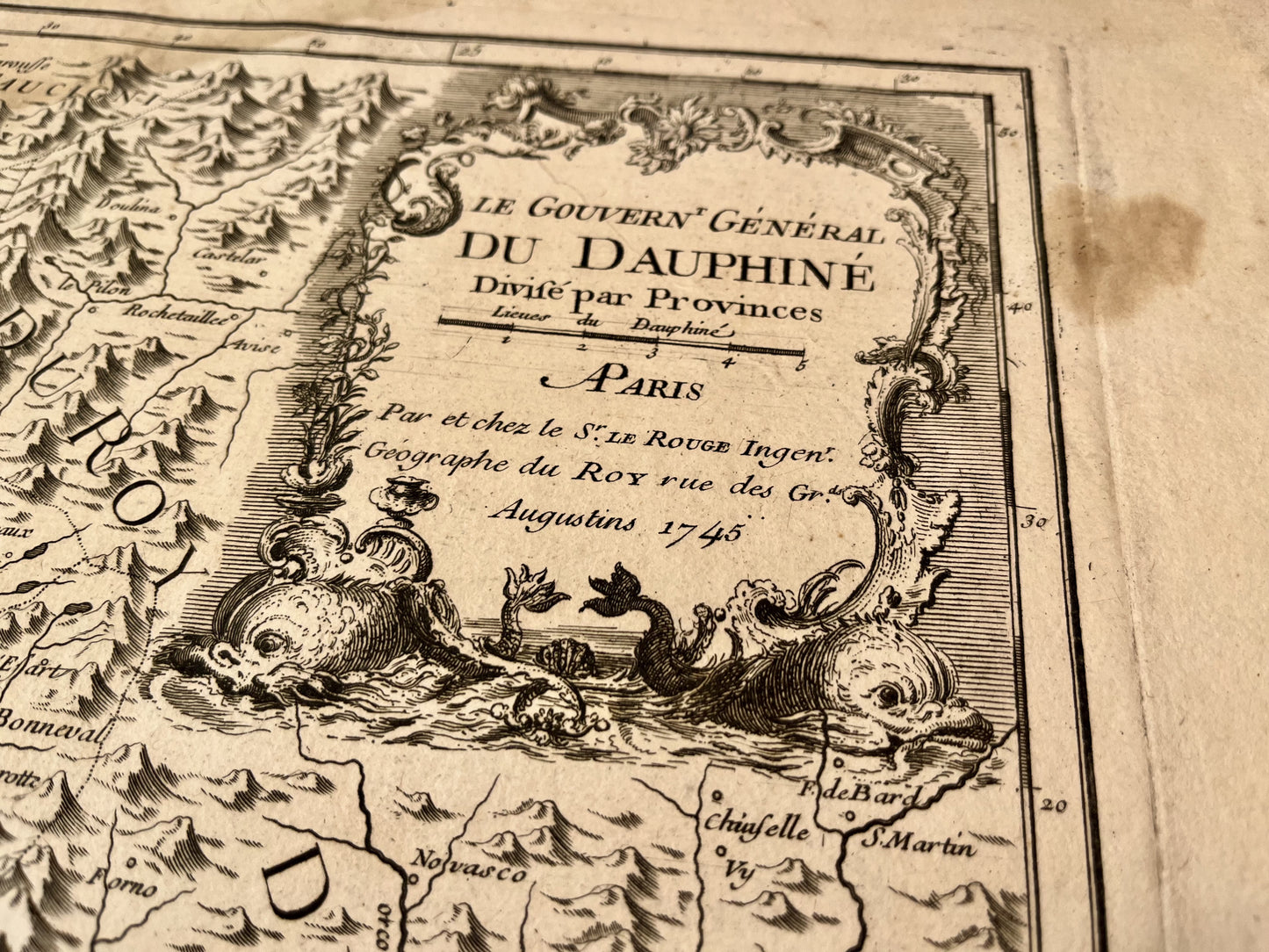
This old map of Dauphiné, an ancient region straddling Isère, Drôme and Hautes-Alpes, was produced by GL. Le Rouge, is dated 1745 and the size of the sheet is 78x54cm. It is decorated with a beautiful cartouche and we see the cities of Grenoble, Sisteron, Turin, Suze, Embrun, Romans-sur-Isère, Chambéry, Lyon...
Condition:
Moisture stains on the edges, fold in the center and tears on the edges. Please note, my maps are old and are not always in perfect condition!
-

“Hello, thank you for sending this, the cards are superb!”
Jean-Philippe
-
"They are very beautiful, just need to frame them! Thank you"
Baptiste
-
"Fast shipping and very good tracking."
Alice
-
"My husband loved the maps I gave him for Christmas!"
Solène

-

Secure payment
-

Careful shipping
-

No reproduction
-

Satisfied or refunded