


Antique map of the Island of Elba and the southern coast of Tuscany
Antique map of the Island of Elba and the southern coast of Tuscany
Couldn't load pickup availability
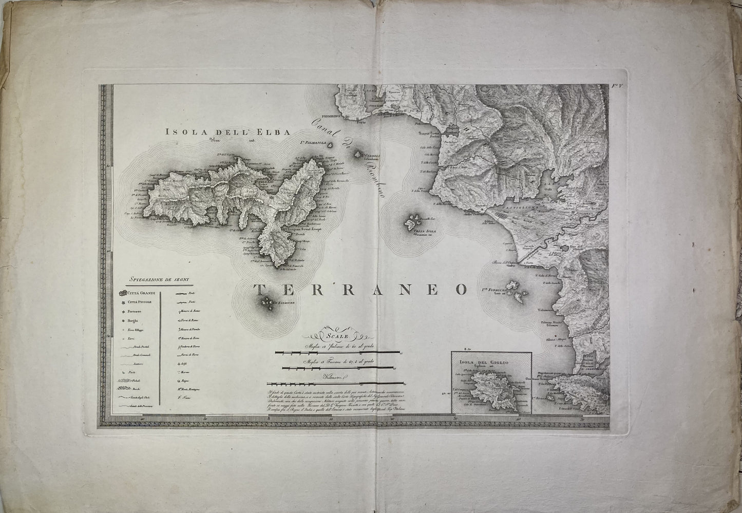
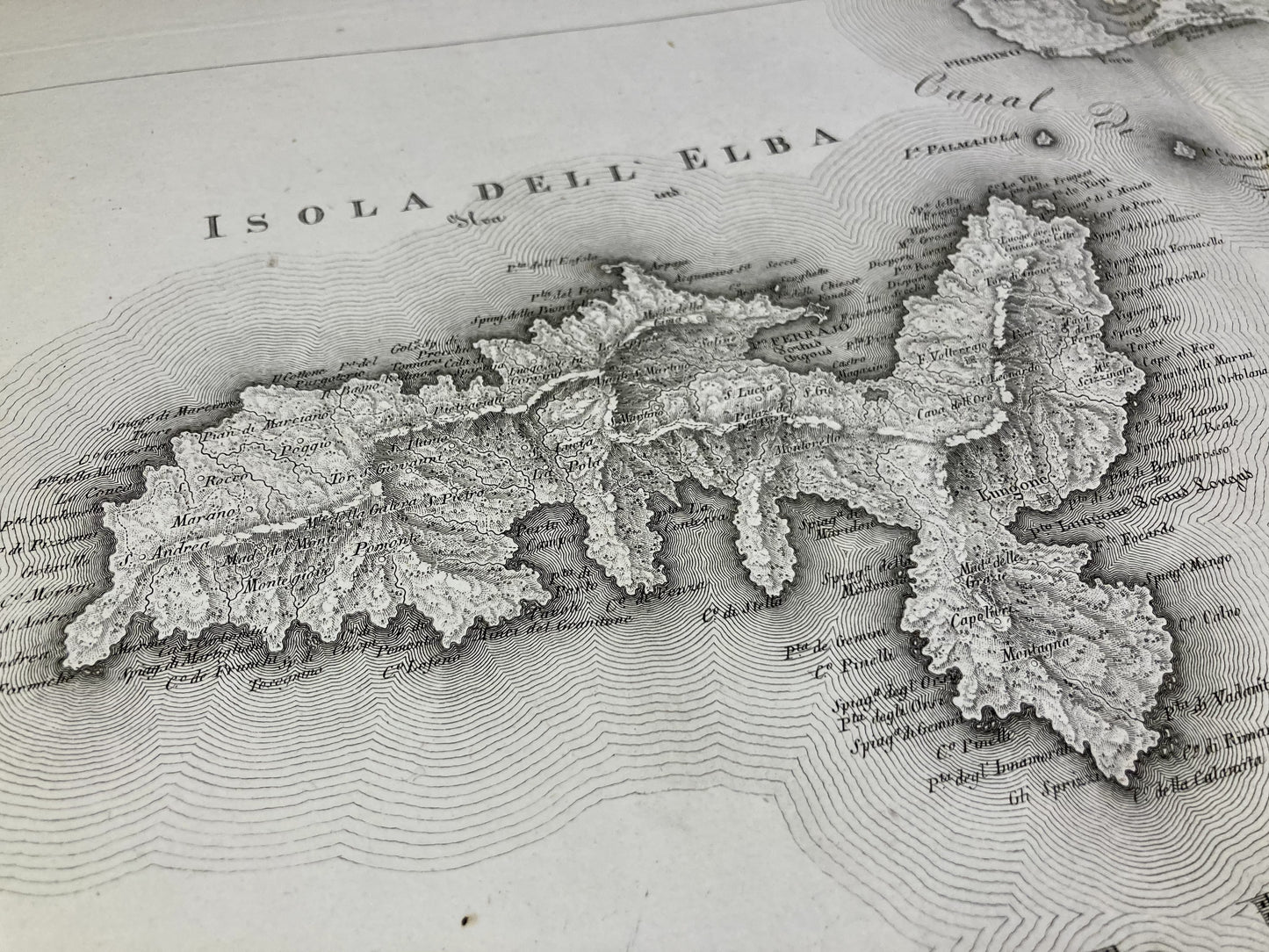
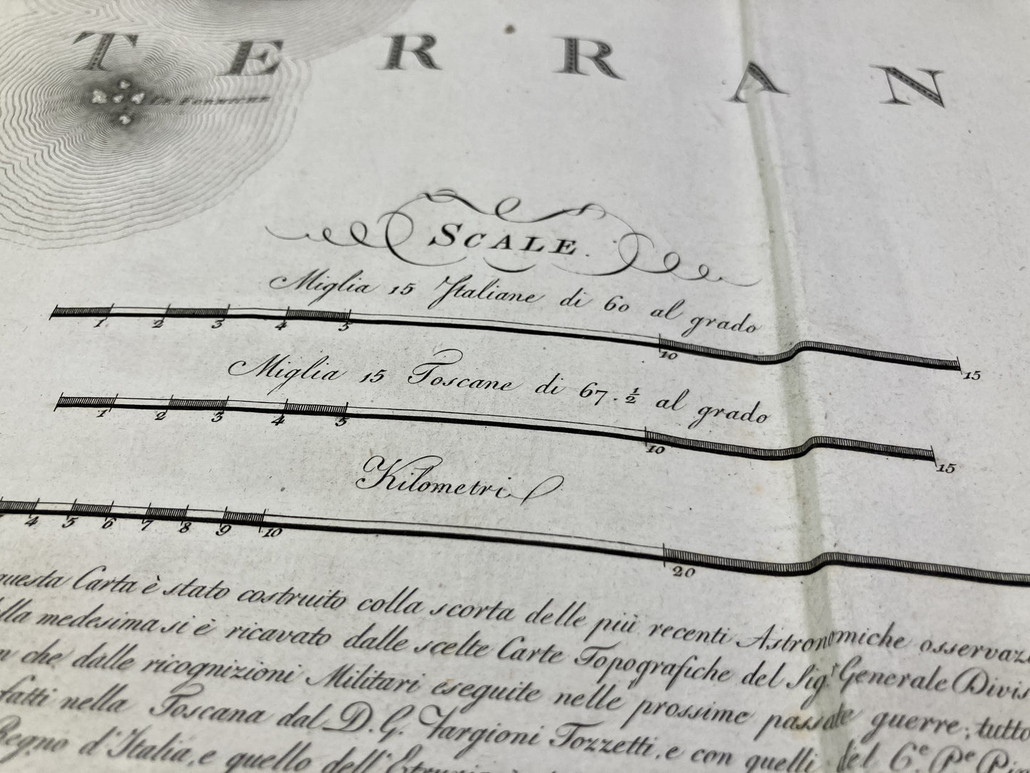
This antique Italian map depicts the coast of Tuscany from Piombino to Orbetello as well as the Island of Elba. It dates from the beginning of the 19th century and measures 80x55.5cm.
Condition:
Tears on the edges and stains. Please note, my maps are old and are not always in perfect condition!
List of towns and villages represented:
Piombino, Castiglione della Pescaia, Grosseto, Orbetello, Portoferraio,...
-

Secure payment
-

Careful shipping
-

No reproduction
-

Satisfied or refunded


-

“Hello, thank you for sending this, the cards are superb!”
Jean-Philippe
-
"They are very beautiful, just need to frame them! Thank you"
Baptiste
-
"Fast shipping and very good tracking."
Alice
-
"My husband loved the maps I gave him for Christmas!"
Solène
