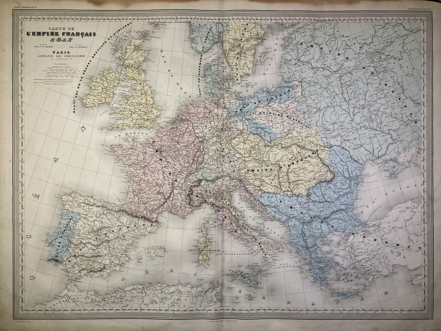
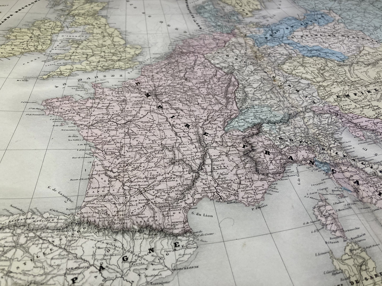
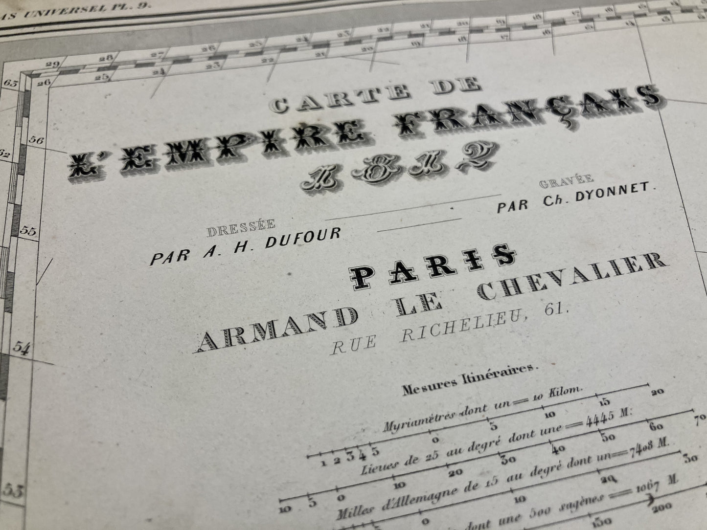
Large old map of Europe in 1812 by AH Dufour
Couldn't load pickup availability
This old map representing Europe in 1812 was produced by the Geographer AH Dufour. It dates from the middle of the 19th century and its size is 81x60cm.
Condition:
Stains and fold in the center. Please note, my maps are old and are not always in perfect condition!
![Carte ancienne de l'Europe en 1812 par A.H. Dufour](http://carteancienne.com/cdn/shop/files/Carte-Ancienne-Europe-1812-Dufour-1.jpg?v=1704459860&width=1445)
![Détail de la carte ancienne de l'Europe en 1812 par A.H. Dufour](http://carteancienne.com/cdn/shop/files/Carte-Ancienne-Europe-1812-Dufour-2.jpg?v=1704459860&width=1445)
![Cartouche de la carte ancienne de l'Europe en 1812 par A.H. Dufour](http://carteancienne.com/cdn/shop/files/Carte-Ancienne-Europe-1812-Dufour-3.jpg?v=1704459859&width=1445)
-
Satisfied or refunded !
You don't like the card? The return is at your expense but the card is fully refunded.
-
No reproduction!
All the cards in my collection are originals that I have found since I was very young.
-
Fast and quality shipping
Whatever the shipping method, shipments are made within 24 hours in reinforced tubes.
These old maps may interest you
-
Old illustrated cards
Discover my collection of old illustrated geographical maps. Perfect for history lovers,...
-
Old maps of France
Discover here my old maps of France. From Paris to Marseille, I...
-
Cassini maps
Discover my collection of old Cassini maps. To help you find the...