


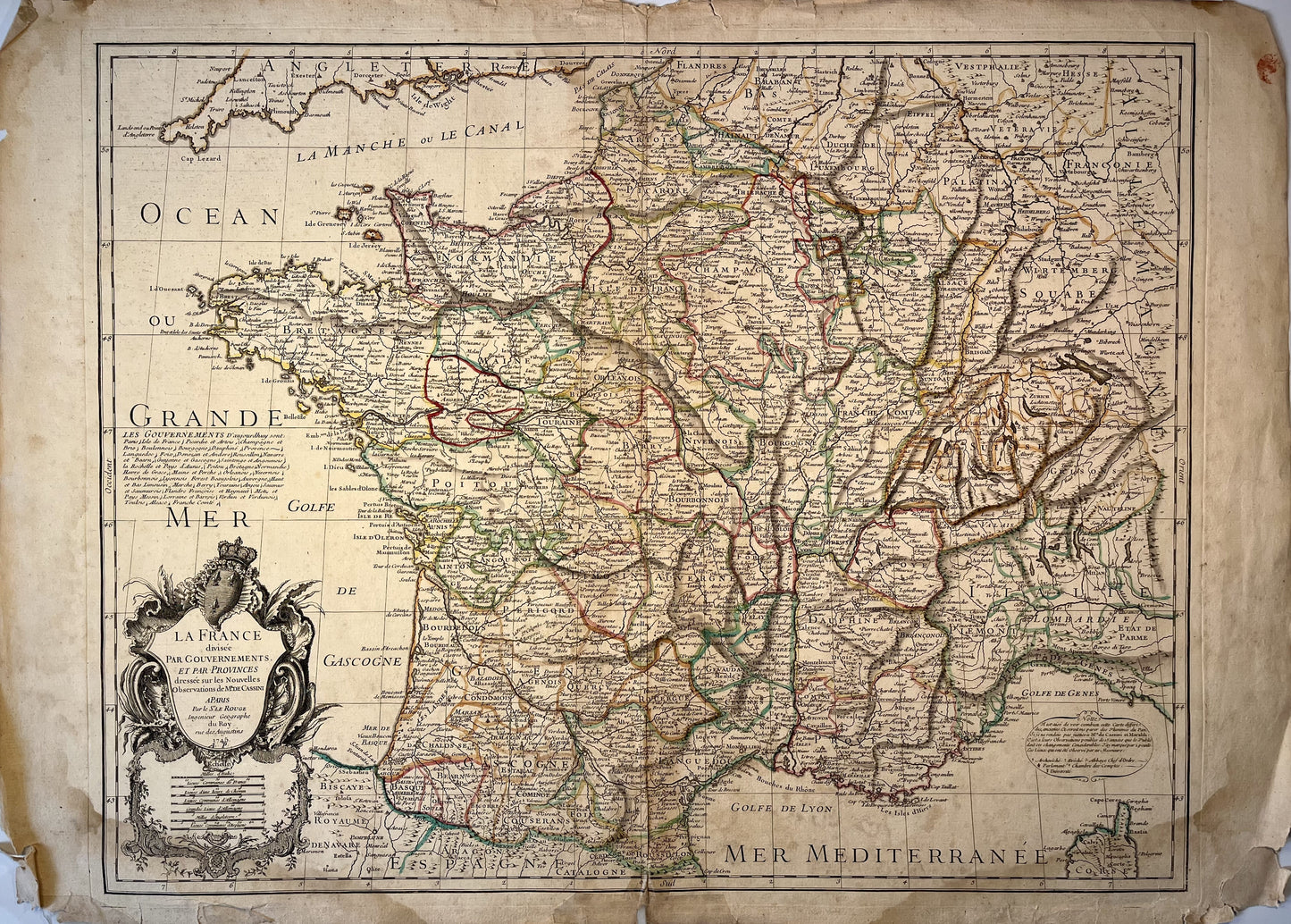
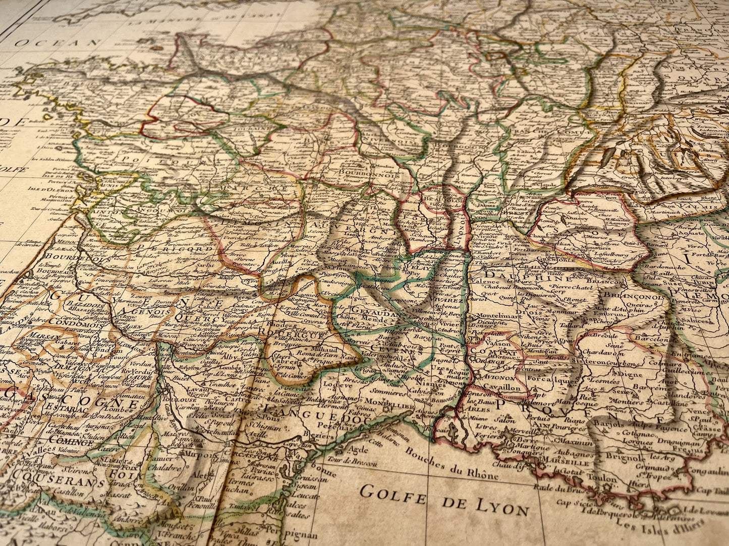
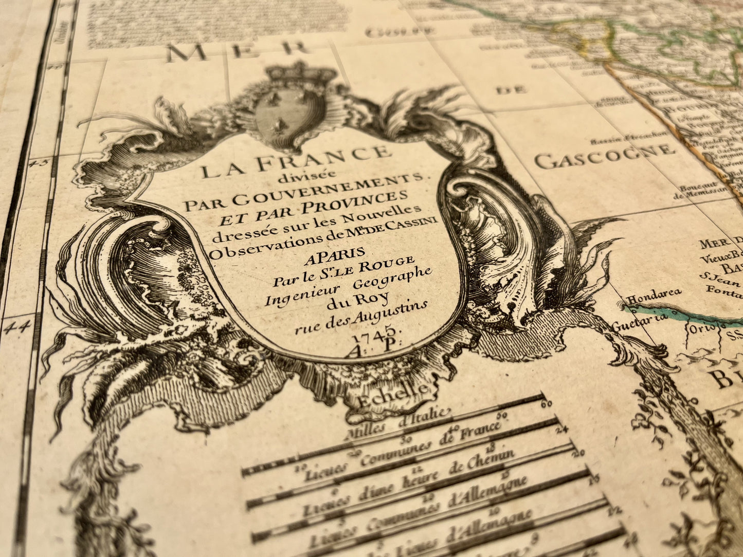
Antique map of France by GL. Le Rouge - 1745
Antique map of France by GL. Le Rouge - 1745
Regular price
130,00 €
Regular price
160,00 €
Sale price
130,00 €
Unit price
per
Tax included.
Couldn't load pickup availability
This antique map of France divided by Governments and Provinces was produced by the cartographer GL. Le Rouge. It is dated 1745 and its size is 75x54cm.
Condition:
Minimal stains, creases and basic repair with adhesive tape on the bottom. Please note, my maps are old and are not always in perfect condition!
-

Paiement sécurisé
-

Envoi soigné
-

Aucune reproduction
-

Satisfait ou remboursé


