Antique map of the French Republic by P. Dumez and PG Chanlaire
Antique map of the French Republic by P. Dumez and PG Chanlaire
Couldn't load pickup availability
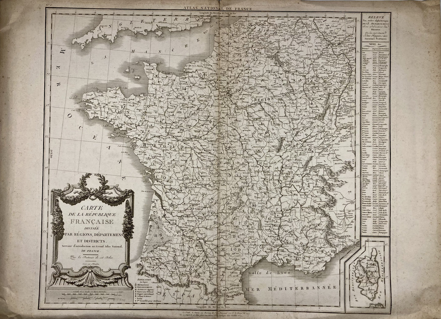
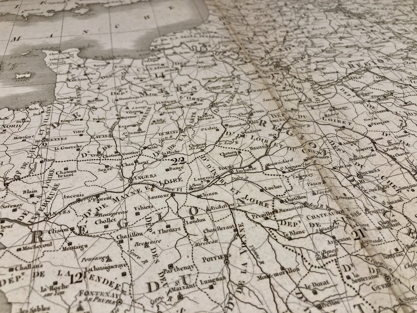
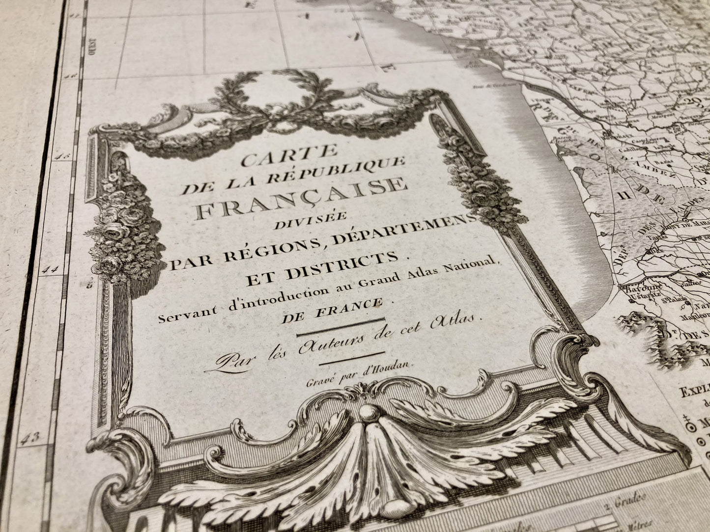
This antique map of the French Republic divided by regions, departments and districts was produced by cartographers Pierre Dumez and Pierre-Gilles Chanlaire and engraved by François d'Houdan. It dates from the beginning of the 19th century and its size is 74x54cm.
Condition:
Minimal stains, folds in the center and on the edges, small tear at the top, in the center. Please note, my maps are old and are not always in perfect condition!
-

“Hello, thank you for sending this, the cards are superb!”
Jean-Philippe
-
"They are very beautiful, just need to frame them! Thank you"
Baptiste
-
"Fast shipping and very good tracking."
Alice
-
"My husband loved the maps I gave him for Christmas!"
Solène

-

Secure payment
-

Careful shipping
-

No reproduction
-

Satisfied or refunded